Digital Maps and Geospatial Data | Princeton University

latin america census uruguay Remove constraint latin america census uruguay

Search Results Header

Search Results

Number of results to display per page

1. Uruguay migration data from 2011 census

Princeton University Restricted content 
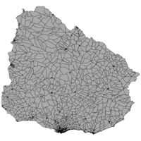
Uruguay migration data from 2011 census. Shapefile. princeton-9s161f33z. 2011. East View Geospatial. Official population and housing data for Uruguay from the 2011 census. This census is provided at the census tract administrative level (ADM3) and ...

2. Uruguay housing data from 2011 census

Princeton University Restricted content Uruguay housing data from 2011 census. Shapefile. princeton-q237j111w. 2011. East View Geospatial. Official population and housing data for Uruguay from the 2011 census. This census is provided at the census tract administrative level (ADM3) and ...

3. Uruguay economic data from 2011 census

Princeton University Restricted content Uruguay economic data from 2011 census. Shapefile. princeton-2b88qm34p. 2011. East View Geospatial. Official population and housing data for Uruguay from the 2011 census. This census is provided at the census tract administrative level (ADM3) and ...

4. Uruguay social data from 2011 census

Princeton University Restricted content Uruguay social data from 2011 census. Shapefile. princeton-fj236926h. 2011. East View Geospatial. Official population and housing data for Uruguay from the 2011 census. This census is provided at the census tract administrative level (ADM3) and ...

5. Uruguay demographic data from 2011 census

Princeton University Restricted content Uruguay demographic data from 2011 census. Shapefile. princeton-6395wg258. 2011. East View Geospatial. Official population and housing data for Uruguay from the 2011 census. This census is provided at the census tract administrative level (ADM3) and ...

6. Uruguay transportation data from 2011 census

Princeton University Restricted content Uruguay transportation data from 2011 census. Shapefile. princeton-k930c5205. 2011. East View Geospatial. Official population and housing data for Uruguay from the 2011 census. This census is provided at the census tract administrative level (ADM3) and ...

7. Caribbean America

Princeton University Public content Caribbean America. TIFF. [Washington, D.C. : Central Intelligence Agency], 1986. princeton-dv13zv863. 1986. United States. Central Intelligence Agency. "800371 7-86." Relief shown by shading and spot heights. "Boundary representation is not necessarily authoritative.".

9. Uruguay Census 2011

Collection Stanford University Public content Uruguay Census 2011. stanford-dz529rx1786. 2018. East View Cartographic, Inc. This collection contains shapefiles representing key statistics from the 2011 Census of Uruguay. Original Census documentation (in Spanish) is incl...

10. Nighttime Lights of Latin America and the Caribbean - Human Settlements, 1994-1995

Raster Stanford University Public content Nighttime Lights of Latin America and the Caribbean - Human Settlements, 1994-1995. GeoTIFF. National Geophysical and Solar-Terrestrial Data Center. stanford-vt902fz3161. 2009. National Geophysical and Solar-Terrestrial Data Center. This map shows light sources from human settlements in Latin America and the Caribbean as observed during 1994-1995. The Defense Meteorological Sat...