Digital Maps and Geospatial Data | Princeton University

latin america census colombia Remove constraint latin america census colombia

Search Results Header

Search Results

Number of results to display per page

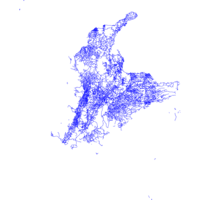
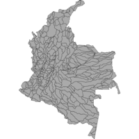
1. Colombia Census 2005

Collection Stanford University Public content Colombia Census 2005. stanford-pb773xr7607. 2018. East View Cartographic, Inc. This collection contains shapefiles representing key statistics from the 2005 Census of Colombia. The original questionairre along with other suppo...

2. GAR15 Global Exposure Dataset for Colombia

Point Stanford University Public content GAR15 Global Exposure Dataset for Colombia. Shapefile. United Nations. Office for Disaster Risk Reduction. stanford-pc465yk3883. 2015. Global Resource Information Database and United Nations. Office for Disaster Risk Reduction. This point shapefile includes estimation on the economic value of the exposed assets in Colombia as well as their physical characteristics in urban...

3. 1:1,000,000-Scale County Boundaries of the United States, 2014

Polygon Stanford University Public content 1:1,000,000-Scale County Boundaries of the United States, 2014. Shapefile. Geological Survey (U.S.). stanford-wg010mf7692. 2014. Geological Survey (U.S.). This polygon shapefile contains the county boundaries of the United States, Puerto Rico, and the U.S. Virgin Islands, by showing the counties as ar...

4. 1:1,000,000-Scale National Boundaries of the United States, 2014

Polygon Stanford University Public content 1:1,000,000-Scale National Boundaries of the United States, 2014. Shapefile. Geological Survey (U.S.). stanford-hb541mt8292. 2014. Geological Survey (U.S.). This polygon shapefile contains the boundaries of the United States, Puerto Rico, and the U.S. Virgin Islands. The map layer was created by extract...

5. 1:1,000,000-Scale State Boundaries of the United States, 2014

Polygon Stanford University Public content 1:1,000,000-Scale State Boundaries of the United States, 2014. Shapefile. National Atlas of the United States. stanford-wj635fh1294. 2014. National Atlas of the United States. This polygon shapefile portrays the state boundaries of the United States, Puerto Rico, and the U.S. Virgin Islands. The map layer was created by e...

6. Cities and Towns 1:1,000,000 Scale United States, Puerto Rico, and Virgin Islands 2014

Point Tufts University Public content Cities and Towns 1:1,000,000 Scale United States, Puerto Rico, and Virgin Islands 2014. Shapefile. Geological Survey (U.S.). tufts-uscitiestowns1mil14. 2014. This point dataset represents cities and towns in the United States, Puerto Rico, and the U.S. Virgin Islands with data from the 2010 census. A ci...

7. Cities and Towns of the United States, 2014

Point Stanford University Public content Cities and Towns of the United States, 2014. Shapefile. National Atlas of the United States. stanford-bx729wr3020. 2014. National Atlas of the United States. This point shapefile includes cities and towns in the United States, Puerto Rico, and the U.S. Virgin Islands. A city or town is a place with a rec...

8. Global Map: 1:1,000,000-Scale Political Areas of the United States, 2014

Polygon Stanford University Public content Global Map: 1:1,000,000-Scale Political Areas of the United States, 2014. Shapefile. National Atlas of the United States. stanford-cs453hh9696. 2014. National Atlas of the United States. This polygon shapefile includes Global Map data showing the counties and equivalent entities of the United States, Puerto Rico, and the U.S. Virgin...

9. Global Map: 1:1,000,000-Scale Political Boundary Lines of the United States, 2014

Line Stanford University Public content Global Map: 1:1,000,000-Scale Political Boundary Lines of the United States, 2014. Shapefile. National Atlas of the United States. stanford-vm820jh8767. 2014. National Atlas of the United States. This line shapefile includes Global Map data showing the counties and equivalent entities of the United States, Puerto Rico, and the U.S. Virgin Is...

10. Global Map: Cities and Towns of the United States, 2014

Point Stanford University Public content Global Map: Cities and Towns of the United States, 2014. Shapefile. National Atlas of the United States. stanford-nh933kw1202. 2014. National Atlas of the United States. This point shapefile includes Global Map data showing cities and towns in the United States, Puerto Rico, and the U.S. Virgin Islands. The data are...

11. Main Airports Colombia 2014

Point Tufts University Public content Main Airports Colombia 2014. Shapefile. Colombia. Ministerio de Transporte - Sistema Integral Nacional de Informacion de Carreteras (SINC). tufts-colombia-mainairports-14. 2014. This point dataset represents the main Airports in Colombia for the year 2014.

12. Petroleum and Gas Exploration Areas Colombia 2014

Polygon Tufts University Public content Petroleum and Gas Exploration Areas Colombia 2014. Shapefile. Sistema de Inforrmacion Ambiental de Colombia (SIAC). tufts-colombia-petroleumgasexplorationareas-14. 2014. This polygon dataset represents areas of exploration for Gas and Petroleum production in Colombia until the year 2014.

13. Ramsar Protected Swamps and Wetlands, Colombia, 2014

Polygon Tufts University Public content Ramsar Protected Swamps and Wetlands, Colombia, 2014. Shapefile. Sistema de Inforrmacion Ambiental de Colombia (SIAC). tufts-colombia-ramsar-swampswetlands-14. 2014. This polygon dataset shows the Ramsar protected swamps and wetlands in Colombia for the year 2014. Wetlands under Ramsar protection are considered ...

14. 1:1,000,000-Scale Combined Statistical Areas, 2013

Polygon Stanford University Public content 1:1,000,000-Scale Combined Statistical Areas, 2013. Shapefile. National Atlas of the United States. stanford-mb303sh3837. 2013. National Atlas of the United States. This polygon shapefile contains combined statistical areas in the United States and Puerto Rico. Combined statistical areas consist of two or more ...

15. 1:1,000,000-Scale Core Based Statistical Areas, 2013

Polygon Stanford University Public content 1:1,000,000-Scale Core Based Statistical Areas, 2013. Shapefile. National Atlas of the United States. stanford-bn076jc5300. 2013. National Atlas of the United States. This polygon shapefile contains core based statistical areas in the United States and Puerto Rico. The map layer was created from the CENSUS 2010 T...

16. City of New York, NY Planning

Polygon Tufts University Public content City of New York, NY Planning. Shapefile. New York (N.Y.). Department of City Planning . tufts-nycassemblydistricts13. 2013. This polygon dataset represents districts in New york City, which were created by the Department of City Planning to aid city agencies in administe...

17. Combined Statistical Areas United States and Puerto Rico 2013

Polygon Tufts University Public content Combined Statistical Areas United States and Puerto Rico 2013. Shapefile. Geological Survey (U.S.). tufts-uscsa13. 2013. This polygon dataset represents Combined Statistical Areas in the United States and Puerto Rico. Combined statistical areas consist of two or more...

18. Community Districts New York City 2013

Polygon Tufts University Public content Community Districts New York City 2013. Shapefile. New York (N.Y.). Department of City Planning. tufts-nyccommunitydistricts13. 2013. This polygon dataset represents New York City community districts. These are mandated by the city charter to review and monitor quality of life iss...

19. Core Based Statistical Areas United States and Puerto Rico 2010

Polygon Tufts University Public content Core Based Statistical Areas United States and Puerto Rico 2010. Shapefile. Geological Survey (U.S.). tufts-uscbsa10. 2013. This polygon datasets portrays core based statistical areas in the United States and Puerto Rico in 2010. The map layer was created from the CENSU...

20. Energy Infrastructure (Requiring Env. Permits), Colombia, 2013

Polygon Tufts University Public content Energy Infrastructure (Requiring Env. Permits), Colombia, 2013. Shapefile. Sistema de Inforrmacion Ambiental de Colombia (SIAC). tufts-colombia-energyinfrastructure-13. 2013. This polygon dataset represents electric power production and distribution infrastructure that require environmental permits to function in Colombi...

21. Gross Education Coverage Per Municipality, Colombia, 2013

Polygon Tufts University Public content Gross Education Coverage Per Municipality, Colombia, 2013. Shapefile. Instituto Geografico "Agustin Codazzi". tufts-colombia-grossedcoverage-13. 2013. This polygon dataset shows the gross education coverage by level per municipality for the year 2013. The percentage provided is the ratio of studen...

22. High Voltage Transmission Lines, Colombia, 2013

Line Tufts University Public content High Voltage Transmission Lines, Colombia, 2013. Shapefile. Sistema de Inforrmacion Ambiental de Colombia (SIAC). tufts-colombia-highvoltagelines-13. 2013. This line dataset represents electricity high voltage transmission lines under the supervision of the National Environmental Agency (ANLA) in Colom...

23. Mining Projects, Colombia, 2013

Polygon Tufts University Public content Mining Projects, Colombia, 2013. Shapefile. Sistema de Inforrmacion Ambiental de Colombia (SIAC). tufts-colombia-miningprojects-13. 2013. This polygon dataset represents areas of mining titles in Colombia until the year 2013. The polygons represent both active mines of all type of min...

24. Municipality Boundaries Mexico 2013

Polygon Tufts University Public content Municipality Boundaries Mexico 2013. Shapefile. Instituto Nacional de Estadistica y Geografia (Mexico). tufts-mexicomunicipalityboundaries13. 2013. This polygon dataset shows boundaries for major municipalities in Mexico. This dataset is part of the most current version of INEGI's "Marco Geos...

25. Petroleum and Gas Extraction Sites Colombia 2013

Point Tufts University Public content Petroleum and Gas Extraction Sites Colombia 2013. Shapefile. Sistema de Inforrmacion Ambiental de Colombia (SIAC). tufts-colombia-petroleumgasexplotation-sites-13. 2013. This point dataset represents exploitation sites where Gas or Petroleum has been extracted in Colombia for the year 2013.

26. Pipelines, Colombia, 2013

Line Tufts University Public content Pipelines, Colombia, 2013. Shapefile. Sistema de Inforrmacion Ambiental de Colombia (SIAC). tufts-colombia-pipelines-13. 2013. This line dataset represents pipelines in Colombia for the year 2013. The pipelines included in this shapefile serve multiple purposes as described...

27. State Boundaries Mexico 2013

Polygon Tufts University Public content State Boundaries Mexico 2013. Shapefile. Instituto Nacional de Estadistica y Geografia (Mexico). tufts-mexicostateboundaries13. 2013. This polygon dataset shows Mexico's state boundaries. This dataset is part of the most current version of INEGI's "Marco Geostatistico Nacional,"...

28. Transmission Lines, Colombia, 2013

Line Tufts University Public content Transmission Lines, Colombia, 2013. Shapefile. Sistema de Inforrmacion Ambiental de Colombia (SIAC). tufts-colombia-transmissionlines-13. 2013. This line dataset represents electricity transmission lines under the supervision of the National Environmental Agency (ANLA) in Colombia for the y...

29. Watersheds Colombia 2013

Polygon Tufts University Public content Watersheds Colombia 2013. Shapefile. Instituto de Hidrologia, Meteorologia y Estudios Ambientales (Colombia). tufts-colombia-watersheds-13. 2013. This polygon dataset shows major hydrological basins and their sub-basin watersheds for Colombia in the year 2013.

30. 1:1,000,000-Scale State Boundaries of the United States, 2012

Polygon Stanford University Public content 1:1,000,000-Scale State Boundaries of the United States, 2012. Shapefile. National Atlas of the United States. stanford-jv962kc4000. 2012. National Atlas of the United States. This polygon shapefile portrays the state boundaries of the United States, Puerto Rico, and the U.S. Virgin Islands. The map layer was created by e...

31. Average Annual Precipitation Colombia 2012

Polygon Tufts University Public content Average Annual Precipitation Colombia 2012. Shapefile. Sistema de Inforrmacion Ambiental de Colombia (SIAC). tufts-colombia-precipitation-12. 2012. This polygon dataset shows average levels of precipitation in Colombia for the year 2012.

32. Average Annual Temperature and Climatic Zones, Colombia, 2012

Polygon Tufts University Public content Average Annual Temperature and Climatic Zones, Colombia, 2012. Shapefile. Sistema de Inforrmacion Ambiental de Colombia (SIAC). tufts-colombia-avgtempclimaticzones-12. 2012. This polygon dataset shows average annual temperatures in degrees celsius in Colombia for the year 2012. The shapefile also includes climatic zones...

33. Canals Colombia 2012

Line Tufts University Public content Canals Colombia 2012. Shapefile. Instituto Geografico "Agustin Codazzi.". tufts-colombiacanal12. 2012. This line dataset represents canals in Colombia.

34. Congressional Districts New Hampshire 20120509

Polygon Tufts University Public content Congressional Districts New Hampshire 20120509. Shapefile. NH GRANIT (Firm). tufts-nhcongressionaldistricts120509. 2012. This polygon dataset shows the New Hampshire congressional district boundaries for 2012. The US district boundaries were generated based on the 20...

35. Electricity Coverage Per Muncipality, Colombia, 2012

Polygon Tufts University Public content Electricity Coverage Per Muncipality, Colombia, 2012. Shapefile. Instituto Geografico "Agustin Codazzi". tufts-colombia-electricitycoveragetotal-12. 2012. This polygon dataset presents the ratio between the percentage of households with electric service, over the total number of households per munici...

36. Executive Council District Boundaries New Hampshire 2012

Polygon Tufts University Public content Executive Council District Boundaries New Hampshire 2012. Shapefile. NH GRANIT (Firm). tufts-nhexecutivecouncildistricts12. 2012. This polygon dataset shows the Executive Council district boundaries drawn by the New Hampshirec based on the 2010 US Census population. count. Bou...

37. Forest Reserves Colombia 2012

Polygon Tufts University Public content Forest Reserves Colombia 2012. Shapefile. Sistema de Inforrmacion Ambiental de Colombia (SIAC). tufts-colombia-forest-reserves-12. 2012. This polygon dataset represents legally protected forest reserves in Colombia through 2012. The polygon represents protective forest areas or fores...

38. Guyana economic data from 2012 census

Princeton University Restricted content Guyana economic data from 2012 census. Shapefile. princeton-qj72pg280. 2012. East View Geospatial. Official population and housing data for Guyana from the 2012 census. This census is provided at the council administrative level (ADM3) and includ...

39. Guyana housing data from 2012 census

Princeton University Restricted content Guyana housing data from 2012 census. Shapefile. princeton-ks65hm35f. 2012. East View Geospatial. Official population and housing data for Guyana from the 2012 census. This census is provided at the council administrative level (ADM3) and includ...

40. Guyana social data from 2012 census

Princeton University Restricted content Guyana social data from 2012 census. Shapefile. princeton-3t945z930. 2012. East View Geospatial. Official population and housing data for Guyana from the 2012 census. This census is provided at the council administrative level (ADM3) and includ...

41. Guyana transportation data from 2012 census

Princeton University Restricted content Guyana transportation data from 2012 census. Shapefile. princeton-02871402z. 2012. East View Geospatial. Official population and housing data for Guyana from the 2012 census. This census is provided at the council administrative level (ADM3) and includ...

42. House Floterial District Boundaries New Hampshire 2012

Polygon Tufts University Public content House Floterial District Boundaries New Hampshire 2012 . Shapefile. NH GRANIT (Firm). tufts-nhhousefloterialdistricts12. 2012. This polygon dataset shows the New Hampshire House of Representatives "floterial" district boundaries drawn by the New Hampshire Legislature based ...

43. Indigenous Areas Colombia 2012

Polygon Tufts University Public content Indigenous Areas Colombia 2012. Shapefile. Instituto Geografico "Agustin Codazzi.". tufts-colombiaindigenous12. 2012. This polygon dataset represents special area designations, specifically for indigenous peoples (translated from "resguardo indigena".).

44. Land for Black Communities, Colombia, 2012

Polygon Tufts University Public content Land for Black Communities, Colombia, 2012. Shapefile. Instituto Geografico "Agustin Codazzi". tufts-colombia-land-for-black-communities-12. 2012. This polygon dataset shows special reservations for Afro Colombian and Palenquero Communities in Colombia for the year 2012. These reservations con...

45. Lang Climatic Classification Colombia 2012

Polygon Tufts University Public content Lang Climatic Classification Colombia 2012. Shapefile. Sistema de Inforrmacion Ambiental de Colombia (SIAC). tufts-colombia-lang-climatic-classification-12. 2012. This polygon dataset shows Lang's Climatic Classification in Colombia for the year 2012. This climatic classification represents an aridity index t...

46. Named Urban Areas Mexico 2012

Polygon Tufts University Public content Named Urban Areas Mexico 2012. Shapefile. Instituto Nacional de Estadistica y Geografia (Mexico). tufts-mexiconamedurbanareas12. 2012. This polygon dataset shows urban areas in Mexico, identified by their official geographically recognized place name. These urban localities are fur...

47. National Parks Colombia 2012

Polygon Tufts University Public content National Parks Colombia 2012. Shapefile. Sistema de Inforrmacion Ambiental de Colombia (SIAC). tufts-colombia-national-parks-12. 2012. This polygon dataset represents National Parks in Colombia through 2012.

48. Páramos Ecosystems, Colombia, 2012

Polygon Tufts University Public content Páramos Ecosystems, Colombia, 2012. Shapefile. Sistema de Inforrmacion Ambiental de Colombia (SIAC). tufts-colombia-paramosecosystems-12. 2012. This polygon dataset represents Paramos (also known as Montane Grasslands and Shrublands or Alpine Tundra Ecosystems) that are considered by the Co...

49. Regional Natural Parks, Colombia, 2012

Polygon Tufts University Public content Regional Natural Parks, Colombia, 2012. Shapefile. Sistema de Inforrmacion Ambiental de Colombia (SIAC). tufts-colombia-regnaturalparks-12. 2012. This polygon dataset represents Regional (sub-national) natural parks in Colombia through 2012.

50. Rural Electricity Coverage Per Municipality, Colombia, 2012

Polygon Tufts University Public content Rural Electricity Coverage Per Municipality, Colombia, 2012. Shapefile. Instituto Geografico "Agustin Codazzi". tufts-colombia-electricitycoveragerural-12. 2012. This polygon dataset presents the ratio between the percentage of rural households with electric service, over the total number of rural household...

51. Rural Locations Mexico 2012

Point Tufts University Public content Rural Locations Mexico 2012. Shapefile. Instituto Nacional de Estadistica y Geografia (Mexico). tufts-mexicorurallocations12. 2012. This point dataset shows rural locations in Mexico, based on the "Inventario Nacional de Viviendas 2012," or their National Inventory of Homes. T...

52. Senate District Boundaries New Hampshire 2012

Polygon Tufts University Public content Senate District Boundaries New Hampshire 2012. Shapefile. NH GRANIT (Firm). tufts-nhsenatedistricts12. 2012. This polygon dataset shows New Hampshire Senate district boundaries drawn by the New Hampshire Legislature based on the 2010 US Census population ...

53. Swamps and Wetlands Colombia 2012

Polygon Tufts University Public content Swamps and Wetlands Colombia 2012. Shapefile. Sistema de Inforrmacion Ambiental de Colombia (SIAC). tufts-colombia-swampswetlands-12. 2012. This polygon dataset shows the swamps and wetlands in Colombia for the year 2012. Some of these wetlands coincide with Colombias larger rivers. .

54. Swamps Colombia 2012

Polygon Tufts University Public content Swamps Colombia 2012. Shapefile. Instituto Geografico "Agustin Codazzi.". tufts-colombiaswamp12. 2012. This polygon dataset represents swamps in Colombia.

55. Tropical Dry Forests, Colombia, 2014

Polygon Tufts University Public content Tropical Dry Forests, Colombia, 2014. Shapefile. Sistema de Inforrmacion Ambiental de Colombia (SIAC). tufts-colombia-tropical-dry-forest-14. 2012. This polygon dataset represents Tropical, dry, forests which are considered by the Colombian government as strategic and unique ecosystems. It is a...

56. Urban Electricity Coverage Per Municipality, Colombia, 2012

Polygon Tufts University Public content Urban Electricity Coverage Per Municipality, Colombia, 2012. Shapefile. Instituto Geografico "Agustin Codazzi". tufts-colombia-electricitycoverageurban-12. 2012. This polygon dataset presents the ratio between the percentage of urban households with electric service, over the total number of urban household...

57. Urban Geostatistical Areas Mexico 2012

Polygon Tufts University Public content Urban Geostatistical Areas Mexico 2012. Shapefile. Instituto Nacional de Estadistica y Geografia (Mexico). tufts-mexicourbanareas12. 2012. This polygon dataset shows basic geostatistical urban areas in Mexico. This is based on Mexico's "Inventario Nacional de Viviendas 2012," or their...

58. 112th Congressional Boundaries USA 2011

Polygon Tufts University Public content 112th Congressional Boundaries USA 2011. Shapefile. U.S. Census Bureau. tufts-uscongdistrict11. 2011. This polygon dataset represents 112th congressional boundaries in the United States. The 112th Congressional District Boundaries data set contains ...

59. Aqueduct Coverage Per Municipality, Colombia, 2011

Polygon Tufts University Public content Aqueduct Coverage Per Municipality, Colombia, 2011. Shapefile. Instituto Geografico "Agustin Codazzi". tufts-colombia-aqueductcoveragetotal-11. 2011. This polygon dataset presents the ratio between the percentage of households with aqueduct service, over the total number of households per munici...

60. Cities USA 2011

Point Tufts University Public content Cities USA 2011. Shapefile. United States. Department of Transportation. Research and Innovative Technology Administration. tufts-uscities11. 2011. This point dataset represents cities in the United States, Puerto Rico and the U.S. Virgin Islands. These cities were collected from the 1970 Nati...

61. Coastlines, Colombia, 2011

Line Tufts University Public content Coastlines, Colombia, 2011. Shapefile. Instituto Geografico "Agustin Codazzi". tufts-colombia-coastline-11. 2011. This line dataset represents the coastlines in Colombia at a 1:500,000 scale.

62. Costa Rica demographic data from 2011 census

Princeton University Restricted content Costa Rica demographic data from 2011 census. Shapefile. princeton-5d86p6211. 2011. East View Geospatial. Official population and housing data for Costa Rica from the 2011 census. This census is provided at the district administrative level (ADM3) and i...

63. Costa Rica economic data from 2011 census

Princeton University Restricted content Costa Rica economic data from 2011 census. Shapefile. princeton-1r66j711n. 2011. East View Geospatial. Official population and housing data for Costa Rica from the 2011 census. This census is provided at the district administrative level (ADM3) and i...

64. Costa Rica housing data from 2011 census

Princeton University Restricted content Costa Rica housing data from 2011 census. Shapefile. princeton-x059cf32j. 2011. East View Geospatial. Official population and housing data for Costa Rica from the 2011 census. This census is provided at the district administrative level (ADM3) and i...

65. Costa Rica migration data from 2011 census

Princeton University Restricted content Costa Rica migration data from 2011 census. Shapefile. princeton-s7526k40b. 2011. East View Geospatial. Official population and housing data for Costa Rica from the 2011 census. This census is provided at the district administrative level (ADM3) and i...

66. Costa Rica social data from 2011 census

Princeton University Restricted content Costa Rica social data from 2011 census. Shapefile. princeton-ng451q507. 2011. East View Geospatial. Official population and housing data for Costa Rica from the 2011 census. This census is provided at the district administrative level (ADM3) and i...

67. Drainage and Rivers, Colombia, 2011

Line Tufts University Public content Drainage and Rivers, Colombia, 2011. Shapefile. Instituto Geografico "Agustin Codazzi". tufts-colombia-drainage-and-rivers-11. 2011. This line dataset represents Colombia's drainage system and major streams, rivers and creeks.

68. Forest Reserves and Subtractions Colombia 2011

Polygon Tufts University Public content Forest Reserves and Subtractions Colombia 2011. Shapefile. Instituto Geografico "Agustin Codazzi.". tufts-colombiaforestreservsub11. 2011. This polygon dataset represents forest reserves and areas removed from the reserve (referred to as "subtractions") in Colombia.

69. Lakes, Colombia, 2011

Polygon Tufts University Public content Lakes, Colombia, 2011. Shapefile. Instituto Geografico "Agustin Codazzi". tufts-colombia-lakes-11. 2011. This polygon dataset represents Colombia's lakes. This layer inlcudes only natural lakes, excluding dams or reservoirs created artifitially. .

70. Major Rivers, Colombia, 2011

Polygon Tufts University Public content Major Rivers, Colombia, 2011. Shapefile. Instituto Geografico "Agustin Codazzi". tufts-colombia-major-rivers-11. 2011. This polygon dataset represents Colombia's major rivers.

71. Municipalities Colombia 2011

Polygon Tufts University Public content Municipalities Colombia 2011. Shapefile. Instituto Geografico "Agustin Codazzi". tufts-colombia-municipalities-11. 2011. This polygon dataset represents municipalities and non municipalized areas for Colombia in the year 2011. The shapefile includes 1101 colombian mun...

72. Railway Infrastructure, Colombia, 2011

Line Tufts University Public content Railway Infrastructure, Colombia, 2011. Shapefile. Instituto Geografico "Agustin Codazzi". tufts-colombia-railways-11. 2011. This line dataset represents railway infrastructure in Colombia at a 1:500,000 scale as of 2011.

73. Reservoirs and Dams, Colombia, 2011

Polygon Tufts University Public content Reservoirs and Dams, Colombia, 2011. Shapefile. Instituto Geografico "Agustin Codazzi". tufts-colombia-reservoirs-and-dams-11. 2011. This polygon dataset represents Colombia's dams or reservoirs created artifitially.

74. Roads, Colombia, 2011

Line Tufts University Public content Roads, Colombia, 2011. Shapefile. Instituto Geografico "Agustin Codazzi". tufts-colombia-roads-11. 2011. This line dataset represents roads in Colombia at a 1:500,000 scale as of 2011.

75. State House of Representatives Districts Massachusetts 2011

Polygon Tufts University Public content State House of Representatives Districts Massachusetts 2011. Shapefile. MassGIS (Office : Mass.) . tufts-madistrict11. 2011. This polygon dataset represents districts in Massachusetts, which were based on demographic data from the 2010 U.S. Census. They were used for elec...

76. Urban Locations for Municipalities, Colombia, 2011

Point Tufts University Public content Urban Locations for Municipalities, Colombia, 2011. Shapefile. Instituto Geografico "Agustin Codazzi". tufts-colombia-municipalities-urban-location-11. 2011. This point dataset represents main urban location for municipalities and non municipalized areas for Colombia in the year 2011. The shapefile inclu...

77. Uruguay demographic data from 2011 census

Princeton University Restricted content Uruguay demographic data from 2011 census. Shapefile. princeton-6395wg258. 2011. East View Geospatial. Official population and housing data for Uruguay from the 2011 census. This census is provided at the census tract administrative level (ADM3) and ...

78. Uruguay economic data from 2011 census

Princeton University Restricted content Uruguay economic data from 2011 census. Shapefile. princeton-2b88qm34p. 2011. East View Geospatial. Official population and housing data for Uruguay from the 2011 census. This census is provided at the census tract administrative level (ADM3) and ...

79. Uruguay housing data from 2011 census

Princeton University Restricted content Uruguay housing data from 2011 census. Shapefile. princeton-q237j111w. 2011. East View Geospatial. Official population and housing data for Uruguay from the 2011 census. This census is provided at the census tract administrative level (ADM3) and ...

80. Uruguay migration data from 2011 census

Princeton University Restricted content Uruguay migration data from 2011 census. Shapefile. princeton-9s161f33z. 2011. East View Geospatial. Official population and housing data for Uruguay from the 2011 census. This census is provided at the census tract administrative level (ADM3) and ...

81. Uruguay social data from 2011 census

Princeton University Restricted content Uruguay social data from 2011 census. Shapefile. princeton-fj236926h. 2011. East View Geospatial. Official population and housing data for Uruguay from the 2011 census. This census is provided at the census tract administrative level (ADM3) and ...

82. Uruguay transportation data from 2011 census

Princeton University Restricted content Uruguay transportation data from 2011 census. Shapefile. princeton-k930c5205. 2011. East View Geospatial. Official population and housing data for Uruguay from the 2011 census. This census is provided at the census tract administrative level (ADM3) and ...

83. U.S. Census Tracts, 2013

Princeton University Restricted content U.S. Census Tracts, 2013. Shapefile. princeton-g732db55s. 2011. TomTom North America, Inc. U.S. Census Tracts represents the U.S. Census tracts of the United States in the 50 states, the District of Columbia, and Puerto Rico.

84. Venezuela demographic data from 2011 census

Princeton University Restricted content Venezuela demographic data from 2011 census. Shapefile. princeton-2227mx843. 2011. East View Geospatial. Official population and housing data for Venezuela from the 2011 census. This census is provided at the parroquias administrative level (ADM3) and ...

85. Venezuela economic data from 2011 census

Princeton University Restricted content Venezuela economic data from 2011 census. Shapefile. princeton-x920g504f. 2011. East View Geospatial. Official population and housing data for Venezuela from the 2011 census. This census is provided at the parroquias administrative level (ADM3) and ...

86. Venezuela housing data from 2011 census

Princeton University Restricted content Venezuela housing data from 2011 census. Shapefile. princeton-sj139913v. 2011. East View Geospatial. Official population and housing data for Venezuela from the 2011 census. This census is provided at the parroquias administrative level (ADM3) and ...

87. Venezuela migration data from 2011 census

Princeton University Restricted content Venezuela migration data from 2011 census. Shapefile. princeton-ns064f228. 2011. East View Geospatial. Official population and housing data for Venezuela from the 2011 census. This census is provided at the parroquias administrative level (ADM3) and ...

88. Venezuela social data from 2011 census

Princeton University Restricted content Venezuela social data from 2011 census. Shapefile. princeton-db78tm211. 2011. East View Geospatial. Official population and housing data for Venezuela from the 2011 census. This census is provided at the parroquias administrative level (ADM3) and ...

89. Venezuela transportation data from 2011 census

Princeton University Restricted content Venezuela transportation data from 2011 census. Shapefile. princeton-j098zk30x. 2011. East View Geospatial. Official population and housing data for Venezuela from the 2011 census. This census is provided at the parroquias administrative level (ADM3) and ...

90. Water Sanitation Coverage Per Municipality, Colombia, 2011

Polygon Tufts University Public content Water Sanitation Coverage Per Municipality, Colombia, 2011. Shapefile. Instituto Geografico "Agustin Codazzi". tufts-colombia-watersanitationcoveragetotal-11. 2011. This polygon dataset presents the ratio between the percentage of households with water sanitation service, over the total number of households pe...

92. Annual Agricultural Water Usage, Colombia, 2010

Polygon Tufts University Public content Annual Agricultural Water Usage, Colombia, 2010. Shapefile. Sistema de Inforrmacion Ambiental de Colombia (SIAC). tufts-colombia-agriculturalwater-10. 2010. This polygon dataset shows annual water usage for the agricultural sector in Colombia for the year 2010. Each polygon represents an hydrographic su...

93. Annual Hydrological Performance Colombia 2010

Polygon Tufts University Public content Annual Hydrological Performance Colombia 2010. Shapefile. Instituto Geografico "Agustin Codazzi.". tufts-colombiahydroperform10. 2010. This polygon dataset represents the annual hydrological performance in Colombia.

94. Argentina demographic data from 2010 census

Princeton University Restricted content Argentina demographic data from 2010 census. Shapefile. princeton-fx719t474. 2010. East View Geospatial. Official population housing data for Argentina down to township, including 52408 vector polygons with native-language names and unique identifier c...

95. Argentina demographic data from 2010 census

Princeton University Restricted content Argentina demographic data from 2010 census. Shapefile. princeton-dcrj430g155. 2010. East View Geospatial. Official demographic data from the 2010 Argentina census. Data are presented at the level of townships (fourth-order administrative divisions).

96. Argentina economic data from 2010 census

Princeton University Restricted content Argentina economic data from 2010 census. Shapefile. princeton-b5644z54t. 2010. East View Geospatial. Official population housing data for Argentina down to township, including 52408 vector polygons with native-language names and unique identifier c...

97. Argentina education data from 2010 census

Princeton University Restricted content Argentina education data from 2010 census. Shapefile. princeton-dch128nr30f. 2010. East View Geospatial. Official education data from the 2010 Argentina census. Data are presented at the level of townships (fourth-order administrative divisions).

98. Argentina employment data from 2010 census

Princeton University Restricted content Argentina employment data from 2010 census. Shapefile. princeton-dccc08hs21j. 2010. East View Geospatial. Official employment data from the 2010 Argentina census. Data are presented at the level of townships (fourth-order administrative divisions).

99. Argentina housing data from 2010 census

Princeton University Restricted content Argentina housing data from 2010 census. Shapefile. princeton-6d5703605. 2010. East View Geospatial. Official population housing data for Argentina down to township, including 52408 vector polygons with native-language names and unique identifier c...

100. Argentina housing data from 2010 census

Princeton University Restricted content Argentina housing data from 2010 census. Shapefile. princeton-dcms35tm23r. 2010. East View Geospatial. Official housing data from the 2010 Argentina census. Data are presented at the level of townships (fourth-order administrative divisions).