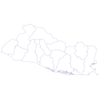
Central America & Panamá. JPEG 2000. "Geographia" Ltd. stanford-fw822kk2165. 1920. Geographia Ltd. Relief shown by hachures and spot heights. "Copyright. "Geographia" Ltd. ..." Indexed for provinces in Guatemala and El Salvador. Insets: Panamá on...
Indiae orientalis insvlarvmqve adiacientivm typvs. JPEG. (Antwerp). p16022coll230:3600. 1592. Ortelius, Abraham, 1527-1598. Relief shown pictorially.; Includes title in cartouche, coat of arms and illustrations of ships, mermaids, and sea monsters.; Includes southwest se...
Americae nova tabula. JPEG. Abraham Ortelius. 5cfaa6aa-db0e-4056-8622-70145a3f4298. 1635. Blaeu, Willem Janszoon, 1571-1638. 1 map: color; Relief shown pictorially; Shows drainage and settlements; Appears in the author's Le théâtre dv monde, on novvel atlas; Includes 10...
[Americae sive novi orbis nova descriptio]. JPEG 2000. Abraham Ortelius. stanford-ms282mt5756. 1570. Ortelius, Abraham, 1527-1598. [Abraham Ortelius] Relief shown pictorially. [In Ortel (Abraham). Theatrum orbis terrarum. fol. Antiverpiæ, apud Ægid Coppenium Diesth, 1570]. Cum ...
Americae sive novi orbis nova descriptio. JPEG. Abraham Ortelius. 7e0062d1-6643-4c90-aaa0-97bac5389481. 1570. Ortelius, Abraham, 1527-1598. 1 map: hand colored; Relief shown pictorially; (In Ortel (Abraham). Theatrum orbis terrarum. fol. Antiverpiæ, apud Ægid Coppenium Diesth, 1570); Cu...
Tartariae Imperium. JPEG 2000. Apud Haeredes Simonis Galignani de Karera,. stanford-pm323nt1979. 1596. Magini, Giovanni Antonio, 1555-1617 and Porro, Girolamo, 1520-1604. Giovanni Antonio Magini. From the 1596 atlas : Geographiae universae tum veteris tum novae absolutissimum opus duobus voluminibus distinctum, in qu...
Orbis vetus, et orbis veteris utraque continens, terrarum q3 tractus Arcticus, et Antarcticus. JPEG 2000. Apud P. Mortier. stanford-fm706sb1090. 1705. Sanson, Nicolas, 1600-1667, Mortier, Pierre, 1661-1711, and Cóvens et Mortier. Auctore N. Sanson Abbavillaeo, et Christianiss. Galliar Regis Geographo. California shown as an unlabeled island with flat northern coast. Depicts ...
Orbis vetus, et orbis veteris utraque continens, terrarum q3 tractus Arcticus, et Antarcticus. JPEG 2000. Apud P. Mortier. stanford-qx771kk2987. 1705. Sanson, Nicolas, 1600-1667, Mortier, Pierre, 1661-1711, and Cóvens et Mortier. Auctore N. Sanson Abbavillaeo, et Christianiss. Galliar Regis Geographo. California shown as an unlabeled island with flat northern coast. Depicts ...
Geographic Names: San Francisco Bay Area, California, 2006. Shapefile. Bay Area Open Space Council. stanford-gq515vq0921. 2006. Bay Area Open Space Council, Conservation Lands Network, San Francisco Bay Area Upland Habitat Goals Project, and GreenInfo Network (Firm). This point shapefile depicts physical and cultural geographic features of all types, not including roads and highways, within the nine county San F...
California Regional Transportation Planning Agencies, 2013. Shapefile. California. Department of Transportation. stanford-rw871gr7791. 2013. California. Department of Transportation. This polygon shapefile contains the boundaries of California Regional Transportation Planning Agencies (RTPA) as of February, 2014. These data were...
Costa Rica. (1991/relief). . TIFF. Central Intelligence Agency. princeton-fj236354d. 1991. Central Intelligence Agency. This is a map of Costa Rica with relief, shown at a 1:1,500,000 scale. The map was created by the Central Intelligence Agency.
Costa Rica summary map. (1991/relief). . TIFF. Central Intelligence Agency. princeton-47429b53k. 1991. Central Intelligence Agency. This is a map of Costa Rica, shown at a scale of 1:1,500,000. Included is information pertaining to the country profile. The map was created by the...
AUDIENCE DE GUADALAJARA, NOUVEAU MEXIQUE, CALIFORNIE, &c. JPEG 2000. Chez P. Mariette. stanford-kc128tv5108. 1656. Sanson, Nicolas, 1600-1667. [1656], in French, with imprint 'A Paris chez P. Mariette rue S. Iacques a l'Esperance Avec Pri. pour 20 ans'. Manuscript '63' (top right, outside ...
Tabularum geographicarum contractarum libri quatuor. JPEG 2000. Cornelium Nicolai. stanford-qv774nk8098. 1600. Bertius, Petrus, 1565-1629, Claesz, Cornelis, approximately 1546-1609, Jansson, Jan, 1588-1664, Hondius, Jodocus, 1563-1612, and Keere, Pieter van den, 1571-approximately 1646. P Bertii. Errata on p. [646]. Engraved t.p. with navigators, cosmographers at table and America & ship in background. Verso depicts Magellan's ...
Atlas de la America del Sur. JPEG 2000. Direccion Hidrografica de Madrid ;. stanford-zs890wk1927. 1800. Espinosa, Jose de, Salazar, Luis Maria de, Massa, Gasparo, González, Tomás, Maré, M. C., Oyarvide, Andrés de, Bauzá, Felipe, Esteve, Rafael, 1772-1847, Morata, Juan, Noguera, C., Jorata, J., Lángara, Juan de, 1736-1806, Selma, Ferdinand, 1752-1810, Moreno Tejada, Juan, Gangoiti, Pedro Manuel, 1779-1830, Cornel, Antonio, Noguera, Clemente, Cardano, Felipe, Malaspina, Alessandro, 1754-1809, and Spain Dirección de Hidrografía. Leather binding with decorative gilt trim. Marbled end papers. First 4 and last 4 pages blank (included in page description). Depths shown by bathy...
Population at the SDE (Section d'énumération) level Port au-Prince Haiti 2003. Shapefile. Elsevier-Dutton (Publishing firm). tufts-haitipopulationsde2003. 2003. This polygon dataset represents population density within Haiti at the SDE (Section d'énumération) level from 2003.
Mapa de la Isla de Cuba : indicando la geografía física y política y tambien las grandes lineas de communicacion. TIFF. En Paris ; New York: Turgis Jne. editeur, Rue des Ecoles, 60 ... ; [1851?] (Paris : Delarue, Impr.). princeton-8w32r792g. 1851. Vuillemin, A. (Alexandre), 1812-. Relief shown by hachures. Includes Inset maps: Plano de La Habana -- Mapa indicando el curso de los buques de vapor -- Isla de Puertorico. Includes...
U.S. Census Block Groups, 2017. Shapefile. Esri. princeton-6395wc232. 2010. TomTom North America, Inc. U.S. Census Block Groups represents the Census block groups of the United States in the 50 states, the District of Columbia, and Puerto Rico.
U.S. Census Tracts, 2017. Shapefile. Esri. princeton-m613n273g. 2010. TomTom North America, Inc. U.S. Census Tracts represents the Census tracts of the United States in the 50 states, the District of Columbia, and Puerto Rico.
U.S. Highways, 2008. Shapefile. Esri. princeton-k3569847z. 2002. TomTom North America, Inc. U.S. Highways represents the major and minor highways of the United States. These include interstates, U.S. highways, state highways, major roads, ...
U.S. Major Highways, 2008. Shapefile. Esri. princeton-2514nq64k. 2002. TomTom North America, Inc. U.S. Major Highways represents the major highways of the United States. These include interstates, U.S. highways, state highways, and major roads. ...
1:1,000,000-Scale County Boundaries of the United States, 2014. Shapefile. Geological Survey (U.S.). stanford-wg010mf7692. 2014. Geological Survey (U.S.). This polygon shapefile contains the county boundaries of the United States, Puerto Rico, and the U.S. Virgin Islands, by showing the counties as ar...
1:1,000,000-Scale National Boundaries of the United States, 2014. Shapefile. Geological Survey (U.S.). stanford-hb541mt8292. 2014. Geological Survey (U.S.). This polygon shapefile contains the boundaries of the United States, Puerto Rico, and the U.S. Virgin Islands. The map layer was created by extract...
Built Up Locations United States, Puerto Rico, and the U.S. Virgin Islands 2010. Shapefile. Geological Survey (U.S.). tufts-usbuiltuplocations10. 1972. This point dataset includes Global Map data showing built up areas, primarily cities and towns, in the United States, Puerto Rico, and the U.S. Vir...
Built Up Locations United States, Puerto Rico, and the U.S. Virgin Islands 2010. Shapefile. Geological Survey (U.S.). tufts-usbuiltupareas10. 1972. This point dataset includes Global Map data showing built up areas, primarily cities and towns, in the United States, Puerto Rico, and the U.S. Vir...
Cities and Towns 1:1,000,000 Scale United States, Puerto Rico, and Virgin Islands 2014. Shapefile. Geological Survey (U.S.). tufts-uscitiestowns1mil14. 2014. This point dataset represents cities and towns in the United States, Puerto Rico, and the U.S. Virgin Islands with data from the 2010 census. A ci...
Cities and Towns 1:2,000,000 Scale United States and Virgin Islands 1972-2004. Shapefile. Geological Survey (U.S.). tufts-uscitiestowns2mil7204. 1972. This point dataset represents cities in the United States, Puerto Rico and the U.S. Virgin Islands, collected from the 1970 National Atlas of the U...
Combined Statistical Areas United States and Puerto Rico 2013. Shapefile. Geological Survey (U.S.). tufts-uscsa13. 2013. This polygon dataset represents Combined Statistical Areas in the United States and Puerto Rico. Combined statistical areas consist of two or more...
Congressional Districts for 107th Congress United States 2001. Shapefile. Geological Survey (U.S.). tufts-uscongdist107th01. 2001. This polygon dataset represents the Congressional Districts of the United States for the 107th Congress. The data set was created by extracting li...
Core Based Statistical Areas United States and Puerto Rico 2010. Shapefile. Geological Survey (U.S.). tufts-uscbsa10. 2013. This polygon datasets portrays core based statistical areas in the United States and Puerto Rico in 2010. The map layer was created from the CENSU...
Federal and Department of Defense Expenditures by State United States 2000 2005 2009. Shapefile. Geological Survey (U.S.). tufts-usfederaldodexpendituresperstate000509. 2000. This polygon dataset shows Federal and Department of Defense (DOD) Expenditures by State for the United States for the years 2000, 2005, and 2009. ...
Federal Expenditures by County United States 2000 2005 2009. Shapefile. Geological Survey (U.S.). tufts-usfedexpenditures000509. 2000. This polygon dataset shows Federal expenditures by US county or county equivalent for the years 2000, 2005, and 2009. Amounts listed are total doll...
Voter Data per State United States 2000 - 2008. Shapefile. Geological Survey (U.S.). tufts-usvoterperstate0008. 2000. This polygon dataset shows the US percentage of voting age persons registered to vote and voted, per State for 2000-2008. Data is expressed in perc...
El Salvador Cities With Population 10 Thousand and More, 1992. Shapefile. Gfk MACON Company. princeton-736666232. 2006. GfK MACON. This data includes El Salvador major cities created by GfK MACON company, Germany.
El Salvador District Boundaries, 1997. Shapefile. Gfk MACON Company. princeton-pg15bg31n. 2006. GfK MACON. This map includes the district boundaries of El Salvador created by GfK MACON company, Germany.
El Salvador Major Highways, 1992. Shapefile. Gfk MACON Company. princeton-kp78gj10f. 2006. GfK MACON. This data includes El Salvador major highways created by GfK MACON company, Germany.
El Salvador Major Lakes, 1992. Shapefile. Gfk MACON Company. princeton-7h149r52r. 2006. GfK MACON. This data include major lakes of El Salvador created by GfK MACON company, Germany.
El Salvador Major Rivers, 1992. Shapefile. Gfk MACON Company. princeton-ng451k09p. 2006. GfK MACON. This data include major rivers of El Salvador created by GfK MACON company, Germany.
El Salvador Major Roads, 1992. Shapefile. Gfk MACON Company. princeton-sj1393643. 2006. GfK MACON. This data includes El Salvador major roads created by GfK MACON company, Germany.
El Salvador Municipality Boundaries, 1997. Shapefile. Gfk MACON Company. princeton-9g54xk08m. 2006. GfK MACON. This map includes the municipality boundaries of El Salvador created by GfK MACON company, Germany.
Mapa geologico de Guatemala = Geological map of Guatemala. Cerro Montecristo, hoja 2359 III G. TIFF. Guatemala : Instituto Geográfico Nacional, 1966. princeton-t148fj97j. 1966. Guatemala. Instituto Geografico Nacional. North Decimal Degree 14.500000. South Decimal Degree 14.3333. East Decimal Degree -89.2500. West Decimal ...
Mapa geologico de Guatemala = Geological map of Guatemala. Chanmagua, hoja 2369 I G. TIFF. Guatemala : Instituto Geográfico Nacional, 1966. princeton-xs55md90g. 1966. Guatemala. Instituto Geografico Nacional. North Decimal Degree 14.666700. South Decimal Degree 14.5000. East Decimal Degree -89.0000. West Decimal ...
Mapa geologico de Guatemala = Geological map of Guatemala. Esquipulas, hoja 2359 IV G. TIFF. Guatemala : Instituto Geográfico Nacional, 1966. princeton-p8418q058. 1966. Guatemala. Instituto Geografico Nacional. North Decimal Degree 14.666700. South Decimal Degree 14.5000. East Decimal Degree -89.2500. West Decimal ...
Mapa geologico de Guatemala = Geological map of Guatemala. Jocotan, hoja 2360 III G. TIFF. Guatemala : Instituto Geográfico Nacional, 1966. princeton-dv13zw06x. 1966. Guatemala. Instituto Geografico Nacional. North Decimal Degree 14.500000. South Decimal Degree 14.6667. East Decimal Degree -89.2500. West Decimal ...
Mapa geologico de Guatemala = Geological map of Guatemala. Timushan, hoja 2360 II G. TIFF. Guatemala : Instituto Geográfico Nacional, 1966. princeton-jm214q98d. 1966. Guatemala. Instituto Geografico Nacional. North Decimal Degree 14.833300. South Decimal Degree 14.6667. East Decimal Degree -89.0000. West Decimal ...
Mapa geologico de Guatemala = Geological map of Guatemala. La Democracia, hoja 1862 IV G. TIFF. Guatemala : Instituto Geográfico Nacional, 1967. princeton-3j333409r. 1967. Guatemala. Instituto Geografico Nacional. North Decimal Degree 15.666700. South Decimal Degree 15.5000. East Decimal Degree -91.7500. West Decimal ...
Mapa geologico de Guatemala = Geological map of Guatemala. Cuilco, hoja 1862 III G. TIFF. Guatemala : Instituto Geográfico Nacional, 1968. princeton-79408000z. 1968. Guatemala. Instituto Geografico Nacional. North Decimal Degree 15.500000. South Decimal Degree 15.3333. East Decimal Degree -91.7500. West Decimal ...
Mapa geologico de Guatemala = Geological map of Guatemala. San Sebastian Huehuetenango, hoja 1862 II G. TIFF. Guatemala : Instituto Geográfico Nacional, 1972. princeton-bz60cz116. 1972. Guatemala. Instituto Geografico Nacional. North Decimal Degree 15.500000. South Decimal Degree 15.3333. East Decimal Degree -91.5000. West Decimal ...
Mapa geologico de Guatemala = Geologic map of Guatemala. Amatitlan, hoja 2059 II G. TIFF. Guatemala : Instituto Geográfico Nacional, 1975. princeton-kh04dr53g. 1975. Guatemala. Instituto Geografico Nacional. North Decimal Degree 14.500000. South Decimal Degree 14.3333. East Decimal Degree -90.5000. West Decimal ...
Mapa geologico de Guatemala = Geological map of Guatemala. Nebaj, hoja 1962 II G. TIFF. Guatemala : Instituto Geográfico Nacional, 1975. princeton-q811km45j. 1975. Guatemala. Instituto Geografico Nacional. North Decimal Degree 15.500000. South Decimal Degree 15.3333. East Decimal Degree -91.0000. West Decimal ...
Mapa geologico de Guatemala = Geological map of Guatemala. Sacapulas, hoja 1961 I G. TIFF. Guatemala : Instituto Geográfico Nacional, 1975. princeton-v118rg387. 1975. Guatemala. Instituto Geografico Nacional. North Decimal Degree 15.333300. South Decimal Degree 15.1667. East Decimal Degree -91.0000. West Decimal ...
Mapa geologico de Guatemala = Geological map of Guatemala. San Jose Pinula, hoja 2159 IV G. TIFF. Guatemala : Instituto Geográfico Nacional, 1975. princeton-b2773x532. 1975. Guatemala. Instituto Geografico Nacional. North Decimal Degree 14.666700. South Decimal Degree 14.5000. East Decimal Degree -90.2500. West Decimal ...
Mapa geologico de Guatemala = Geological map of Guatemala. San Miguel Acatan, hoja 1863 II G. TIFF. Guatemala : Instituto Geográfico Nacional, 1976. princeton-zs25xb30p. 1976. Guatemala. Instituto Geografico Nacional. North Decimal Degree 15.833300. South Decimal Degree 15.6667. East Decimal Degree -91.5000. West Decimal ...
Mapa geologico de Guatemala = Geological map of Guatemala. Todos Santos Cuchumatan, hoja 1862 I G. TIFF. Guatemala : Instituto Geográfico Nacional, 1976. princeton-gq67jt02x. 1976. Guatemala. Instituto Geografico Nacional. North Decimal Degree 15.666700. South Decimal Degree 15.5000. East Decimal Degree -91.5000. West Decimal ...
A map of the United States of Mexico. JPEG 2000. H.S. Tanner, No. 177 Chestnut St. ,. stanford-pn863fv0810. 1800. Tanner, Henry Schenck, 1786-1858. by H. S. Tanner. Relief shown by hachures. Latitudinal and longitudinal lines. Prime meridian: Washington. Coordinates approximate and based on Gre...
Coasts, Brazil, 1830 (Raster Image). GeoTIFF. Harvard Map Collection, Harvard College Library. harvard-g5401-c6-1830-r2. 1830. Harvard Map Collection, Harvard College Library, R. Blachford & Co., Patriceo, Jose., and Pimental, Manoel. This layer is a georeferenced raster image of the historic paper map entitled: Blachford & Co.'s new chart of the coast of Brazil : from the Equato...
Eastern North America, 1813 (Image 2 of 4) (Raster Image). GeoTIFF. Harvard Map Collection, Harvard College Library. harvard-g3700-1813-l4-sh2. 1813. Harvard Map Collection, Harvard Library, Lewis, Samuel, 1753 or 4-1822., Plowman, Thomas Lowry., Fairman, Gideon, 1774-1827., and Hooker, William, 1782-1856. This layer is a georeferenced raster image of the historic paper map entitled: A correct map of the United States with the West Indies : from the b...
Eastern North America, 1813 (Image 3 of 4) (Raster Image). GeoTIFF. Harvard Map Collection, Harvard College Library. harvard-g3700-1813-l4-sh3. 1813. Harvard Map Collection, Harvard Library, Lewis, Samuel, 1753 or 4-1822., Plowman, Thomas Lowry., Fairman, Gideon, 1774-1827., and Hooker, William, 1782-1856. This layer is a georeferenced raster image of the historic paper map entitled: A correct map of the United States with the West Indies : from the b...
Eastern North America, 1813 (Image 4 of 4) (Raster Image). GeoTIFF. Harvard Map Collection, Harvard College Library. harvard-g3700-1813-l4-sh4. 1813. Harvard Map Collection, Harvard Library, Lewis, Samuel, 1753 or 4-1822., Plowman, Thomas Lowry., Fairman, Gideon, 1774-1827., and Hooker, William, 1782-1856. This layer is a georeferenced raster image of the historic paper map entitled: A correct map of the United States with the West Indies : from the b...
Guatemala, 1902 (Raster Image). GeoTIFF. Harvard Map Collection, Harvard College Library. harvard-g4810-1902-h4. 1902. Harvard Map Collection, Harvard College Library, Harvard University. Library. Open Collections Program, Hendges, M., and Andrew B. Graham Co. This layer is a georeferenced raster image of the historic paper map entitled: Guatemala : from official and other sources, prepared in the Bureau ...
James Cook Expeditions, Pacific Ocean, 1776-1779 (Raster Image). GeoTIFF. Harvard Map Collection, Harvard College Library. harvard-g9231-s12-1780-l5. 1776. Harvard Map Collection, Harvard College Library, Harvard University. Library. Open Collections Program, and Libreria de Copin. This layer is a georeferenced raster image of the historic paper map entitled: Mapa que demuestra el derrotero q[ue] : hizo M. Cook en 1776, 1777, ...
New England and Middle Atlantic States, ca. 1730 (Raster Image). GeoTIFF. Harvard Map Collection, Harvard College Library. harvard-g3720-1730-s4. 1730. Harvard Map Collection, Harvard College Library and Seutter, Matthaeus, 1678-1756. This layer is a georeferenced raster image of the historic paper map entitled: Recens edita totius Novi Belgii in America Septentrionali siti, deli...
North America, 1853 (Image 4 of 4) (Raster Image). GeoTIFF. Harvard Map Collection, Harvard College Library. harvard-g3300-1853-m6-sh4. 1853. Harvard Map Collection, Harvard College Library, Monk, Jacob., and A. Hoen & Co. This layer is a georeferenced raster image of the historic paper map entitled: New map of that portion of North America, exhibiting the United Stat...
North America, 1856 (Image 2 of 4) (Raster Image). GeoTIFF. Harvard Map Collection, Harvard College Library. harvard-g3300-1856-w5-sh2. 1856. Harvard Map Collection, Harvard College Library, Williams, W. (Wellington), and Mitchell, S. Augustus (Samuel Augustus), 1792-1868. This layer is a georeferenced raster image of the historic paper map entitled: Mitchell's new national map exhibiting the United States : with the ...
Western Hemisphere, 1740 (Image 1 of 2) (Raster Image). GeoTIFF. Harvard Map Collection, Harvard College Library. harvard-g3290-1740-l4-sheet-1. 1740. Harvard Map Collection, Harvard College Library, Harvard University. Library. Open Collections Program, Leth, Andries de, 1662-1731., and Leth, Hendrik de, 1703-1766. This layer is a georeferenced raster image of the historic paper map entitled: Carte nouvelle de la mer du Sud : dressee par ordre des principaux d...
Western Hemisphere, 1740 (Image 2 of 2) (Raster Image). GeoTIFF. Harvard Map Collection, Harvard College Library. harvard-g3290-1740-l4-sheet-2. 1740. Harvard Map Collection, Harvard College Library, Harvard University. Library. Open Collections Program, Leth, Andries de, 1662-1731., and Leth, Hendrik de, 1703-1766. This layer is a georeferenced raster image of the historic paper map entitled: Carte nouvelle de la mer du Sud : dressee par ordre des principaux d...
Bay of All Saints, Bahia, Brazil, ca. 1710 (Raster Image). GeoTIFF. Harvard Map Collection, Harvard Library. harvard-g5562-a4-1710-m6. 1710. Harvard Map Collection, Harvard Library and Mortier, Pierre. This layer is a georeferenced raster image of the historic paper map entitled: Sinus omnium sanctoru[m]. It was published by the workshop of P. Mor...
Central America & Caribbean Region, 1803 (Image 1 of 4) (Raster Image). GeoTIFF. Harvard Map Collection, Harvard Library. harvard-g4900-1803-a7-sh1. 1803. Harvard Map Collection, Harvard College Library, Arrowsmith, Aaron, 1750-1823., and Jones & Smith. This layer is a georeferenced raster image of the historic paper map entitled: Chart of the West Indies and Spanish Dominions in North America, by ...
Central America & Caribbean Region, 1803 (Image 2 of 4) (Raster Image). GeoTIFF. Harvard Map Collection, Harvard Library. harvard-g4900-1803-a7-sh2. 1803. Harvard Map Collection, Harvard College Library, Arrowsmith, Aaron, 1750-1823., and Jones & Smith. This layer is a georeferenced raster image of the historic paper map entitled: Chart of the West Indies and Spanish Dominions in North America, by ...
Central America & Caribbean Region, 1803 (Image 3 of 4) (Raster Image). GeoTIFF. Harvard Map Collection, Harvard Library. harvard-g4900-1803-a7-sh3. 1803. Harvard Map Collection, Harvard College Library, Arrowsmith, Aaron, 1750-1823., and Jones & Smith. This layer is a georeferenced raster image of the historic paper map entitled: Chart of the West Indies and Spanish Dominions in North America, by ...
Central America & Caribbean Region, 1803 (Image 4 of 4) (Raster Image). GeoTIFF. Harvard Map Collection, Harvard Library. harvard-g4900-1803-a7-sh4. 1803. Harvard Map Collection, Harvard College Library, Arrowsmith, Aaron, 1750-1823., and Jones & Smith. This layer is a georeferenced raster image of the historic paper map entitled: Chart of the West Indies and Spanish Dominions in North America, by ...
Central America & Caribbean Region, 1858 (Raster Image). GeoTIFF. Harvard Map Collection, Harvard Library. harvard-g4390-1858-k5. 1858. Harvard Map Collection, Harvard College Library, Kiepert, Heinrich, 1818-1899., Humboldt, Alexander von, 1769-1859., and Reimer, Dietrich, 1818-1899. This layer is a georeferenced raster image of the historic paper map entitled: A new map of tropical-America, north of the Equator : comprising the...
Central South America, ca. 1750 (Raster Image). GeoTIFF. Harvard Map Collection, Harvard Library. harvard-g5200-1750-s4. 1750. Harvard Map Collection, Harvard Library and Seutter, Matthaeus, 1678-1756. This layer is a georeferenced raster image of the historic paper map entitled: Paraquariae Provinciae Soc. Iesu cum adiacentibus novissima descript...
Gulf of Mexico and Caribbean in 1654 (Raster Image). GeoTIFF. Harvard Map Collection, Harvard Library. harvard-g1059-w57-1654-pf-sh14. 1654. Harvard Map Collection, Harvard Library, Jacobsz, Theunis, 1632?-1679., and Wit, Frederik de. This layer is a georeferenced raster image of the historic paper map entitled: Pascaerte van West Indien : van de Caribes tot aen de Golfo van Mexi...
Gulf of Mexico and Caribbean Sea Region, 1717 (Raster Image). GeoTIFF. Harvard Map Collection, Harvard Library. harvard-g4390-1717-f4. 1717. Harvard Map Collection, Harvard College Library, Fer, Nicolas de, 1646-1720., and Starckman, P. This layer is a georeferenced raster image of the historic paper map entitled: Le Golfe de Mexique : et les provinces et isles qui l'environe comme...
Gulf of Mexico and Caribbean Sea Region, 1774 (Image 1 of 2) (Raster Image). GeoTIFF. Harvard Map Collection, Harvard Library. harvard-g4390-1774-s6-sh1. 1774. Harvard Map Collection, Harvard College Library, Speer, Joseph Smith., and Bowen, Thomas, -1790. This layer is a georeferenced raster image of the historic paper map entitled: To His Royal Highness. George Augustus Frederick. Prince of Wales &c...
Gulf of Mexico and Caribbean Sea Region, 1774 (Image 2 of 2) (Raster Image). GeoTIFF. Harvard Map Collection, Harvard Library. harvard-g4390-1774-s6-sh2. 1774. Harvard Map Collection, Harvard College Library, Speer, Joseph Smith., and Bowen, Thomas, -1790. This layer is a georeferenced raster image of the historic paper map entitled: To His Royal Highness. George Augustus Frederick. Prince of Wales &c...
Gulf of Mexico and Caribbean Sea Region, 1779-1782 (Image 1 of 2) (Raster Image). GeoTIFF. Harvard Map Collection, Harvard Library. harvard-g4390-1779-r6-sh1. 1779. Harvard Map Collection, Harvard College Library and Robert Sayer and John Bennett (Firm). This layer is a georeferenced raster image of the historic paper map entitled: A new general chart of the West Indies : from the latest marine jour...
Gulf of Mexico and Caribbean Sea Region, 1779-1782 (Image 2 of 2) (Raster Image). GeoTIFF. Harvard Map Collection, Harvard Library. harvard-g4390-1779-r6-sh2. 1779. Harvard Map Collection, Harvard College Library and Robert Sayer and John Bennett (Firm). This layer is a georeferenced raster image of the historic paper map entitled: A new general chart of the West Indies : from the latest marine jour...
Gulf of Mexico and Caribbean Sea Region, ca. 1708 (Raster Image). GeoTIFF. Harvard Map Collection, Harvard Library. harvard-g4390-1708-o8. 1708. Harvard Map Collection, Harvard Library, Ottens, R. (Reiner), 1698-1750., Ottens, J. (Josua), 1704-1765., and R. & J. Ottens. This layer is a georeferenced raster image of the historic paper map entitled: Nova Isthmi Americani, qui et Panamiensis item Dariensis, tabula, in...
Gulf of Mexico and Caribbean Sea Region, ca. 1715 (Raster Image). GeoTIFF. Harvard Map Collection, Harvard Library. harvard-g4390-1715-m6. 1715. Harvard Map Collection, Harvard College Library and Moll, Herman, d. 1732. This layer is a georeferenced raster image of the historic paper map entitled: A map of the West-Indies or the islands of America in the North Sea ...
Gulf of Suez and Sinai Peninsula, 1772 (Raster Image). GeoTIFF. Harvard Map Collection, Harvard Library. harvard-g8302-s52-1772-n5. 1772. Harvard Map Collection, Harvard Library, Niebuhr, Carsten, 1733-1815, and Defehrt, A. J. This layer is a georeferenced raster image of the historic paper map entitled: Tabula itineraria a Sues usque ad Dsjäbbel el Mokátteb et Montem Sin...
Northern South America, ca. 1736 (Raster Image). GeoTIFF. Harvard Map Collection, Harvard Library. harvard-g5200-1736-l5-copya. 1736. Harvard Map Collection, Harvard Library, L'Isle, Guillaume de, 1675-1726., and Homann Erben (Firm). This layer is a georeferenced raster image of the historic paper map entitled: Tabula Americae specialis geographica regni Peru, Brasiliae, Terrae ...
Portobelo Bay, Panama, 1740 (Raster Image). GeoTIFF. Harvard Map Collection, Harvard Library. harvard-g4872-p6-1740-d7. 1740. Harvard Map Collection, Harvard Library, Durell, Philip, -1766., and Homann Erben (Firm). This layer is a georeferenced raster image of the historic paper map entitled: Portus pulchri, in Isthmo Panamensi siti accurata ichnographia ex pr...
Nova Hispania et Nova Galicia. JPEG 2000. Hendrik Hondius. stanford-sq426wd0172. 1636. Mercator, Gerhard, 1512-1594, Hondius, Hendrik, 1597-1651, and Jansson, Jan, 1588-1664. Relief shown pictorially. 2 indexes in sea; index in cartouche: Notularum circa Mexico explanatio. Decorative cartouches, coats of arms, figures, c...
Americae. JPEG 2000. Hugo Allard. stanford-tt437zq0720. 1640. Allardt, Hugo, -1691 and Velde, Jan van de, 1593-1641. Hugo Allardt excudit. inde Kalver Straet inde Werrelt Kaert ; Velde schulp. Relief shown pictorially. California shown as an island with indented n...
Aqueduct Coverage Per Municipality, Colombia, 2005. Shapefile. Instituto Geografico "Agustin Codazzi". tufts-colombia-aqueductcoveragetotal-05. 2005. This polygon dataset presents the ratio between the percentage of households with aqueduct service, over the total number of households per munici...
Average Number of Dwelling Households per Municipalities, Colombia, 2005. Shapefile. Instituto Geografico "Agustin Codazzi". tufts-colombia-avghouseholdsdwelling-05. 2005. This polygon dataset presents the average number of households per dewelling by municipalities, resulting from the 2005 census. No data is availabl...
Electricity Coverage Per Municipality, Colombia, 2005. Shapefile. Instituto Geografico "Agustin Codazzi". tufts-colombia-electricitycoveragetotal-05. 2005. This polygon dataset presents the ratio between the percentage of households with electric service, over the total number of households per munici...
Female Population Per Municipality, Colombia, 2005. Shapefile. Instituto Geografico "Agustin Codazzi". tufts-colombia-popfemale-05. 2005. This polygon dataset presents the total female population per municipality for 2005. Data comes from the 2005 census. No data is available for the...
Hectares of Forest Per Municipality, Colombia, 2006. Shapefile. Instituto Geografico "Agustin Codazzi". tufts-colombia-hectaresforestmunicipality-06. 2006. This polygon dataset presents the total number of hectares of forest per municipality for the year 2006. No data is available for the following Mun...
Hectares of Pastures Per Municipality, Colombia, 2006. Shapefile. Instituto Geografico "Agustin Codazzi". tufts-colombia-hectarespasturesmunicipality-06. 2006. This polygon dataset presents the total number of hectares of pastures per municipality for the year 2006. No data is available for the following M...
Housing Quality Per Municipality, Colombia, 2005. Shapefile. Instituto Geografico "Agustin Codazzi". tufts-colombia-housingquality-05. 2005. This polygon dataset presents a score for housing quality per municipality, resulting from the 2005 census. The score which ranges from 1.59 (being...
Male Population Per Municipality, Colombia, 2005. Shapefile. Instituto Geografico "Agustin Codazzi". tufts-colombia-popmale-05. 2005. This polygon dataset presents the total male population per municipality for 2005. Data comes from the 2005 census. No data is available for the f...
Natural Gas Coverage Per Municipality, Colombia, 2005. Shapefile. Instituto Geografico "Agustin Codazzi". tufts-colombia-naturalgascoveragetotal-05. 2005. This polygon dataset presents the ratio between the percentage of households with natural gas service, over the total number of households per mun...
Rural and Urban Population Per Municipality, Colombia, 2005. Shapefile. Instituto Geografico "Agustin Codazzi". tufts-colombia-popurbanrural-05. 2005. This polygon dataset presents the urban and rural population per municipality. Data comes from the 2005 census, but it has been reviewed by the DAN...
Rural Aqueduct Coverage Per Municipality, Colombia, 2005. Shapefile. Instituto Geografico "Agustin Codazzi". tufts-colombia-aqueductcoveragerural-05. 2005. This polygon dataset presents the ratio between the percentage of rural households with aqueduct service, over the total number of rural household...
Rural Electricity Coverage Per Municipality, Colombia, 2005. Shapefile. Instituto Geografico "Agustin Codazzi". tufts-colombia-electricitycoveragerural-05. 2005. This polygon dataset presents the ratio between the percentage of rural households with electric service, over the total number of rural household...