Digital Maps and Geospatial Data | Princeton University

latin america census el salvador Remove constraint latin america census el salvador

Search Results Header

Search Results

Number of results to display per page

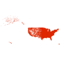
451. Core Based Statistical Areas United States and Puerto Rico 2010

Polygon Tufts University Public content Core Based Statistical Areas United States and Puerto Rico 2010. Shapefile. Geological Survey (U.S.). tufts-uscbsa10. 2013. This polygon datasets portrays core based statistical areas in the United States and Puerto Rico in 2010. The map layer was created from the CENSU...

452. Built Up Locations United States, Puerto Rico, and the U.S. Virgin Islands 2010

Point Tufts University Public content Built Up Locations United States, Puerto Rico, and the U.S. Virgin Islands 2010. Shapefile. Geological Survey (U.S.). tufts-usbuiltuplocations10. 1972. This point dataset includes Global Map data showing built up areas, primarily cities and towns, in the United States, Puerto Rico, and the U.S. Vir...

454. Ecuador Toponyms

Point The University of Texas at Austin Public content Ecuador Toponyms. Shapefile. utaustin_121140. This shapefile is comprised of toponymic data generated from topographic maps (1:50,000) of Ecuador’s Oriente - a region which is defined by the tr...

455. Geographic Names: San Francisco Bay Area, California, 2006

Point Stanford University Public content Geographic Names: San Francisco Bay Area, California, 2006. Shapefile. Bay Area Open Space Council. stanford-gq515vq0921. 2006. Bay Area Open Space Council, Conservation Lands Network, San Francisco Bay Area Upland Habitat Goals Project, and GreenInfo Network (Firm). This point shapefile depicts physical and cultural geographic features of all types, not including roads and highways, within the nine county San F...

456. United States National Park System, 2013

Polygon Columbia University Public content United States National Park System, 2013. Shapefile. sde-columbia-ntad_2013_parks. 2011. United States. Bureau of Transportation Statistics and United States. National Park Service. United States National Park System, 2013 is a polygon theme representing the National Park System.