Portugal Major Dams, 2005. Shapefile. Gfk MACON Company. princeton-2n49t313t. 2006. GfK MACON. This data include major dams of Portugal created by GfK MACON company, Germany.
Finland Cities With Population From 50 Thousand To 100 Thousand, 2004. Shapefile. Gfk MACON Company. princeton-h128ng323. 2006. GfK MACON. This data includes Finland cities with population between 50 thousand and 100 thousand created by GfK MACON company, Germany.
Slovakia Major Railways, 2005. Shapefile. Gfk MACON Company. princeton-tb09j724z. 2006. GfK MACON. This data includes Slovakia major railways created by GfK MACON company, Germany.
Belarus Major Lakes, 2004. Shapefile. Gfk MACON Company. princeton-8c97kr819. 2006. GfK MACON. This data include major lakes of Belarus created by GfK MACON company, Germany.
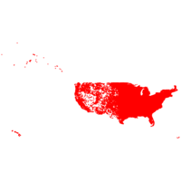
U.S. Institutions 2008. Shapefile. ESRI. princeton-8s45qb42m. 2007. Tele Atlas North America, Inc. U.S. Institutions represents point locations within the United States for common institution landmark types including hospitals, educational instit...
Croatia Major Lakes, 2005. Shapefile. Gfk MACON Company. princeton-g732db498. 2006. GfK MACON. This data include major lakes of Croatia created by GfK MACON company, Germany.
Estonia Minor Rivers, 2005. Shapefile. Gfk MACON Company. princeton-2f75r976k. 2006. GfK MACON. This data include minor rivers of Estonia created by GfK MACON company, Germany.
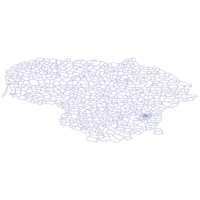
Czech Republic Region Boundaries, 2005. Shapefile. Gfk MACON Company. princeton-qn59q550r. 2006. GfK MACON. This map includes the region boundaries of Czech Republic created by GfK MACON company, Germany.
Wyoming Block Groups 2002. Shapefile. Environmental Systems Research Institute, Inc. (ESRI). princeton-5138jg575. 2002. Geographic Data Technology, Inc. (GDT). Wyoming Block Groups represents the U.S. Census block groups of Wyoming.
Missouri Major Roads 2002. Shapefile. Environmental Systems Research Institute, Inc. (ESRI). princeton-xs55md56k. 1999. Geographic Data Technology, Inc. (GDT). Missouri Major Roads represents interstate, U.S., and state highways and other major thoroughfares within Missouri.
China Cities With Population From 70 Thousand To 100 Thousand, 2004. Shapefile. Gfk MACON Company. princeton-q811km194. 2006. GfK MACON. This data includes China cities with population between 70 thousand and 100 thousand created by GfK MACON company, Germany.
California Block Centroid Populations 2002. Shapefile. Environmental Systems Research Institute, Inc. (ESRI). princeton-08612q12s. 2000. Environmental Systems Research Institute, Inc. (ESRI). California Block Centroid Populations represents the population of the U.S. Census block centroids for California. U.S. Census blocks are the smal...
North Korea Major Rivers, 1997. Shapefile. Gfk MACON Company. princeton-2514nn03k. 2006. GfK MACON. This data include major rivers of North Korea created by GfK MACON company, Germany.
U.S. National Atlas Federal and Indian Land Areas 2002. Shapefile. Environmental Systems Research Institute, Inc. (ESRI). princeton-rj430624t. 1972. National Atlas of the United States and the United States Geological Survey. U.S. National Atlas Federal and Indian Land Areas represents the federal and Indian owned land areas (e.g., Bureau of Indian Affairs, Department of...
Oregon Block Centroid Populations 2002. Shapefile. Environmental Systems Research Institute, Inc. (ESRI). princeton-2b88qd78x. 2000. Environmental Systems Research Institute, Inc. (ESRI). Oregon Block Centroid Populations represents the population of the U.S. Census block centroids for Oregon. U.S. Census blocks are the smallest geo...
Bosnia-Herzegovina Municipality Boundaries, 2005. Shapefile. Gfk MACON Company. princeton-n009w3897. 2006. GfK MACON. This map includes the municipality boundaries of Bosnia-Herzegovina created by GfK MACON company, Germany.
U.S. National Atlas Historic Earthquakes 2000. Shapefile. Environmental Systems Research Institute, Inc. (ESRI). princeton-dr26z008n. 1568. National Atlas of the United States and the United States Geological Survey. U.S. National Atlas Historic Earthquakes represents the locations of significant, historic earthquakes in United States and adjacent Canada and Mex...
Ireland Major City Areas, 2005. Shapefile. Gfk MACON Company. princeton-9z903161x. 2006. GfK MACON. This data includes Ireland major city areas created by GfK MACON company, Germany.
Slovakia Cities With Population From 20 Thousand To 50 Thousand, 2005. Shapefile. Gfk MACON Company. princeton-dz010r54r. 2006. GfK MACON. This data includes Slovakia cities with population between 20 thousand and 50 thousand created by GfK MACON company, Germany.
Europe Cities 2002. Shapefile. Environmental Systems Research Institute, Inc. (ESRI). princeton-wp988m54h. 1999. AND Data Solutions, B.V. Europe Cities represents the cities of Europe.
U.S. Geographic Names Information System Church 2002. Shapefile. Environmental Systems Research Institute, Inc. (ESRI). princeton-8k71nj76h. 2000. United States Geological Survey. U.S. Geographic Names Information System Church represents an automated inventory of the proper names and locations of physical and cultural geogra...
Netherlands Municipality Boundaries, 2005. Shapefile. Gfk MACON Company. princeton-xk81jn02f. 2006. GfK MACON. This map includes the municipality boundaries of Netherlands created by GfK MACON company, Germany.
Belgium 3-Digit Postcode Areas, 2005. Shapefile. Gfk MACON Company. princeton-tb09j731z. 2006. GfK MACON. This data includes Belgium 3 digit postcode areas created by GfK MACON company, Germany.
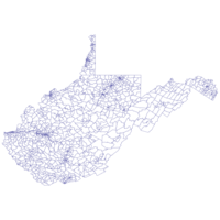
West Virginia Block Groups 2002. Shapefile. Environmental Systems Research Institute, Inc. (ESRI). princeton-nz8061348. 2002. Geographic Data Technology, Inc. (GDT). West Virginia Block Groups represents the U.S. Census block groups of West Virginia.
World Countries (Generalized) 1999. Shapefile. Environmental Systems Research Institute, Inc. (ESRI). princeton-x346d5779. 1996. Environmental Systems Research Institute, Inc. (ESRI). World Countries (Generalized) represents generalized boundaries for the countries of the world, as they existed in 1998.
South Carolina Rivers 2002. Shapefile. Environmental Systems Research Institute, Inc. (ESRI). princeton-ms35tb25d. 1997. Geographic Data Technology, Inc. (GDT). South Carolina Rivers represents streams and rivers within South Carolina.
Pakistan Cities With Population From 100 Thousand to 1 Million, 1995. Shapefile. princeton-2f75r9626. 2006. GfK MACON. This data includes Pakistan cities with population 100 thousands to 1 million created by GfK MACON company, Germany.
Puerto Rico Cities With Population From 50 Thousand To 100 Thousand, 2003. Shapefile. Gfk MACON Company. princeton-4j03d1364. 2006. GfK MACON. This data includes Puerto Rico cities with population between 50 thousand and 100 thousand created by GfK MACON company, Germany.
India Major Rivers, 1997. Shapefile. Gfk MACON Company. princeton-f1881n47k. 2006. GfK MACON. This data include major rivers of India created by GfK MACON company, Germany.
Albania Elevations. Shapefile. Gfk MACON Company. princeton-zc77sr758. 2006. GfK MACON. This data include elevations of Albania created by GfK MACON company, Germany.
World Lakes 2002. Shapefile. Environmental Systems Research Institute, Inc. (ESRI). princeton-wp988m41m. 1992. Environmental Systems Research Institute, Inc. (ESRI). World Lakes represents the major lakes and inland seas within the world.
Portugal 2-Digit Postcode Areas, 2005. Shapefile. Gfk MACON Company. princeton-wp988m25n. 2006. GfK MACON. This data includes Portugal 2 digit postcode areas created by GfK MACON company, Germany.
South Carolina Block Centroid Populations 2002. Shapefile. Environmental Systems Research Institute, Inc. (ESRI). princeton-7p88cj08m. 2000. Environmental Systems Research Institute, Inc. (ESRI). South Carolina Block Centroid Populations represents the population of the U.S. Census block centroids for South Carolina. U.S. Census blocks are ...
Malta Major Rivers, 2005. Shapefile. Gfk MACON Company. princeton-wd375x74k. 2006. GfK MACON. This data include major rivers of Malta created by GfK MACON company, Germany.
Mexico Road Routes 2000. Shapefile. Environmental Systems Research Institute, Inc. (ESRI). princeton-jq085m43h. 1992. Environmental Systems Research Institute, Inc. (ESRI). Mexico Road Routes represents the major highway routes of Mexico.
U.S. Geographic Names Information System Cemeteries 2008. Shapefile. ESRI. princeton-td96k418w. 1981. United States Geological Survey. U.S. Geographic Names Information System Cemeteries represents an automated inventory of the proper names and locations of physical and cultural ge...
Lithuania 4-Digit Postcode Areas, 2004. Shapefile. Gfk MACON Company. princeton-v118rg09c. 2006. GfK MACON. This data includes Lithuania 4 digit postcode areas created by GfK MACON company, Germany.
Denmark Minor Roads, 2005. Shapefile. Gfk MACON Company. princeton-c534fq376. 2006. GfK MACON. This data includes Denmark minor roads created by GfK MACON company, Germany.
Ukraine Major City Areas, 2004. Shapefile. Gfk MACON Company. princeton-k930bz69f. 2006. GfK MACON. This data includes Ukraine major city areas created by GfK MACON company, Germany.
U.S. Tracts 2002. Shapefile. Environmental Systems Research Institute, Inc. (ESRI). princeton-xs55md63k. 2002. Geographic Data Technology, Inc. (GDT). U.S. Tracts represents the U.S. Census tracts and block numbering areas (BNA) of the United States in the fifty states and the District of Columbia.
South Carolina Major Roads 2002. Shapefile. Environmental Systems Research Institute, Inc. (ESRI). princeton-sj1393605. 1999. Geographic Data Technology, Inc. (GDT). South Carolina Major Roads represents interstate, U.S., and state highways and other major thoroughfares within South Carolina.
Estonia Cities With Population From 5 Thousand To 10 Thousand, 2005. Shapefile. Gfk MACON Company. princeton-p2676w983. 2006. GfK MACON. This data includes Estonia cities with population between 5 thousand and 10 thousand created by GfK MACON company, Germany.
Iceland 3-Digit Postcode Areas, 2005. Shapefile. Gfk MACON Company. princeton-p2676x00m. 2006. GfK MACON. This data includes Iceland 3 digit postcode areas created by GfK MACON company, Germany.
Malta Region Boundaries, 2005. Shapefile. Gfk MACON Company. princeton-gf06g438q. 2006. GfK MACON. This map includes the region boundaries of Malta created by GfK MACON company, Germany.
U.S. National Atlas Water Feature Lines 2000. Shapefile. Environmental Systems Research Institute, Inc. (ESRI). princeton-wh246t79m. 1995. National Atlas of the United States and the United States Geological Survey. U.S. National Atlas Water Feature Lines represents the linear water features (e.g., aqueducts, canals, intercoastal waterways, and streams) of the ...
France Major Roads, 2005. Shapefile. Gfk MACON Company. princeton-3t945s43p. 2006. GfK MACON. This data includes France major roads created by GfK MACON company, Germany.