Digital Maps and Geospatial Data | Princeton University

Search Results Header

Search Results

Number of results to display per page

221. Mitchell's national map of the American republic or United States of North America. Together with maps of the vicinities of thirty-two of the principal cities and towns in the Union

Princeton University Public content Mitchell's national map of the American republic or United States of North America. Together with maps of the vicinities of thirty-two of the principal cities and towns in the Union. Philadelphia : Published by S. Augustus Mitchell, 1843, c1842. princeton-2r36v098f. 1843. Mitchell, S. Augustus (Samuel Augustus), 1792-1868. Relief shown by hachures. Cover title: Mitchell's national maps of the United States. "Drawn by J.H. Young. Engraved by J.H. Brightly." Second shee...

222. Portobelo Bay, Panama, 1740 (Raster Image)

Raster Harvard University Public content Portobelo Bay, Panama, 1740 (Raster Image). GeoTIFF. Harvard Map Collection, Harvard Library. harvard-g4872-p6-1740-d7. 1740. Harvard Map Collection, Harvard Library, Durell, Philip, -1766., and Homann Erben (Firm). This layer is a georeferenced raster image of the historic paper map entitled: Portus pulchri, in Isthmo Panamensi siti accurata ichnographia ex pr...

223. Novi Belgii, Novæque Angliæ nec non partis Virginiæ tabula

Princeton University Public content Novi Belgii, Novæque Angliæ nec non partis Virginiæ tabula. TIFF. [Amsterdam? : Danckerts?, ca. 1673]. princeton-df65vb21k. 1673. Danckerts, Justus, 1635-1701. The first issue of the "Jansson-Visscher series," lacking Philadelphia. Cf. Campbell, T. New light on the Jansson-Visscher maps of New England (In:...

224. City of New York, NY Planning

Polygon Tufts University Public content City of New York, NY Planning. Shapefile. New York (N.Y.). Department of City Planning . tufts-nycassemblydistricts13. 2013. This polygon dataset represents districts in New york City, which were created by the Department of City Planning to aid city agencies in administe...

225. Novi Belgii, Novaeque Angliae nec non Pennsylvaniae et partis Virginiae tabula

Princeton University Public content Novi Belgii, Novaeque Angliae nec non Pennsylvaniae et partis Virginiae tabula. [Amsterdam? : Danckerts?, ca. 1683]. princeton-nz806205t. 1683. Danckerts, Justus, 1635-1701. Described as the second issue of the "Jansson-Visscher series," with Philadelphia added to place names on map. Cf. Campbell, cited below. Relief sh...

226. Agriculture Census United States 2002

Polygon Tufts University Public content Agriculture Census United States 2002. Shapefile. United States. Department of Agriculture. Statistical Reporting Service. tufts-usagriculturecensus02. 2002. This polygon dataset shows information regarding the 2002 Census of Agriculture in the United States. This map layer portrays a selected set of inf...

227. Gerardi Mercatoris atlas sive cosmographicae meditationes de fabrica mundi et fabricati figura

Image Stanford University Public content Gerardi Mercatoris atlas sive cosmographicae meditationes de fabrica mundi et fabricati figura. JPEG 2000. Sumptibus et typis aeneis Iudoci Hondij,. stanford-nb113sp4551. 1609. Mercator, Gerhard, 1512-1594, Hondius, Jodocus, 1563-1612, Mercator, Rumold, approximately 1545-1599, Mercator, Gerard, approximately 1565-1656, Mercator, Michael, -1600, Llwyd, Humphrey, 1527-1568, Keere, Pieter van den, 1571-approximately 1646, Fayen, Antoine Jean du, approximately 1530-approximately 1616, Bompar, Pierre, La Guillotière, François de, Doetichum, Baptista van, -1611, Mercator, Johannes, approximately 1562-1595, and Lubin, Eilhard, 1565-1621. Hondius acquired Marcator's plates in 1604, added to them and re-issued the atlas in 1606, followed by many subsequent editions, including in diffe...

229. Terra Firma et Novum Regnum Granatense et Popayan

Image Stanford University Public content Terra Firma et Novum Regnum Granatense et Popayan. JPEG 2000. printed by the author. stanford-ff287hd0062. 1671. Relief shown pictorially. Latitudinal and longitudinal lines along margins. Imprint taken from atlas. Decorative cartouches (with indigenous figur...

230. Hanc tabulam continens laetam Pharnambuci victoriam amplissimi consultissimisque Dominis D. Societatis Indiae occidentalis Curatoribus necnon Fortissimo Victoriosissimoque Domino D. Henrico C. Lonq

Image Stanford University Public content Hanc tabulam continens laetam Pharnambuci victoriam amplissimi consultissimisque Dominis D. Societatis Indiae occidentalis Curatoribus necnon Fortissimo Victoriosissimoque Domino D. Henrico C. Lonq. JPEG 2000. [publisher not identified]. stanford-yy204tr5304. 1630. Visscher, Nicolaes, 1618-1679 and Visscher, Claes Jansz., 1586 or 1587-1652. Nicolaus Ioannis Piscator. Relief shown pictorially. North oriented toward bottom of sheet. Date from pencil inscription on map. Decorative cartouc...

231. Quomodo Franciscus Draco

Image Stanford University Public content Quomodo Franciscus Draco. JPEG 2000. [Theodore de Bry]. stanford-tv960zg5387. 1599. Boazio, Baptista, Bry, Theodor de, 1528-1598, Bry, Johann Israel de, -1611, and Bry, Johann Theodor de, 1561-1623. Relief shown pictorially. Index: Explicatio numerorum in tabula consignatorum. Imprint taken from atlas. Compass rose. Depicts Drake's attack on S...

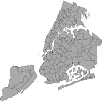
232. Community Districts New York City 2013

Polygon Tufts University Public content Community Districts New York City 2013. Shapefile. New York (N.Y.). Department of City Planning. tufts-nyccommunitydistricts13. 2013. This polygon dataset represents New York City community districts. These are mandated by the city charter to review and monitor quality of life iss...

233. Theatrum orbis terrarum

Image Stanford University Public content Theatrum orbis terrarum. JPEG 2000. apud Ioannem Bapt. Vrintium,. stanford-mp684yf2282. 1603. Ortelius, Abraham, 1527-1598, Bruney, Robert, active 1602-1614, Vrients, Jan Baptista, 1552-1612, Méndez, Diego, Seco, Fernando Alvares, Jolivet, Jean, Surhon, Jacques, Bompar, Pierre, Boileau de Buillon, Gilles, Sgrooten, Christian, approximately 1525-1603, Deventer, Jacob van, -1575, Hoppers, Joachim, 1523-1576, Antoniszoon, Cornelis, approximately 1499-, Stella, Tilemann, 1525-1589, Dryander, Johann, 1500-1560, Mellinger, Johannes, approximately, 1538-1603, Scultetus, Bartholomäus, 1540-1614, Lazius, Wolfgang, 1514-1565, Secsnagel, Marcus, approximately 1520-1580, Reuwich, Erhard, active 1483-1486, Gadner, Georg, 1522-1605, Münster, Sebastian, 1489-1552, Tschudi, Aegidius, 1505-1572, Gastaldi, Giacomo, approximately 1500-approximately 1565, Pinadello, Giovanni, Giovio, Paolo, 1483-1552, Bellarmati, Girolamo, 1493-1555, Danti, Ignazio, 1536-1586, Ligorio, Pirro, approximately 1513-1583, Hirschvogel, Augustin, 1503-1553, Coppo, Pietro, 1469 or 1470-1555 or 1556, Jenkinson, Anthony, 1529-1611, and Teixeira, Luís, active 16th century. First uniformly sized and systematically collected set of maps by different mapmakers (partial list below, in order of appearance); acknowledged a...

234. 1:1,000,000-Scale County Boundaries of the United States, 2014

Polygon Stanford University Public content 1:1,000,000-Scale County Boundaries of the United States, 2014. Shapefile. Geological Survey (U.S.). stanford-wg010mf7692. 2014. Geological Survey (U.S.). This polygon shapefile contains the county boundaries of the United States, Puerto Rico, and the U.S. Virgin Islands, by showing the counties as ar...

235. 1:1,000,000-Scale State Boundaries of the United States, 2012

Polygon Stanford University Public content 1:1,000,000-Scale State Boundaries of the United States, 2012. Shapefile. National Atlas of the United States. stanford-jv962kc4000. 2012. National Atlas of the United States. This polygon shapefile portrays the state boundaries of the United States, Puerto Rico, and the U.S. Virgin Islands. The map layer was created by e...

236. 1:1,000,000-Scale National Boundaries of the United States, 2014

Polygon Stanford University Public content 1:1,000,000-Scale National Boundaries of the United States, 2014. Shapefile. Geological Survey (U.S.). stanford-hb541mt8292. 2014. Geological Survey (U.S.). This polygon shapefile contains the boundaries of the United States, Puerto Rico, and the U.S. Virgin Islands. The map layer was created by extract...

237. Unsatisfied Basic Needs (NBI) Per Municipality, Colombia, 2005

Polygon Tufts University Public content Unsatisfied Basic Needs (NBI) Per Municipality, Colombia, 2005. Shapefile. Instituto Geografico "Agustin Codazzi". tufts-colombia-nbi-05. 2005. This polygon dataset shows the percentage of households and persons in conditions of poverty or misery according to unsatisfied basic needs for mun...

238. 1:1,000,000-Scale State Boundaries of the United States, 2014

Polygon Stanford University Public content 1:1,000,000-Scale State Boundaries of the United States, 2014. Shapefile. National Atlas of the United States. stanford-wj635fh1294. 2014. National Atlas of the United States. This polygon shapefile portrays the state boundaries of the United States, Puerto Rico, and the U.S. Virgin Islands. The map layer was created by e...

239. Typus orbis terrarum

Image Stanford University Public content Typus orbis terrarum. JPEG 2000. s.n. stanford-mc395sc7323. 1700. California shown a labeled island with a rounded northern coast. America stretches to the north and the west, and is fully connected to the Arctic....

240. Indiae orientalis insvlarvmqve adiacientivm typvs

University Of Minnesota university-of-minnesota Public content Indiae orientalis insvlarvmqve adiacientivm typvs. JPEG. (Antwerp). p16022coll230:3600. 1592. Ortelius, Abraham, 1527-1598. Relief shown pictorially.; Includes title in cartouche, coat of arms and illustrations of ships, mermaids, and sea monsters.; Includes southwest se...