Chiles and green peppers, Harvested Area Data Quality, 2000. GeoTIFF. University of Minnesota. Institute on the Environment. stanford-rp680yb4276. 2000. University of Minnesota. Institute on the Environment. This raster dataset represents the agricultural census data quality for harvested areas of chile and green pepper crops. Data quality categories in...
Chiles and green peppers, Crop Yield Data Quality, 2000. GeoTIFF. University of Minnesota. Institute on the Environment. stanford-zd584zb9296. 2000. University of Minnesota. Institute on the Environment. This raster dataset represents the agricultural census data quality for chile and green pepper crop yields. Data quality categories include (0= mis...
Pascaerte van Nova Hispania, Chili, Peru, en Guatimala. TIFF. t'Amsterdam : by Pieter Goos, op't Waater inde Verguelde Zeespiegel, Ao. 1666. princeton-gh93h195d. 1666. Goos, Pieter, approximately 1616-1675 and Goos, Pieter, ca. 1616-1675. From : De Zee-atlas ofte water-wereld ... T'Amsterdam, by Pieter Goos... 1666. Nautical chart showing the coastline of Central America, Peru, and C...
A map of the United States of Mexico. JPEG 2000. H.S. Tanner, No. 177 Chestnut St. ,. stanford-pn863fv0810. 1800. Tanner, Henry Schenck, 1786-1858. by H. S. Tanner. Relief shown by hachures. Latitudinal and longitudinal lines. Prime meridian: Washington. Coordinates approximate and based on Gre...
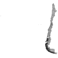
Chile communes, 2017 (Comuna). Shapefile. princeton-k0698c50d. 2017. Chile, National Institute of Statistics/Instituto Nacional de Estadísticas. The communes may have urban, rural or mixed characteristics. In the territory of a commune there may be more than one urban center, be it a city (m...
Costa Rica. (1991/relief). . TIFF. Central Intelligence Agency. princeton-fj236354d. 1991. Central Intelligence Agency. This is a map of Costa Rica with relief, shown at a 1:1,500,000 scale. The map was created by the Central Intelligence Agency.
Costa Rica summary map. (1991/relief). . TIFF. Central Intelligence Agency. princeton-47429b53k. 1991. Central Intelligence Agency. This is a map of Costa Rica, shown at a scale of 1:1,500,000. Included is information pertaining to the country profile. The map was created by the...
America. JPEG 2000. Printed by M[iles]. F[lesher]. for William Humble, and are to be sold at his shop in Popes-head Palace]. stanford-vp127xy8551. 1646. Keere, Pieter van den, 1571-approximately 1646, Humble, William, and Speed, John, 1552?-1629. Petrus Kaerius caelav. Relief shown pictorially. California shown as an island with flat northern coast and few place names: C. Blanco, Pa.d.los Re...
Chile provinces, 2017 (Provincia). Shapefile. princeton-ws859k66c. 2017. Chile, National Institute of Statistics/Instituto Nacional de Estadísticas. Provinces are the units into which a region is administratively divided, with a characteristic productive destination and cultural identity (techni...
AMERICA. JPEG 2000. stanford-jp266yb7109. 1729. Clüver, Philipp, 1580-1622. From Eptiome Geographiae Cluverianae Nova...Phillippi Cluverii? 1727 In Latin. None found. California as an island with indented northern coast and...