Digital Maps and Geospatial Data | Princeton University

latin america census nicaragua Remove constraint latin america census nicaragua

Search Results Header

Search Results

Number of results to display per page

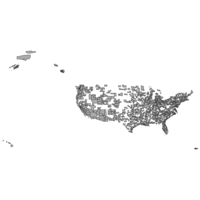
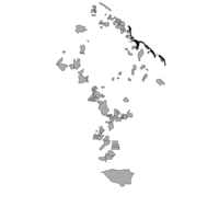
11. 1:1,000,000-Scale Core Based Statistical Areas, 2013

Stanford University Public content 1:1,000,000-Scale Core Based Statistical Areas, 2013. Shapefile. National Atlas of the United States. stanford-bn076jc5300. 2013. National Atlas of the United States. This polygon shapefile contains core based statistical areas in the United States and Puerto Rico. The map layer was created from the CENSUS 2010 T...

12. 1:1,000,000-Scale State Boundaries of the United States, 2012

Stanford University Public content 1:1,000,000-Scale State Boundaries of the United States, 2012. Shapefile. National Atlas of the United States. stanford-jv962kc4000. 2012. National Atlas of the United States. This polygon shapefile portrays the state boundaries of the United States, Puerto Rico, and the U.S. Virgin Islands. The map layer was created by e...

13. Guyana economic data from 2012 census

Princeton University Restricted content Guyana economic data from 2012 census. Shapefile. princeton-qj72pg280. 2012. East View Geospatial. Official population and housing data for Guyana from the 2012 census. This census is provided at the council administrative level (ADM3) and includ...

14. Guyana housing data from 2012 census

Princeton University Restricted content Guyana housing data from 2012 census. Shapefile. princeton-ks65hm35f. 2012. East View Geospatial. Official population and housing data for Guyana from the 2012 census. This census is provided at the council administrative level (ADM3) and includ...

15. Guyana social data from 2012 census

Princeton University Restricted content Guyana social data from 2012 census. Shapefile. princeton-3t945z930. 2012. East View Geospatial. Official population and housing data for Guyana from the 2012 census. This census is provided at the council administrative level (ADM3) and includ...

16. Guyana transportation data from 2012 census

Princeton University Restricted content Guyana transportation data from 2012 census. Shapefile. princeton-02871402z. 2012. East View Geospatial. Official population and housing data for Guyana from the 2012 census. This census is provided at the council administrative level (ADM3) and includ...

17. Costa Rica demographic data from 2011 census

Princeton University Restricted content Costa Rica demographic data from 2011 census. Shapefile. princeton-5d86p6211. 2011. East View Geospatial. Official population and housing data for Costa Rica from the 2011 census. This census is provided at the district administrative level (ADM3) and i...

18. Costa Rica economic data from 2011 census

Princeton University Restricted content Costa Rica economic data from 2011 census. Shapefile. princeton-1r66j711n. 2011. East View Geospatial. Official population and housing data for Costa Rica from the 2011 census. This census is provided at the district administrative level (ADM3) and i...

19. Costa Rica housing data from 2011 census

Princeton University Restricted content Costa Rica housing data from 2011 census. Shapefile. princeton-x059cf32j. 2011. East View Geospatial. Official population and housing data for Costa Rica from the 2011 census. This census is provided at the district administrative level (ADM3) and i...

20. Costa Rica migration data from 2011 census

Princeton University Restricted content Costa Rica migration data from 2011 census. Shapefile. princeton-s7526k40b. 2011. East View Geospatial. Official population and housing data for Costa Rica from the 2011 census. This census is provided at the district administrative level (ADM3) and i...