Digital Maps and Geospatial Data | Princeton University

latin america census costa rica Remove constraint latin america census costa rica

Search Results Header

Search Results

Number of results to display per page

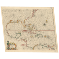
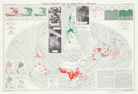
101. Central America & Caribbean Region, 1858 (Raster Image)

Raster Harvard University Public content Central America & Caribbean Region, 1858 (Raster Image). GeoTIFF. Harvard Map Collection, Harvard Library. harvard-g4390-1858-k5. 1858. Harvard Map Collection, Harvard College Library, Kiepert, Heinrich, 1818-1899., Humboldt, Alexander von, 1769-1859., and Reimer, Dietrich, 1818-1899. This layer is a georeferenced raster image of the historic paper map entitled: A new map of tropical-America, north of the Equator : comprising the...

102. Central South America, ca. 1750 (Raster Image)

Raster Harvard University Public content Central South America, ca. 1750 (Raster Image). GeoTIFF. Harvard Map Collection, Harvard Library. harvard-g5200-1750-s4. 1750. Harvard Map Collection, Harvard Library and Seutter, Matthaeus, 1678-1756. This layer is a georeferenced raster image of the historic paper map entitled: Paraquariae Provinciae Soc. Iesu cum adiacentibus novissima descript...

103. Gulf of Mexico and Caribbean in 1654 (Raster Image)

Raster Harvard University Public content Gulf of Mexico and Caribbean in 1654 (Raster Image). GeoTIFF. Harvard Map Collection, Harvard Library. harvard-g1059-w57-1654-pf-sh14. 1654. Harvard Map Collection, Harvard Library, Jacobsz, Theunis, 1632?-1679., and Wit, Frederik de. This layer is a georeferenced raster image of the historic paper map entitled: Pascaerte van West Indien : van de Caribes tot aen de Golfo van Mexi...

104. Gulf of Mexico and Caribbean Sea Region, 1717 (Raster Image)

Raster Harvard University Public content Gulf of Mexico and Caribbean Sea Region, 1717 (Raster Image). GeoTIFF. Harvard Map Collection, Harvard Library. harvard-g4390-1717-f4. 1717. Harvard Map Collection, Harvard College Library, Fer, Nicolas de, 1646-1720., and Starckman, P. This layer is a georeferenced raster image of the historic paper map entitled: Le Golfe de Mexique : et les provinces et isles qui l'environe comme...

105. Gulf of Mexico and Caribbean Sea Region, 1774 (Image 1 of 2) (Raster Image)

Raster Harvard University Public content Gulf of Mexico and Caribbean Sea Region, 1774 (Image 1 of 2) (Raster Image). GeoTIFF. Harvard Map Collection, Harvard Library. harvard-g4390-1774-s6-sh1. 1774. Harvard Map Collection, Harvard College Library, Speer, Joseph Smith., and Bowen, Thomas, -1790. This layer is a georeferenced raster image of the historic paper map entitled: To His Royal Highness. George Augustus Frederick. Prince of Wales &c...

106. Gulf of Mexico and Caribbean Sea Region, 1774 (Image 2 of 2) (Raster Image)

Raster Harvard University Public content Gulf of Mexico and Caribbean Sea Region, 1774 (Image 2 of 2) (Raster Image). GeoTIFF. Harvard Map Collection, Harvard Library. harvard-g4390-1774-s6-sh2. 1774. Harvard Map Collection, Harvard College Library, Speer, Joseph Smith., and Bowen, Thomas, -1790. This layer is a georeferenced raster image of the historic paper map entitled: To His Royal Highness. George Augustus Frederick. Prince of Wales &c...

107. Gulf of Mexico and Caribbean Sea Region, 1779-1782 (Image 1 of 2) (Raster Image)

Raster Harvard University Public content Gulf of Mexico and Caribbean Sea Region, 1779-1782 (Image 1 of 2) (Raster Image). GeoTIFF. Harvard Map Collection, Harvard Library. harvard-g4390-1779-r6-sh1. 1779. Harvard Map Collection, Harvard College Library and Robert Sayer and John Bennett (Firm). This layer is a georeferenced raster image of the historic paper map entitled: A new general chart of the West Indies : from the latest marine jour...

108. Gulf of Mexico and Caribbean Sea Region, 1779-1782 (Image 2 of 2) (Raster Image)

Raster Harvard University Public content Gulf of Mexico and Caribbean Sea Region, 1779-1782 (Image 2 of 2) (Raster Image). GeoTIFF. Harvard Map Collection, Harvard Library. harvard-g4390-1779-r6-sh2. 1779. Harvard Map Collection, Harvard College Library and Robert Sayer and John Bennett (Firm). This layer is a georeferenced raster image of the historic paper map entitled: A new general chart of the West Indies : from the latest marine jour...

109. Gulf of Mexico and Caribbean Sea Region, ca. 1708 (Raster Image)

Raster Harvard University Public content Gulf of Mexico and Caribbean Sea Region, ca. 1708 (Raster Image). GeoTIFF. Harvard Map Collection, Harvard Library. harvard-g4390-1708-o8. 1708. Harvard Map Collection, Harvard Library, Ottens, R. (Reiner), 1698-1750., Ottens, J. (Josua), 1704-1765., and R. & J. Ottens. This layer is a georeferenced raster image of the historic paper map entitled: Nova Isthmi Americani, qui et Panamiensis item Dariensis, tabula, in...

110. Gulf of Mexico and Caribbean Sea Region, ca. 1715 (Raster Image)

Raster Harvard University Public content Gulf of Mexico and Caribbean Sea Region, ca. 1715 (Raster Image). GeoTIFF. Harvard Map Collection, Harvard Library. harvard-g4390-1715-m6. 1715. Harvard Map Collection, Harvard College Library and Moll, Herman, d. 1732. This layer is a georeferenced raster image of the historic paper map entitled: A map of the West-Indies or the islands of America in the North Sea ...

111. Northern South America, ca. 1736 (Raster Image)

Raster Harvard University Public content Northern South America, ca. 1736 (Raster Image). GeoTIFF. Harvard Map Collection, Harvard Library. harvard-g5200-1736-l5-copya. 1736. Harvard Map Collection, Harvard Library, L'Isle, Guillaume de, 1675-1726., and Homann Erben (Firm). This layer is a georeferenced raster image of the historic paper map entitled: Tabula Americae specialis geographica regni Peru, Brasiliae, Terrae ...

112. Portobelo Bay, Panama, 1740 (Raster Image)

Raster Harvard University Public content Portobelo Bay, Panama, 1740 (Raster Image). GeoTIFF. Harvard Map Collection, Harvard Library. harvard-g4872-p6-1740-d7. 1740. Harvard Map Collection, Harvard Library, Durell, Philip, -1766., and Homann Erben (Firm). This layer is a georeferenced raster image of the historic paper map entitled: Portus pulchri, in Isthmo Panamensi siti accurata ichnographia ex pr...

113. Southern South America, Chile/Paraguay, ca. 1747 (Raster Image)

Raster Harvard University Public content Southern South America, Chile/Paraguay, ca. 1747 (Raster Image). GeoTIFF. Harvard Map Collection, Harvard Library. harvard-g5200-1747-o9. 1747. Harvard Map Collection, Harvard Library, Ovalle, Alonso de, 1601-1651., Techo, Nicolás del, 1611-1685., Frézier, Amédée François, 1682-1773., and Homann Erben (Firm). This layer is a georeferenced raster image of the historic paper map entitled: Typus geographicus : Chili a Paraguay, freti Magellanici &c. / ex PP...

114. Washington and British Columbia, ca. 1795 (Raster Image)

Raster Harvard University Public content Washington and British Columbia, ca. 1795 (Raster Image). GeoTIFF. Harvard Map Collection, Harvard Library. harvard-g3512-c6-1795-a4. 1795. Harvard Map Collection, Harvard Library, Alcalá-Galiano, Dionisio, 1760-1805., Valdés Flores Bazán y Peón, Cayetano, 1767-1835., Moreno Tejada, Juan., and Spain. Dirección de Hidrografía. Atlas marítimo español. This layer is a georeferenced raster image of the historic paper map entitled: Carta esferica de los reconocimientos hechos en 1792 en la costa N.O...

115. Nova Hispania et Nova Galicia

Image Stanford University Public content Nova Hispania et Nova Galicia. JPEG 2000. Hendrik Hondius. stanford-sq426wd0172. 1636. Mercator, Gerhard, 1512-1594, Hondius, Hendrik, 1597-1651, and Jansson, Jan, 1588-1664. Relief shown pictorially. 2 indexes in sea; index in cartouche: Notularum circa Mexico explanatio. Decorative cartouches, coats of arms, figures, c...

116. Tabula americae specialis geographica Regui Peru, Brasiliae, Terrae Firmae, & Reg: Amazonum [map] / per Homañianos Heredes

University Of Illinois Urbana Champaign Public content Tabula americae specialis geographica Regui Peru, Brasiliae, Terrae Firmae, & Reg: Amazonum [map] / per Homañianos Heredes. JPEG2000. Hoffmann-La Roche (Nutley, N.J.). a35a48c0-994e-0134-2096-0050569601ca-6. 1945. Homann Erben (Firm). Perú, Terra Firma (nombre tradicional de la costa de Panamá, Colombia, Venezuela, Guiana), Brazil y Región del Amazonas. Original de 1725.";Coor...

117. Americae

Image Stanford University Public content Americae. JPEG 2000. Hugo Allard. stanford-tt437zq0720. 1640. Allardt, Hugo, -1691 and Velde, Jan van de, 1593-1641. Hugo Allardt excudit. inde Kalver Straet inde Werrelt Kaert ; Velde schulp. Relief shown pictorially. California shown as an island with indented n...

118. Aqueduct Coverage Per Municipality, Colombia, 2005

Polygon Tufts University Public content Aqueduct Coverage Per Municipality, Colombia, 2005. Shapefile. Instituto Geografico "Agustin Codazzi". tufts-colombia-aqueductcoveragetotal-05. 2005. This polygon dataset presents the ratio between the percentage of households with aqueduct service, over the total number of households per munici...

119. Average Number of Dwelling Households per Municipalities, Colombia, 2005

Polygon Tufts University Public content Average Number of Dwelling Households per Municipalities, Colombia, 2005. Shapefile. Instituto Geografico "Agustin Codazzi". tufts-colombia-avghouseholdsdwelling-05. 2005. This polygon dataset presents the average number of households per dewelling by municipalities, resulting from the 2005 census. No data is availabl...

120. Electricity Coverage Per Municipality, Colombia, 2005

Polygon Tufts University Public content Electricity Coverage Per Municipality, Colombia, 2005. Shapefile. Instituto Geografico "Agustin Codazzi". tufts-colombia-electricitycoveragetotal-05. 2005. This polygon dataset presents the ratio between the percentage of households with electric service, over the total number of households per munici...

121. Female Population Per Municipality, Colombia, 2005

Polygon Tufts University Public content Female Population Per Municipality, Colombia, 2005. Shapefile. Instituto Geografico "Agustin Codazzi". tufts-colombia-popfemale-05. 2005. This polygon dataset presents the total female population per municipality for 2005. Data comes from the 2005 census. No data is available for the...

122. Housing Quality Per Municipality, Colombia, 2005

Polygon Tufts University Public content Housing Quality Per Municipality, Colombia, 2005. Shapefile. Instituto Geografico "Agustin Codazzi". tufts-colombia-housingquality-05. 2005. This polygon dataset presents a score for housing quality per municipality, resulting from the 2005 census. The score which ranges from 1.59 (being...

123. Male Population Per Municipality, Colombia, 2005

Polygon Tufts University Public content Male Population Per Municipality, Colombia, 2005. Shapefile. Instituto Geografico "Agustin Codazzi". tufts-colombia-popmale-05. 2005. This polygon dataset presents the total male population per municipality for 2005. Data comes from the 2005 census. No data is available for the f...

124. Natural Gas Coverage Per Municipality, Colombia, 2005

Polygon Tufts University Public content Natural Gas Coverage Per Municipality, Colombia, 2005. Shapefile. Instituto Geografico "Agustin Codazzi". tufts-colombia-naturalgascoveragetotal-05. 2005. This polygon dataset presents the ratio between the percentage of households with natural gas service, over the total number of households per mun...

125. Rural and Urban Population Per Municipality, Colombia, 2005

Polygon Tufts University Public content Rural and Urban Population Per Municipality, Colombia, 2005. Shapefile. Instituto Geografico "Agustin Codazzi". tufts-colombia-popurbanrural-05. 2005. This polygon dataset presents the urban and rural population per municipality. Data comes from the 2005 census, but it has been reviewed by the DAN...

126. Rural Aqueduct Coverage Per Municipality, Colombia, 2005

Polygon Tufts University Public content Rural Aqueduct Coverage Per Municipality, Colombia, 2005. Shapefile. Instituto Geografico "Agustin Codazzi". tufts-colombia-aqueductcoveragerural-05. 2005. This polygon dataset presents the ratio between the percentage of rural households with aqueduct service, over the total number of rural household...

127. Rural Electricity Coverage Per Municipality, Colombia, 2005

Polygon Tufts University Public content Rural Electricity Coverage Per Municipality, Colombia, 2005. Shapefile. Instituto Geografico "Agustin Codazzi". tufts-colombia-electricitycoveragerural-05. 2005. This polygon dataset presents the ratio between the percentage of rural households with electric service, over the total number of rural household...

128. Rural Housing Quality Per Municipality, Colombia, 2005

Polygon Tufts University Public content Rural Housing Quality Per Municipality, Colombia, 2005. Shapefile. Instituto Geografico "Agustin Codazzi". tufts-colombia-ruralhousingquality-05. 2005. This polygon dataset presents a score for rural housing quality per municipality, resulting from the 2005 census. The score which ranges from 0.59 ...

129. Rural Natural Gas Coverage Per Municipality, Colombia, 2005

Polygon Tufts University Public content Rural Natural Gas Coverage Per Municipality, Colombia, 2005. Shapefile. Instituto Geografico "Agustin Codazzi". tufts-colombia-naturalgascoveragerural-05. 2005. This polygon dataset presents the ratio between the percentage of rural households with natural gas service, over the total number of rural househ...

130. Rural Unsatisfied Basic Needs (NBI) Per Municipality, Colombia, 2005

Polygon Tufts University Public content Rural Unsatisfied Basic Needs (NBI) Per Municipality, Colombia, 2005. Shapefile. Instituto Geografico "Agustin Codazzi". tufts-colombia-nbirural-05. 2005. This polygon dataset presents the percentage of rural households and persons in conditions of poverty or misery according to unsatisfied basic need...

131. Rural Water Sanitation Coverage Per Municipality, Colombia, 2005

Polygon Tufts University Public content Rural Water Sanitation Coverage Per Municipality, Colombia, 2005. Shapefile. Instituto Geografico "Agustin Codazzi". tufts-colombia-watersanitationcoveragerural-05. 2005. This polygon dataset presents the ratio between the percentage of rural households with water sanitation service, over the total number of rural h...

132. Total Number of Households Per Municipality, Colombia, 2005

Polygon Tufts University Public content Total Number of Households Per Municipality, Colombia, 2005. Shapefile. Instituto Geografico "Agustin Codazzi". tufts-colombia-households-05. 2005. This polygon dataset presents the total number of households per municipality, resulting from the 2005 census. No data is available for the followi...

133. Total Population Per Municipality, Colombia, 2005

Polygon Tufts University Public content Total Population Per Municipality, Colombia, 2005. Shapefile. Instituto Geografico "Agustin Codazzi". tufts-colombia-poptotal-05. 2005. This polygon dataset presents the total population per municipality for 2005. Data comes from the 2005 census, but it has been reviewed by the DANE...

134. Unsatisfied Basic Needs (NBI) Per Municipality, Colombia, 1993

Polygon Tufts University Public content Unsatisfied Basic Needs (NBI) Per Municipality, Colombia, 1993. Shapefile. Instituto Geografico "Agustin Codazzi". tufts-colombia-nbi-93. 1993. This polygon dataset presents the percentage of households and persons in conditions of poverty or misery according to unsatisfied basic needs per ...

135. Unsatisfied Basic Needs (NBI) Per Municipality, Colombia, 2005

Polygon Tufts University Public content Unsatisfied Basic Needs (NBI) Per Municipality, Colombia, 2005. Shapefile. Instituto Geografico "Agustin Codazzi". tufts-colombia-nbi-05. 2005. This polygon dataset shows the percentage of households and persons in conditions of poverty or misery according to unsatisfied basic needs for mun...

136. Unsatisfied Basic Needs (NBI) Per Municipality, Colombia, 2010

Polygon Tufts University Public content Unsatisfied Basic Needs (NBI) Per Municipality, Colombia, 2010. Shapefile. Instituto Geografico "Agustin Codazzi". tufts-colombia-nbi-10. 2010. This polygon dataset presents the percentage of households and persons in conditions of poverty or misery according to unsatisfied basic needs per ...

137. Urban Aqueduct Coverage Per Municipality, Colombia, 2005

Polygon Tufts University Public content Urban Aqueduct Coverage Per Municipality, Colombia, 2005. Shapefile. Instituto Geografico "Agustin Codazzi". tufts-colombia-aqueductcoverageurban-05. 2005. This polygon dataset presents the ratio between the percentage of urban households with aqueduct service, over the total number of urban household...

138. Urban Electricity Coverage Per Municipality, Colombia, 2005

Polygon Tufts University Public content Urban Electricity Coverage Per Municipality, Colombia, 2005. Shapefile. Instituto Geografico "Agustin Codazzi". tufts-colombia-electricitycoverageurban-05. 2005. This polygon dataset presents the ratio between the percentage of urban households with electric service, over the total number of urban household...

139. Urban Housing Quality Per Municipality, Colombia, 2005

Polygon Tufts University Public content Urban Housing Quality Per Municipality, Colombia, 2005. Shapefile. Instituto Geografico "Agustin Codazzi". tufts-colombia-urbanhousingquality-05. 2005. This polygon dataset presents a score for urban housing quality per municipality, resulting from the 2005 census. The score which ranges from 2.13 ...

140. Urban Natural Gas Coverage Per Municipality, Colombia, 2005

Polygon Tufts University Public content Urban Natural Gas Coverage Per Municipality, Colombia, 2005. Shapefile. Instituto Geografico "Agustin Codazzi". tufts-colombia-naturalgascoverageurban-05. 2005. This polygon dataset presents the ratio between the percentage of urban households with natural gas service, over the total number of urban househ...

141. Urban Unsatisfied Basic Needs (NBI) Per Municipality, Colombia, 2005

Polygon Tufts University Public content Urban Unsatisfied Basic Needs (NBI) Per Municipality, Colombia, 2005. Shapefile. Instituto Geografico "Agustin Codazzi". tufts-colombia-nbiurban-05. 2005. This polygon dataset presents the percentage of urban households and persons in conditions of poverty or misery according to unsatisfied basic need...

142. Urban Water Sanitation Coverage Per Municipality, Colombia, 2005

Polygon Tufts University Public content Urban Water Sanitation Coverage Per Municipality, Colombia, 2005. Shapefile. Instituto Geografico "Agustin Codazzi". tufts-colombia-watersanitationcoverageurban-05. 2005. This polygon dataset presents the ratio between the percentage of urban households with water sanitation service, over the total number of urban h...

143. Urban/Rural Households Per Municipality, Colombia, 2005

Polygon Tufts University Public content Urban/Rural Households Per Municipality, Colombia, 2005. Shapefile. Instituto Geografico "Agustin Codazzi". tufts-colombia-householdsurbanrural-05. 2005. This polygon dataset presents the total number of households per municipality, resulting from the 2005 census. No data is available for the followi...

144. Water Sanitation Coverage Per Municipality, Colombia, 2005

Polygon Tufts University Public content Water Sanitation Coverage Per Municipality, Colombia, 2005. Shapefile. Instituto Geografico "Agustin Codazzi". tufts-colombia-watersanitationcoveragetotal-05. 2005. This polygon dataset presents the ratio between the percentage of households with water sanitation service, over the total number of households pe...

145. Land for Black Communities Colombia 2010

Polygon Tufts University Public content Land for Black Communities Colombia 2010. Shapefile. Instituto Geografico "Agustin Codazzi.". tufts-colombiacomblack10. 2010. This polygon dataset represents special area designations, specifically for black community lands (from the translation "tierras de comunidades neg...

147. Level Three Administrative Boundaries (Parroquias) Population Census Ecuador 2010

Polygon Tufts University Public content Level Three Administrative Boundaries (Parroquias) Population Census Ecuador 2010. Shapefile. Instituto Geografico Militar (Ecuador). tufts-ecuadorlev3populationcensus10. 2010. This polygon dataset represents the 2010 population census performed in Ecuador at the level three administrative level (known as parishes or parro...

148. Municipality Boundaries Mexico 2013

Polygon Tufts University Public content Municipality Boundaries Mexico 2013. Shapefile. Instituto Nacional de Estadistica y Geografia (Mexico). tufts-mexicomunicipalityboundaries13. 2013. This polygon dataset shows boundaries for major municipalities in Mexico. This dataset is part of the most current version of INEGI's "Marco Geos...

149. Named Urban Areas Mexico 2012

Polygon Tufts University Public content Named Urban Areas Mexico 2012. Shapefile. Instituto Nacional de Estadistica y Geografia (Mexico). tufts-mexiconamedurbanareas12. 2012. This polygon dataset shows urban areas in Mexico, identified by their official geographically recognized place name. These urban localities are fur...

150. Rural Locations Mexico 2012

Point Tufts University Public content Rural Locations Mexico 2012. Shapefile. Instituto Nacional de Estadistica y Geografia (Mexico). tufts-mexicorurallocations12. 2012. This point dataset shows rural locations in Mexico, based on the "Inventario Nacional de Viviendas 2012," or their National Inventory of Homes. T...

151. State Boundaries Mexico 2013

Polygon Tufts University Public content State Boundaries Mexico 2013. Shapefile. Instituto Nacional de Estadistica y Geografia (Mexico). tufts-mexicostateboundaries13. 2013. This polygon dataset shows Mexico's state boundaries. This dataset is part of the most current version of INEGI's "Marco Geostatistico Nacional,"...

152. Urban Geostatistical Areas Mexico 2012

Polygon Tufts University Public content Urban Geostatistical Areas Mexico 2012. Shapefile. Instituto Nacional de Estadistica y Geografia (Mexico). tufts-mexicourbanareas12. 2012. This polygon dataset shows basic geostatistical urban areas in Mexico. This is based on Mexico's "Inventario Nacional de Viviendas 2012," or their...

153. United Fruit Company steamship service : Cuba, Jamaica, Panama, Honduras, Colombia, Salvador, Costa Rica, Guatemala, Central & South America

University Of Minnesota Public content United Fruit Company steamship service : Cuba, Jamaica, Panama, Honduras, Colombia, Salvador, Costa Rica, Guatemala, Central & South America. JPEG. J.W. Clement Co., Matthews-Northrup Works. p16022coll230:2757. 1929. United Fruit Company. Relief shown by shading.; Includes inset of South America.|68 x 88 centimeters|Scale approximately 1:8,000,000.

154. Nouvelle description de l'Amerique

Image Stanford University Public content Nouvelle description de l'Amerique. JPEG 2000. Jean Boisseau. stanford-nh040md8464. 1643. Boisseau, Jean, active 1637-1658. [Jean Boisseau]. California shown as a large island with slightly rounded northern coast and separated from mainland by very narrow east-west "stra...

155. Macedonia, Epirus et Achaia

Image Stanford University Public content Macedonia, Epirus et Achaia. JPEG 2000. Joan Blaeu. stanford-tf900sm1651. 1645. Blaeu, Willem Janszoon, 1571-1638 and Blaeu, Joan, 1596-1673. G. Blaeu exc. Relief shown pictorially. Bar scale on map given in "Milliaria Germanica communia." Decorative cartouche, ship. Shows historical regi...

156. Cuba Insula

Image Stanford University Public content Cuba Insula. JPEG 2000. Jodocus Hondius. stanford-jc686tb6436. 1613. Mercator, Gerard, approximately, 1565-1656 and Hondius, Jodocus, 1563-1612. Relief shown pictorially. Prime meridian: [Ferro]. Latitudinal and longitudinal lines along margins. Decorative cartouches, ships, sea monsters. Sh...

157. [World map]

Image Stanford University Public content [World map]. JPEG 2000. Johann Christoph Weigel. stanford-qh664hf2573. 1719. Doppelmayr, Johann Gabriel, 1677-1750. California shown as an unlabeled island with a very indented western coast. Hemispheres are tilted at a 45 degree angle toward the center. Includes...

158. Peru

Image Stanford University Public content Peru. JPEG 2000. John Ogilby. stanford-fg622mp4075. 1671. Ogilby, John, 1600-1676. Relief shown pictorially. North oriented toward right of sheet. Latitudinal and longitudinal lines along margins. Imprint taken from atlas. Decorat...

159. Sketch of the state of Costarrica in Central America

Princeton University Public content Sketch of the state of Costarrica in Central America. TIFF. London : published for the Journal of the Royal Geographical Society, by J. Murray, Albemarle Street, 1836. princeton-vq27zq916. 1836. Galindo, Juan, 1802-1839. Departments and districts as 1836 are shown. Relief shown by hachures. From: Journal of the Royal Geographical Society of London. Vol. 6 (1836), pp...

160. Claudii Ptolemaei Alexandrini mathematicor principis, opus Geographiae

Image Stanford University Public content Claudii Ptolemaei Alexandrini mathematicor principis, opus Geographiae. JPEG 2000. Lorenz Fries,. stanford-nj123hx9157. 1522. Ptolemy, active 2nd century, Fries, Lorenz, 1491-1550, and Grüninger, Johann, -1532?. Woodcuts based on those by Martin Waldseemüller, 1470-1519. Relief shown pictorially. Vellum binding. First 4 and last 4 pages blank (included in p...

161. Tabula geographica nova omnium oculis exibens et proponens verissimam descriptionem potentissimi et aurifen Regni Guiana

Image Stanford University Public content Tabula geographica nova omnium oculis exibens et proponens verissimam descriptionem potentissimi et aurifen Regni Guiana. JPEG 2000. M. Becker]. stanford-qw352zt9270. 1599. Hondius, Jodocus, 1563-1612, Bry, Theodor de, 1528-1598, Becker, Matthias, active 1573-1606, and Raleigh, Walter, Sir, 1552?-1618. siti per nautam aliguem qui Gualthero Ralegh navigatione semper adsuit delineata. Relief shown pictorially. Decorative cartouches, compass roses, r...

162. MassDEP Bureau of Waste Prevention location of Major Facilities Massachusetts 1993-2013

Point Tufts University Public content MassDEP Bureau of Waste Prevention location of Major Facilities Massachusetts 1993-2013. Shapefile. MassGIS (Office : Mass.) . tufts-mafacility9313. 1993. The point dataset represents a statewide point dataset containing the location of a subset of facility types regulated by MassDEP’s Bureau of Waste...

163. State House of Representatives Districts Massachusetts 2011

Polygon Tufts University Public content State House of Representatives Districts Massachusetts 2011. Shapefile. MassGIS (Office : Mass.) . tufts-madistrict11. 2011. This polygon dataset represents districts in Massachusetts, which were based on demographic data from the 2010 U.S. Census. They were used for elec...

164. Congressional Districts New Hampshire 20120509

Polygon Tufts University Public content Congressional Districts New Hampshire 20120509. Shapefile. NH GRANIT (Firm). tufts-nhcongressionaldistricts120509. 2012. This polygon dataset shows the New Hampshire congressional district boundaries for 2012. The US district boundaries were generated based on the 20...

165. Correctional Institution Locations New Hampshire 2006-2009

Point Tufts University Public content Correctional Institution Locations New Hampshire 2006-2009. Shapefile. NH GRANIT (Firm). tufts-nhcorrectionalinstitutions0609. 2008. This point dataset shows correctional institutions in New Hampshire. Jails and Prisons (Correctional Institutions). The Jails and Prisons sub-laye...

166. Executive Council District Boundaries New Hampshire 2012

Polygon Tufts University Public content Executive Council District Boundaries New Hampshire 2012. Shapefile. NH GRANIT (Firm). tufts-nhexecutivecouncildistricts12. 2012. This polygon dataset shows the Executive Council district boundaries drawn by the New Hampshirec based on the 2010 US Census population. count. Bou...

167. House Floterial District Boundaries New Hampshire 2012

Polygon Tufts University Public content House Floterial District Boundaries New Hampshire 2012 . Shapefile. NH GRANIT (Firm). tufts-nhhousefloterialdistricts12. 2012. This polygon dataset shows the New Hampshire House of Representatives "floterial" district boundaries drawn by the New Hampshire Legislature based ...

168. Senate District Boundaries New Hampshire 2012

Polygon Tufts University Public content Senate District Boundaries New Hampshire 2012. Shapefile. NH GRANIT (Firm). tufts-nhsenatedistricts12. 2012. This polygon dataset shows New Hampshire Senate district boundaries drawn by the New Hampshire Legislature based on the 2010 US Census population ...

169. 1:1,000,000-Scale Combined Statistical Areas, 2013

Polygon Stanford University Public content 1:1,000,000-Scale Combined Statistical Areas, 2013. Shapefile. National Atlas of the United States. stanford-mb303sh3837. 2013. National Atlas of the United States. This polygon shapefile contains combined statistical areas in the United States and Puerto Rico. Combined statistical areas consist of two or more ...

170. 1:1,000,000-Scale Core Based Statistical Areas, 2013

Polygon Stanford University Public content 1:1,000,000-Scale Core Based Statistical Areas, 2013. Shapefile. National Atlas of the United States. stanford-bn076jc5300. 2013. National Atlas of the United States. This polygon shapefile contains core based statistical areas in the United States and Puerto Rico. The map layer was created from the CENSUS 2010 T...

171. 1:1,000,000-Scale State Boundaries of the United States, 2012

Polygon Stanford University Public content 1:1,000,000-Scale State Boundaries of the United States, 2012. Shapefile. National Atlas of the United States. stanford-jv962kc4000. 2012. National Atlas of the United States. This polygon shapefile portrays the state boundaries of the United States, Puerto Rico, and the U.S. Virgin Islands. The map layer was created by e...

172. 1:1,000,000-Scale State Boundaries of the United States, 2014

Polygon Stanford University Public content 1:1,000,000-Scale State Boundaries of the United States, 2014. Shapefile. National Atlas of the United States. stanford-wj635fh1294. 2014. National Atlas of the United States. This polygon shapefile portrays the state boundaries of the United States, Puerto Rico, and the U.S. Virgin Islands. The map layer was created by e...

173. Agriculture Census of the United States, 2002

Polygon Stanford University Public content Agriculture Census of the United States, 2002. Shapefile. National Atlas of the United States. stanford-qp249dw6789. 2002. National Atlas of the United States. This polygon shapefile portrays a selected set of information that was collected for the 2002 Census of Agriculture by the National Agricultural St...

174. Agriculture Census of the United States, 2007

Polygon Stanford University Public content Agriculture Census of the United States, 2007. Shapefile. National Atlas of the United States. stanford-fz453mf0269. 2007. National Atlas of the United States. This polygon shapefile portrays a selected set of information that was collected for the 2007 Census of Agriculture by the National Agricultural St...

175. Cities and Towns of the United States, 2004

Point Stanford University Public content Cities and Towns of the United States, 2004. Shapefile. National Atlas of the United States. stanford-js689mk1912. 2004. National Atlas of the United States. This point shapefile includes cities in the United States, Puerto Rico and the U.S. Virgin Islands. These cities were collected from the 1970 Natio...

176. Cities and Towns of the United States, 2014

Point Stanford University Public content Cities and Towns of the United States, 2014. Shapefile. National Atlas of the United States. stanford-bx729wr3020. 2014. National Atlas of the United States. This point shapefile includes cities and towns in the United States, Puerto Rico, and the U.S. Virgin Islands. A city or town is a place with a rec...

177. Global Map: 1:1,000,000-Scale Political Areas of the United States, 2014

Polygon Stanford University Public content Global Map: 1:1,000,000-Scale Political Areas of the United States, 2014. Shapefile. National Atlas of the United States. stanford-cs453hh9696. 2014. National Atlas of the United States. This polygon shapefile includes Global Map data showing the counties and equivalent entities of the United States, Puerto Rico, and the U.S. Virgin...

178. Global Map: 1:1,000,000-Scale Political Boundary Lines of the United States, 2014

Line Stanford University Public content Global Map: 1:1,000,000-Scale Political Boundary Lines of the United States, 2014. Shapefile. National Atlas of the United States. stanford-vm820jh8767. 2014. National Atlas of the United States. This line shapefile includes Global Map data showing the counties and equivalent entities of the United States, Puerto Rico, and the U.S. Virgin Is...

179. Global Map: Cities and Towns of the United States, 2014

Point Stanford University Public content Global Map: Cities and Towns of the United States, 2014. Shapefile. National Atlas of the United States. stanford-nh933kw1202. 2014. National Atlas of the United States. This point shapefile includes Global Map data showing cities and towns in the United States, Puerto Rico, and the U.S. Virgin Islands. The data are...

180. Nighttime Lights of Latin America and the Caribbean - Human Settlements, 1994-1995

Raster Stanford University Public content Nighttime Lights of Latin America and the Caribbean - Human Settlements, 1994-1995. GeoTIFF. National Geophysical and Solar-Terrestrial Data Center. stanford-vt902fz3161. 2009. National Geophysical and Solar-Terrestrial Data Center. This map shows light sources from human settlements in Latin America and the Caribbean as observed during 1994-1995. The Defense Meteorological Sat...

181. Community Districts New York City 2013

Polygon Tufts University Public content Community Districts New York City 2013. Shapefile. New York (N.Y.). Department of City Planning. tufts-nyccommunitydistricts13. 2013. This polygon dataset represents New York City community districts. These are mandated by the city charter to review and monitor quality of life iss...

182. City of New York, NY Planning

Polygon Tufts University Public content City of New York, NY Planning. Shapefile. New York (N.Y.). Department of City Planning . tufts-nycassemblydistricts13. 2013. This polygon dataset represents districts in New york City, which were created by the Department of City Planning to aid city agencies in administe...

183. World distribution of spirochetal diseases: 1.Yaws, pinta, bejel

Princeton University Restricted content World distribution of spirochetal diseases: 1.Yaws, pinta, bejel. TIFF. New York, NY : American Geographical Society, 1955. princeton-5999n5195. 1955. American Geographical Society of New York. Briesemeister elliptical equal-area projection. On upper right margin: Atlas of distribution of diseases...

184. Descripcion de las Yndias Ocidentales

Image Stanford University Public content Descripcion de las Yndias Ocidentales. JPEG 2000. Nicolas Rodriquez Franco. stanford-qs151yz7949. 1726. Herrera y Tordesillas, Antonio de, -1625. Antonio de Herrera y Tordesillas, who was the official historian of Castile and the Indies compiled a history of the Spanish conquests and early ex...

185. Americae nova descriptio

Image Stanford University Public content Americae nova descriptio. JPEG 2000. Petrus Kaerius excudit. stanford-ks356zj7198. 1614. Keere, Pieter van den, 1571-approximately 1646 and Goos, Abraham. Relief shown pictorially. Shows Tierra del Fuego as an island. Along bottom: Prima orbis circumnavigatio 1525. Secunda orbis circumnavigatio 1580. ...

186. Mitchell's national map of the American republic or United States of North America. Together with maps of the vicinities of thirty-two of the principal cities and towns in the Union

Princeton University Public content Mitchell's national map of the American republic or United States of North America. Together with maps of the vicinities of thirty-two of the principal cities and towns in the Union. Philadelphia : Published by S. Augustus Mitchell, 1843, c1842. princeton-2r36v098f. 1843. Mitchell, S. Augustus (Samuel Augustus), 1792-1868. Relief shown by hachures. Cover title: Mitchell's national maps of the United States. "Drawn by J.H. Young. Engraved by J.H. Brightly." Second shee...

187. America

Image Stanford University Public content America. JPEG 2000. Printed by M[iles]. F[lesher]. for William Humble, and are to be sold at his shop in Popes-head Palace]. stanford-vp127xy8551. 1646. Keere, Pieter van den, 1571-approximately 1646, Humble, William, and Speed, John, 1552?-1629. Petrus Kaerius caelav. Relief shown pictorially. California shown as an island with flat northern coast and few place names: C. Blanco, Pa.d.los Re...

188. The Gulf of Nicoya

University Of Chicago Public content The Gulf of Nicoya. JPEG. Printed by W. Botham for James Knapton. 018b1db0-726a-4727-af0a-5c7e18783ace. 1707. 1 map: black and white; "Fig XXVII."; Vertical axis of map oriented, from top to bottom, west to east; Print version published as a fold out plate ...

189. Blanchards new map of the territories

Image Stanford University Public content Blanchards new map of the territories. JPEG 2000. R. Blanchard 140 Lake St,. stanford-kr140fz6488. 1800. Blanchard, Rufus, 1821-1904. Rufus Blanchard 140 Lake St. Chicago Relief shown by hachures. Includes table of distances: Pony express mail and telegraph route; and statistical ...

190. Bay Area Counties

Polygon University of California, Berkeley Public content Bay Area Counties. Shapefile. San Francisco (Calif.). Department Of Telecommunications and Information Services. ark28722-s7hs4j. 2006. US Census Bureau. Bay Area Counties.

191. Costa Rica 1:10,000. Ciudad de San Jose

Princeton University Restricted content Costa Rica 1:10,000. Ciudad de San Jose. TIFF. San Jose, Costa Rica : Costa Rica. Instituto Geografico de Costa Rica, 1959. princeton-9p290f174. 1959. A scanned map object.

192. Costa Rica 1:25,000

Princeton University Restricted content Costa Rica 1:25,000. TIFF. San Jose, Costa Rica : Ministerio de Obras Públicas. Instituto Geográfico de Costa Rica, 1950. princeton-g158bn14h. 1950. Instituto Geográfico Nacional (Costa Rica). Map shows roads, schools, churches, hospitals, cemeteries, parks, and rivers. Relief shown by 5 meters contour interval and spot heights. Includes ...

193. Costa Rica 1:10,000

Princeton University Restricted content Costa Rica 1:10,000. TIFF. San José : Instituto Geográfico Nacional, 1979. princeton-gx41mn70r. 1979. Instituto Geográfico Nacional (Costa Rica). Map shows roads, railroads, bridges, densely populated areas, important buildings, tanks, electric transmission lines, area limits, rivers, and veg...

194. San José

Princeton University Restricted content San José. TIFF. San José, Costa Rica : Instituto Geográfico Nacional, 1982. princeton-w3763b62s. 1982. Instituto Geográfico Nacional (Costa Rica). Map shows roads, railroads, important buildings, tanks, electric transmission lines, area limits, rivers, parks, and built-up areas. Includes index...

195. Costa Rica 1:10,000

Princeton University Restricted content Costa Rica 1:10,000. TIFF. San José, Costa Rica : Instituto Geográfico Nacional, 1991. princeton-d504rq18h. 1991. Instituto Geográfico Nacional (Costa Rica). Topographic map series of Costa Rica towns and cities showing roads, tracks, footpaths, administrative boundaries, water features, vegetation, cult...

196. Costa Rica 1:10,000

Princeton University Restricted content Costa Rica 1:10,000. TIFF. San José, Costa Rica : Instituto Geográfico Nacional, 1991. princeton-8c97kv27r. 1991. Instituto Geográfico Nacional (Costa Rica). Topographic map series of Costa Rica towns and cities showing roads, tracks, footpaths, administrative boundaries, water features, vegetation, cult...

197. Costa Rica 1:10,000

Princeton University Restricted content Costa Rica 1:10,000. TIFF. San José, Costa Rica : Instituto Geográfico Nacional, 1991. princeton-4m90f035x. 1991. Instituto Geográfico Nacional (Costa Rica). Map shows roads, railroads, area limits, built-up areas, buildings of public interest, types of vegetation, and water and land features. Relief sho...

198. Costa Rica 1:10,000

Princeton University Restricted content Costa Rica 1:10,000. TIFF. San José, Costa Rica : Instituto Geográfico Nacional, 1991. princeton-2v23vz23z. 1991. Instituto Geográfico Nacional (Costa Rica). Topographic map series of San Jose Province and adjacent provinces showing roads, tracks, footpaths, boundaries, water features, vegetation, cultiv...

199. Costa Rica 1:10,000

Princeton University Restricted content Costa Rica 1:10,000. TIFF. San José, Costa Rica : Instituto Geográfico Nacional, 1991. princeton-z316q543r. 1991. Instituto Geográfico Nacional (Costa Rica). Topographic map series of Costa Rica towns and cities showing roads, tracks, footpaths, administrative boundaries, water features, vegetation, cult...

200. Costa Rica 1:10,000

Princeton University Restricted content Costa Rica 1:10,000. TIFF. San José, Costa Rica : Instituto Geográfico Nacional, 1991. princeton-6m311t14w. 1991. Instituto Geográfico Nacional (Costa Rica). Topographic map series of Costa Rica towns and cities showing roads, tracks, footpaths, administrative boundaries, water features, vegetation, cult...