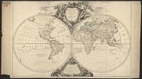
Americae sive novi orbis, nova descriptio. TIFF. [Antverpiae : Ex officina Plantiniana, Apud I. Moretum, 1601]. princeton-sj139379z. 1587. Ortelius, Abraham, 1527-1598. From: Theatrum orbis terrarum. Antverpiae : Ex officina Plantiniana, Apud I. Moretum, 1601. Latin text on verso. Map shows Americas, Pacific Ocean ...
[America]. JPEG 2000. stanford-bc854pr7981. 1719. Homann, Johann Baptist, 1663-1724. California labeled "C". Initials are used as place names throughout, and are keyed to an atlas index. It was used as a teaching atlas. California a...
U.S. Census Tracts, 2013. Shapefile. princeton-g732db55s. 2011. TomTom North America, Inc. U.S. Census Tracts represents the U.S. Census tracts of the United States in the 50 states, the District of Columbia, and Puerto Rico.
U.S. Census Tracts, 2017. Shapefile. Esri. princeton-m613n273g. 2010. TomTom North America, Inc. U.S. Census Tracts represents the Census tracts of the United States in the 50 states, the District of Columbia, and Puerto Rico.
AMERICÆ Descriptio. JPEG 2000. stanford-bd419mh1051. 1660. Clüver, Philipp, 1580-1622. In Latin. None found. California as an island with flat northern coast, with place names: C. Mendocino, C.d. Pinas, C.d. Galera, I.S. Augustin, C d...
AMERICA Septentrionalis. JPEG 2000. stanford-xm469xm6113. 1683. Sanson, Nicolas, 1600-1667. California as an island with flat northern coast sloping up to east. Few place names on island: C. Blanq, C. Mendocino, C. de Pinos and C. de S Luc...
Novi orbis pars borealis, America scilicet, complectens Floridam, Baccalaon, Canadam, terram Corterialem, Virginiam, Norombecam, pluresque alias provincias. TIFF. [S.l. : s.n., between 1600 and 1608?]. princeton-bn999858w. 1600. Quad, Matthias, 1557-1613. Relief shown pictorially. Based on Cornelis de Jode's map of America, showing Northwest passage, Virginia placed in New England area, and a peninsu...
Americæ nova tabula. TIFF. [Amsterdami? : Apud Guiljelmum et Iohannem Blaeu?, 1635?]. princeton-qr46r266q. 1635. Blaeu, Willem Janszoon, 1571-1638. Relief shown pictorially. "Cum privilegio decem annorum." Appears in Blaeu's Theatrum orbis terrarum. Includes inset of Greenland, note, and ill., ...
Map of the United States showing the distribution of the lines of mean annual temperature : prepared to illustrate the corresponding distribution of the population at the date of the Tenth Census. JPEG. [Census Bureau]. 7140014d-17ab-4ab5-ba2e-c440a2a59cdc. 1880. Gannett, Henry, 1846-1914. Scale [ca. 1:12,000,000]; 1 map: color, mounted on linen; 26 x 41 cm Atmospheric temperature--United States--Maps.
Peruuiae auriferæ regionis typus. TIFF. [Antwerp : Plantin, 1591]. princeton-j098zc942. 1591. Ortelius, Abraham, 1527-1598. Shows portion of Central America, northwestern South America, southern United States, and coast of Tamaulipas in Mexico. Relief shown pictorially. ...
U.S. Census Block Groups, 2017. Shapefile. Esri. princeton-6395wc232. 2010. TomTom North America, Inc. U.S. Census Block Groups represents the Census block groups of the United States in the 50 states, the District of Columbia, and Puerto Rico.
N.8. Croquis general de los rios estudiados por la Comision Exploradora del Istmo Fitz-Carrald. JPEG. Carlos Fabbri. p16022coll230:2737. 1902. Torres, Juan M. Peru.; Shows grid, roads, railways, international boundaries.; Relief shown by shading.|62 x 76 centimeters|Scale indeterminable.
Americae nova tabula. JPEG. Abraham Ortelius. 5cfaa6aa-db0e-4056-8622-70145a3f4298. 1635. Blaeu, Willem Janszoon, 1571-1638. 1 map: color; Relief shown pictorially; Shows drainage and settlements; Appears in the author's Le théâtre dv monde, on novvel atlas; Includes 10...
Americae. JPEG 2000. [Theodore de Bry],. stanford-qx744gb3141. 1593. Bry, Theodor de, 1528-1598, Bry, Johann Israel de, -1611, and Bry, Johann Theodor de, 1561-1623. Relief shown pictorially. Imprint taken from atlas. Shows fortified settlements on the islands of St. Vincent and Maro, and the surrounding mainlan...
L'AMERIQUE SEPTENTRIONALE. Dressée sur les Observations de Mrs. de l' Academie Royale des Sciences & quelques autres, & sur les Memoires les plus recens. JPEG 2000. stanford-kv124sx5188. 1700. L'Isle, Guillaume de, 1675-1726. California as peninsula; west coast extended north to C. Mendocin. Engraved by: N. Guerard (below title cartouche). Title cartouche with mythologic...
Americae. JPEG 2000. Hugo Allard. stanford-tt437zq0720. 1640. Allardt, Hugo, -1691 and Velde, Jan van de, 1593-1641. Hugo Allardt excudit. inde Kalver Straet inde Werrelt Kaert ; Velde schulp. Relief shown pictorially. California shown as an island with indented n...
L'AMERICA Descritta conforme lo stato presente et accresciuta di varie notizie. JPEG 2000. stanford-nc126wy3758. 1702. Canali, Gio. Battista (Giovanni Battista). California as an island on Briggs model. Dedicated to: Gregorio Barbarigo. Title cartouche contains Barbarigo crest. Includes three tables: Divsion...
TOTIVS AMERICÆ NOVA ET EXACTA TABVLA EX OPTIMIS TVM GEOGRAPHORVM, TVM ALIORVM | SCRIPTIS COLLECTA, ET AD HODIERNAM REGNORVM PRINCIPATVVM, ET MAI[?]RVM PARTIVM DISTINCTIONEM ACCOMMODATA PER CORN. DANKERVM |[=] CARTE NOVVELLE ET EXACTE DE L'AMERIQVE NOVVELLEMENT DRESSEE SVR LES MEMOIRES | DES MEILLEURS GEOGRAPHES ET AVTRES ESCRIVAINS DE NOSTRE TEM [ ... ?] ET PRINCIPALES PARTIES QVY SY TROVVENT A PRESENT. JPEG 2000. stanford-tf486tz1347. 1647. Per Corn. Dankervm, Mariette, Pierre, Mariette, Pierre (ca. 1602-53), Danckerts, Cornelius, the younger (1664-1717), and Duval [Du Val], Pierre (1618-83). Referred to as “old ugly.” Framed on the wall in the basement hallway. Title in Latin and French.California as an island with flat northern coast....
Le provincie di Quito, Lima, e Plata. TIFF. Venezia : Presso Antonio Zatta e figli, 1794. princeton-h702q882k. 1794. Zatta, Antonio, active 1757-1797. Map of Ecuador, Peru, Chile and part of Argentina; relief shown pictorially. From: Atlante novissimo. Venezia [Venice] : Presso Antonio Zatta, 1779...
Dominia Anglorum in America Septentrionali. [Norimbergæ, 1759]. princeton-wd375z66h. 1759. Homann Erben (Firm). Relief shown pictorially. Sheet title in Latin and German. Individual map titles and text in German. Maps in English and German. From the authors' ...
AMERICÆ SEPTENTRIONALIS TABULA. JPEG 2000. stanford-gn298pj4727. 1704. Wells, Edward, 1667-1727. See also separate entry in book database. California as an island with indented northern coast and blank to its north. None found. Dedicated to Tho...
Novissima et Accuratissima TOTIUS AMERICÆ DESCRIPTIO. JPEG 2000. stanford-sk402kh8074. 1671. Ogilby, John, 1600-1676. Engraved by: F. Lamb, Sculp (lower right). Wagner 404; Tooley 35 (Plate 42). Place names in Latin. Based on Visscher map; California as an island w...
Descripcion de las Yndias Ocidentales. JPEG 2000. Nicolas Rodriquez Franco. stanford-qs151yz7949. 1726. Herrera y Tordesillas, Antonio de, -1625. Antonio de Herrera y Tordesillas, who was the official historian of Castile and the Indies compiled a history of the Spanish conquests and early ex...
AMERICÆ Aucta DELINEATIO. JPEG 2000. stanford-qf555ns8242. 1745. Weigel, Christoph, 1654-1725. [1745], Mare Iesso rather than Mare de Iesso as in State 1. Much of the lettering in the oceans is in bold. In German and Latin. California as an i...
AMERICÆ Aucta DELINEATIO. JPEG 2000. stanford-nj318gt4956. 1745. Weigel, Christoph, 1654-1725. Includes bibliographical references (p. xv-xvi) and indexes. In German and Latin. California as an island with indented northern coast, including n...
The Beni River from a reduction of the original surveys by Dr. E. Heath, supplied by himself. TIFF. London : Edward Stanford, 1883. princeton-gq67jt68h. 1883. Sharbau, H. (Henry). Includes inset map: Part of Peru and Bolivia, to illustrate the paper by Clements R. Markham, C.B. [scale ca. 1:7,509,000]. Relief shown by hachure...
America Septentrionalis. JPEG 2000. Venalis prostat apud Tobiam Conr. Lotter. stanford-xg598wd4681. 1772. Lotter, Georg Friedrich, Lotter, Tobias Conrad, 1717-1777, and L'Isle, Guillaume de, 1675-1726. per G. de L'Isle, geographum. G.F. Lotter, sculps. Hand colored. Relief shown pictorially. Includes "Annotatio." Based on De L'Isle's map of 1700. ...
AMERICA SEPTENTRIO= NALlS. JPEG 2000. stanford-wn503xg3716. 1653. Valck, G. (Gerard), 1651 or 1652-1726 and Schenk, Pieter, approximately 1698-1775. California of Briggs type, with nearly flat northern coast. C. Blanco is point furthest north. Includes I. de Ceintas off west coast of California....
AMERICA SEPTENTRIO= NALIS. JPEG 2000. stanford-kc023qd4183. 1700. Hondius, Hendrik, 1597-1651 and Jansson, Jan, 1588-1664. Later reproduction, [unknown date], with Amstelodami, Excusum apud Iudocum et Henricum Hondium. Anno 1631. with text of manuscript appearance. With...
AMERICÆ Aucta DELINEATIO. JPEG 2000. stanford-vj690bj8285. 1720. Weigel, Christoph, 1654-1725. See general notes. [1745], Mare Iesso rather than Mare de Iesso as in State 1. Much of the lettering in the oceans is in bold. Issued in: Atlas por...
Carta esferica que comprehende la costa ocidental de America. JPEG 2000. Spain. Dirección de Hidrografía],. stanford-gp568kp2179. 1800. Cornel, Antonio, 1745-1821, Bauzá, Felipe, Selma, Ferdinand, 1752-1810, and Spain Depósito Hidrográfico. levantada de orden del Rey N.S. en 1791, por varios oficiales de su Real Armada presentada á S.M. por Mano del Exmo. Señor Don Antonio Cornel Secre...
MEXICVM In hac forma in lucem edebat. JPEG 2000. stanford-dz199sd1640. 1660. Nicolosi, Giovanni Battista, 1610-1670. California with 5 place names: C. Blanco, D.d.Pinos, C.S.Martin, P.ta d.Palmar, and C.S.Lucas. Issued in his: Dell'Hercole e studio geografico, [Ma...
[Americae sive novi orbis nova descriptio]. JPEG 2000. Abraham Ortelius. stanford-ms282mt5756. 1570. Ortelius, Abraham, 1527-1598. [Abraham Ortelius] Relief shown pictorially. [In Ortel (Abraham). Theatrum orbis terrarum. fol. Antiverpiæ, apud Ægid Coppenium Diesth, 1570]. Cum ...
CONTINENTEM NOVITER DETECTAM COMPONEBAT. JPEG 2000. stanford-hc386xs3338. 1660. Nicolosi, Giovanni Battista, 1610-1670. California with 2 place names: C. Blanco and C.S. Lucas. California with 3rd place name: C. de Pinos. Issued in his: Dell' Hercole e studio geograf...
Agriculture Census of the United States, 2007. Shapefile. National Atlas of the United States. stanford-fz453mf0269. 2007. National Atlas of the United States. This polygon shapefile portrays a selected set of information that was collected for the 2007 Census of Agriculture by the National Agricultural St...
DESCRIPTIO INDIÆ OCCIDENTALIS Per Antonium de Herrera Regium Indiarum et Castellæ Historiographum. JPEG 2000. stanford-hf530hv9225. 1622. Herrera y Tordesillas, Antonio de, -1625. Map on 2nd title page of: Descriptio Indiae Occidentalis / per Antonium de Herrera Regium Indiarum et Castellæ Historiographum. Issued with Dutch f...
Agriculture Census of the United States, 2002. Shapefile. National Atlas of the United States. stanford-qp249dw6789. 2002. National Atlas of the United States. This polygon shapefile portrays a selected set of information that was collected for the 2002 Census of Agriculture by the National Agricultural St...
Americae sive novi orbis nova descriptio. JPEG. Abraham Ortelius. 7e0062d1-6643-4c90-aaa0-97bac5389481. 1570. Ortelius, Abraham, 1527-1598. 1 map: hand colored; Relief shown pictorially; (In Ortel (Abraham). Theatrum orbis terrarum. fol. Antiverpiæ, apud Ægid Coppenium Diesth, 1570); Cu...
Americae sive novi orbis nova descriptio. JPEG. abc7e5d3-61a1-44db-9f88-7e254a2016ed. 1570. Ortelius, Abraham, 1527-1598. 1 map: hand colored; Relief shown pictorially; (In Ortel (Abraham). Theatrum orbis terrarum. fol. Antiverpiæ, apud Ægid Coppenium Diesth, 1570); Cu...
Pascaart vertoonende de Zeecusten van Chili, Peru, Hispania, Nova, Nova Granada, en California. JPEG 2000. stanford-qt469cf8909. 1660. Doncker, Hendrick, 1626-1699. See general notes. With added outline of Yucatan Peninsula and east coast of Central America. "Duytsche mylen 15 in een graadt. " By Hendrick Donck...
Americae nova descriptio. JPEG 2000. Petrus Kaerius excudit. stanford-ks356zj7198. 1614. Keere, Pieter van den, 1571-approximately 1646 and Goos, Abraham. Relief shown pictorially. Shows Tierra del Fuego as an island. Along bottom: Prima orbis circumnavigatio 1525. Secunda orbis circumnavigatio 1580. ...
AMERICA SEPTENTRIO= NALIS. JPEG 2000. stanford-cq445xf9935. 1636. Hondius, Hendrik, 1597-1651 and Jansson, Jan, 1588-1664. Issued in: Gerardi Mercatoris Atlantis Novi Pars Tertia ... -- Amsterdam, Henrici Hondij, 1636. Issued in: Le Nouveau Theatre du Monde ou Nouvel At...
AMERICA SEPTENTRIONALIS divisa in suas principales partes ET STATUS seu Dominatus Regis GALLIÆ, CASTILLÆ, ANGLIÆ, SUECIÆ DANIÆ et BATAVORUM P.D. Sanson Geographum Regis Galliæ ordinarium. JPEG 2000. stanford-wk428tr8961. 1675. Hofmann, Johann Jacob, ǂd 17th/18th cent. California as very large island on second Sanson model, with Terra de Iesso vel Ieço and Mare de Iesso to northwest. Based on Sanson-Jaillot map of...
Atlas de la America del Sur. JPEG 2000. Direccion Hidrografica de Madrid ;. stanford-zs890wk1927. 1800. Espinosa, Jose de, Salazar, Luis Maria de, Massa, Gasparo, González, Tomás, Maré, M. C., Oyarvide, Andrés de, Bauzá, Felipe, Esteve, Rafael, 1772-1847, Morata, Juan, Noguera, C., Jorata, J., Lángara, Juan de, 1736-1806, Selma, Ferdinand, 1752-1810, Moreno Tejada, Juan, Gangoiti, Pedro Manuel, 1779-1830, Cornel, Antonio, Noguera, Clemente, Cardano, Felipe, Malaspina, Alessandro, 1754-1809, and Spain Dirección de Hidrografía. Leather binding with decorative gilt trim. Marbled end papers. First 4 and last 4 pages blank (included in page description). Depths shown by bathy...
Virginia, Marylandia et Carolina in America Septentrionali, Britannorum industria excultæ. TIFF. [Nuremberg? : s.n., 1714]. princeton-mw22v7847. 1714. Homann, Johann Baptist, 1663-1724. Relief shown pictorially. Depths shown by soundings. Also covers New Jersey, southern Pennsylvania, and New York City region. Names in Latin or Eng...
America septentrionalis et meridionalis. JPEG 2000. [Friderich Christian Pelt. stanford-hh071qv4863. 1768. Pelt, Friedrich Christian. California shown as labeled island with an indented northern coast. Title cartouche in upper left. Illustration of natives in lower right. Last map...
Novæ Hispaniæ, Chili, Peruviæ, et Guatimalæ Littoræ. JPEG 2000. apud L. Renard. stanford-vb308jj3961. 1715. Renard, Louis, approximately 1678-. 2 bar scales on map, given in “Geometrische of Duytshce Mylen” (or “Miliaria Geometrica”) and “France Mylen” (or “Miliaria Gallica”). Longitudinal ...
Peruuiae auriferæ regionis typus. TIFF. [Antwerp : Plantin, 1584]. princeton-bk128d41w. 1584. Ortelius, Abraham, 1527-1598. Shows portion of Central America, northwestern South America, southern United States, and coast of Tamaulipas in Mexico. Relief shown pictorially. ...
Peruuiae auriferæ regionis typus. TIFF. [Antwerp : Plantin, 1584]. princeton-8g84mp10q. 1584. Ortelius, Abraham, 1527-1598. Shows portion of Central America, northwestern South America, southern United States, and coast of Tamaulipas in Mexico. Relief shown pictorially. ...
Indien onder den Heer Lopo Vaz de Sampayo, als Gouverneur Generaal, tot aan Nieuw-Spanje in America en kusten van Peru en Chili bevaaren. JPEG 2000. door Pieter Vander Aa, met privilegie. stanford-jt771sv9375. 1707. Aa, Pieter van der, 1659-1733. Map extending from Africa to the Americas. Covers the Indian Ocean and the Pacific Ocean, the islands and adjacent landmasses, stretching from the ...
Orbis vetus in utrâque continente: juxta mentem Sansonianam distinctus, nec non observationibus astronomicis redactus, accurante; Robert de Vaugondy, geographo regis ordinario. JPEG. a47488d7-26be-4b1c-a4af-4383951e6991. 1752. Robert de Vaugondy, Gilles, 1688-1766.,Boudet, Antoine, 1715?-1787 engraver.,Dahl, James, former owner. Relief shown pictorially. Includes two latin inscriptions about the author and mapseller. Also includes a decorative cartouche framed by an angel a...
Expugnatio civitatis S. Augustini in America Sitae. JPEG 2000. [Theodore de Bry]. stanford-ty643gx4377. 1599. Boazio, Baptista, Bry, Johann Israel de, -1611, and Bry, Johann Theodor de, 1561-1623. Relief shown pictorially. Index: Numerorum in tabula explicatio. Imprint taken from atlas. Based on Boazio's map of 1589. Compass rose. Depicts Dra...
[Lisbon, from "Americae tertia pars"]. JPEG 2000. publisher not identified,. stanford-rx656zw1047. 1592. Bry, Theodor de, 1528-1598 and Staden, Hans, approximately 1525-approximately 1576. Relief shown pictorially. Bird's eye view. Depicts Portuguese caravels departing Lisbon for Brazil, the West Indies, and America. Shows port, ships...
AMERIQUE SEPTENTRIONALE divisée en ses principales parties, ou sont distingués les vns des autres LES ESTATS suivant qu'ils appartiennent presentemet aux FRANÇOIS, CASTILLANS, ANGLOIS, SUEDOIS, DANOIS, HOLLANDOIS. Tirée des Relations de toutes ces Nations Par le Sr. Sanson, Geographe Ordinaire du Roy. JPEG 2000. stanford-mw236cd6430. 1692. Jaillot, Alexis Hubert, 1632?-1712. First issued in 1674. Reissued 1685, 1690, 1692, and 1695. Of these, only the 1692 issue has been seen and listed as a separate state; if the other...
(Composite of) A map of South America, containing Tierra-Firma, Guyana, New Granada, Amazonia, Brasil, Peru, Paraguay, Chaco, Tucuman, Chili and Patagonia. From Mr d'Anville with several improvements and additions, and the newest discoveries London, printed for Robert Sayer, no. 53 Fleet Street, as the Act directs, July the 1st 1787 (Raster Image). GeoTIFF. Cartography Associates. stanford-bx570yf9284. 1787. Rumsey, David, 1944- and Kitchin, Thomas. This layer is a georeferenced image of a map of South America originally created by Thomas Kitchin in 1787. The original map appears in "A general ...
Carta de' paesi situati sul Mare del Sud da Panama fino a Guajaquil : perchè serva alla Storia dell' America del Sigr. Robertson. TIFF. [Milano : N. Bettoni, 1822]. princeton-0v838301p. 1822. Pezze, Giuseppe. Map of western South America from Colombia to northern Peru; also shows a portion of Central America; relief shown by hachures. In: Storia dell'Ame...
La Paz. TIFF. Army Map Service. 90cab090-fb52-49fc-9484-d703482aa47e. 1922. Map of South America - La Paz , 1922. Scale=1:1,000,000. Topography, towns, roads, political boundaries for parts of Bolivia, Chile, Peru.
Descriptionis Ptolemaicæ augmentum. JPEG 2000. apud Franciscum Fabri, bibliopolam iuratum,. stanford-yf178kx2075. 1603. Wytfliet, Corneille. Cornelio Wytfliet Louaniensi auctore. First published in 1597 (Louvain: Jan Bogaerd). Relief shown pictorially. Vellum binding. First 2 and last 2 ...
El Salvador’s Total and Registered Displaced Population by Department, 1971-1992. Shapefile. utaustin_73105. Polygon shapefile of El Salvador’s departments representing census data for 1971, 1983, and 1992: 1.) Total population by department in 1971 data w...
Nouvelle description de l'Amerique. JPEG 2000. Jean Boisseau. stanford-nh040md8464. 1643. Boisseau, Jean, active 1637-1658. [Jean Boisseau]. California shown as a large island with slightly rounded northern coast and separated from mainland by very narrow east-west "stra...
Nova Hispania et Nova Galicia. JPEG 2000. Hendrik Hondius. stanford-sq426wd0172. 1636. Mercator, Gerhard, 1512-1594, Hondius, Hendrik, 1597-1651, and Jansson, Jan, 1588-1664. Relief shown pictorially. 2 indexes in sea; index in cartouche: Notularum circa Mexico explanatio. Decorative cartouches, coats of arms, figures, c...
Blanchards new map of the territories. JPEG 2000. R. Blanchard 140 Lake St,. stanford-kr140fz6488. 1800. Blanchard, Rufus, 1821-1904. Rufus Blanchard 140 Lake St. Chicago Relief shown by hachures. Includes table of distances: Pony express mail and telegraph route; and statistical ...
U.S. Major Highways, 2008. Shapefile. Esri. princeton-2514nq64k. 2002. TomTom North America, Inc. U.S. Major Highways represents the major highways of the United States. These include interstates, U.S. highways, state highways, and major roads. ...
U.S. Highways, 2008. Shapefile. Esri. princeton-k3569847z. 2002. TomTom North America, Inc. U.S. Highways represents the major and minor highways of the United States. These include interstates, U.S. highways, state highways, major roads, ...
[“ In hat mappa lector... cum enim tota Chilensis regionus...”]. JPEG 2000. publisher not identified,. stanford-ct435ky3217. 1620. Bry, Theodor de, 1528-1598. Relief shown pictorially. Descriptive text. Decorative cartouche, native figures, llama. Shows topography, volcanoes, waterways, ports.
La galerie agreable du monde. JPEG 2000. par Pierre van der Aa, Marchand Libraire, imprimeur de l'Université & de la Ville,. stanford-hh661fs2671. 1729. Aa, Pieter van der, 1659-1733, Wit, Frederik de, Goeree, Jan, 1670-1731, Allard, Carel, 1648-approximately 1709, Marquette, Jacques, 1637-1675, and Joliet, Louis, 1645-1700. Relief shown pictorially. Latitudinal and longitudinal lines. Leather and vellum binding. Red fore-edges. V. 1: [2], 15 pages, [2] leaves of plates...
Novi Belgii, Novæque Angliæ nec non partis Virginiæ tabula. TIFF. [Amsterdam? : Danckerts?, ca. 1673]. princeton-df65vb21k. 1673. Danckerts, Justus, 1635-1701. The first issue of the "Jansson-Visscher series," lacking Philadelphia. Cf. Campbell, T. New light on the Jansson-Visscher maps of New England (In:...
L' Amerique septentrionale. JPEG 2000. s.n. stanford-ws465kb7898. 1700. Relief shown pictorially. Map of North and Central America with California shown as a labeled island with an indented northern coast and place name...
Nova Virginiæ tabula. JPEG 2000. ex officina Judoci Hondii. stanford-qz731xg9124. 1618. Hondius, Jodocus, 1563-1612 and Gryp, Dirck. ex officina Judoci Hondii ; D Grijp sculpt. Relief shown pictorially. North oriented toward right of sheet. Longitudinal lines along margins. Key o...
Navigatio ac itinerarium Iohannis Hugonis Linscotani in orientalem sive Lusitanorum Indiam, descriptiones eiusdem terræ ac tractuum littoralium. JPEG 2000. Veneunt apud Iohannem Walschaert,. stanford-jh359kq7869. 1614. Linschoten, Jan Huygen van, 1563-1611, Walschaert, Hans, active 1614-1636, Doetichum, Johan van, the elder, -1600, Doetichum, Johan van, the younger, active 1592-1630, Doetichum, Baptista van, -1611, and Langren, Arnold Florent van, 1580-1644. Abridged Latin translation of Itinerario, voyage ofte schipvaert, Amsterdam, Cornelis Claesz, 1596; Latin translation originally published in the H...
Novi Belgii, Novaeque Angliae nec non Pennsylvaniae et partis Virginiae tabula. [Amsterdam? : Danckerts?, ca. 1683]. princeton-nz806205t. 1683. Danckerts, Justus, 1635-1701. Described as the second issue of the "Jansson-Visscher series," with Philadelphia added to place names on map. Cf. Campbell, cited below. Relief sh...
Mitchell's national map of the American republic or United States of North America. Together with maps of the vicinities of thirty-two of the principal cities and towns in the Union. Philadelphia : Published by S. Augustus Mitchell, 1843, c1842. princeton-2r36v098f. 1843. Mitchell, S. Augustus (Samuel Augustus), 1792-1868. Relief shown by hachures. Cover title: Mitchell's national maps of the United States. "Drawn by J.H. Young. Engraved by J.H. Brightly." Second shee...
Gerardi Mercatoris atlas sive cosmographicae meditationes de fabrica mundi et fabricati figura. JPEG 2000. Sumptibus et typis aeneis Iudoci Hondij,. stanford-nb113sp4551. 1609. Mercator, Gerhard, 1512-1594, Hondius, Jodocus, 1563-1612, Mercator, Rumold, approximately 1545-1599, Mercator, Gerard, approximately 1565-1656, Mercator, Michael, -1600, Llwyd, Humphrey, 1527-1568, Keere, Pieter van den, 1571-approximately 1646, Fayen, Antoine Jean du, approximately 1530-approximately 1616, Bompar, Pierre, La Guillotière, François de, Doetichum, Baptista van, -1611, Mercator, Johannes, approximately 1562-1595, and Lubin, Eilhard, 1565-1621. Hondius acquired Marcator's plates in 1604, added to them and re-issued the atlas in 1606, followed by many subsequent editions, including in diffe...
Terra Firma et Novum Regnum Granatense et Popayan. JPEG 2000. printed by the author. stanford-ff287hd0062. 1671. Relief shown pictorially. Latitudinal and longitudinal lines along margins. Imprint taken from atlas. Decorative cartouches (with indigenous figure...
Hanc tabulam continens laetam Pharnambuci victoriam amplissimi consultissimisque Dominis D. Societatis Indiae occidentalis Curatoribus necnon Fortissimo Victoriosissimoque Domino D. Henrico C. Lonq. JPEG 2000. [publisher not identified]. stanford-yy204tr5304. 1630. Visscher, Nicolaes, 1618-1679 and Visscher, Claes Jansz., 1586 or 1587-1652. Nicolaus Ioannis Piscator. Relief shown pictorially. North oriented toward bottom of sheet. Date from pencil inscription on map. Decorative cartouc...
Quomodo Franciscus Draco. JPEG 2000. [Theodore de Bry]. stanford-tv960zg5387. 1599. Boazio, Baptista, Bry, Theodor de, 1528-1598, Bry, Johann Israel de, -1611, and Bry, Johann Theodor de, 1561-1623. Relief shown pictorially. Index: Explicatio numerorum in tabula consignatorum. Imprint taken from atlas. Compass rose. Depicts Drake's attack on Sa...
Claudii Ptolemaei Alexandrini mathematicor principis, opus Geographiae. JPEG 2000. Lorenz Fries,. stanford-nj123hx9157. 1522. Ptolemy, active 2nd century, Fries, Lorenz, 1491-1550, and Grüninger, Johann, -1532?. Woodcuts based on those by Martin Waldseemüller, 1470-1519. Relief shown pictorially. Vellum binding. First 4 and last 4 pages blank (included in p...
1:1,000,000-Scale County Boundaries of the United States, 2014. Shapefile. Geological Survey (U.S.). stanford-wg010mf7692. 2014. Geological Survey (U.S.). This polygon shapefile contains the county boundaries of the United States, Puerto Rico, and the U.S. Virgin Islands, by showing the counties as ar...
1:1,000,000-Scale State Boundaries of the United States, 2012. Shapefile. National Atlas of the United States. stanford-jv962kc4000. 2012. National Atlas of the United States. This polygon shapefile portrays the state boundaries of the United States, Puerto Rico, and the U.S. Virgin Islands. The map layer was created by e...
Typus orbis terrarum. JPEG 2000. s.n. stanford-mc395sc7323. 1700. California shown a labeled island with a rounded northern coast. America stretches to the north and the west, and is fully connected to the Arctic....
1:1,000,000-Scale National Boundaries of the United States, 2014. Shapefile. Geological Survey (U.S.). stanford-hb541mt8292. 2014. Geological Survey (U.S.). This polygon shapefile contains the boundaries of the United States, Puerto Rico, and the U.S. Virgin Islands. The map layer was created by extract...
1:1,000,000-Scale State Boundaries of the United States, 2014. Shapefile. National Atlas of the United States. stanford-wj635fh1294. 2014. National Atlas of the United States. This polygon shapefile portrays the state boundaries of the United States, Puerto Rico, and the U.S. Virgin Islands. The map layer was created by e...
Indiae orientalis insvlarvmqve adiacientivm typvs. JPEG. (Antwerp). p16022coll230:3600. 1592. Ortelius, Abraham, 1527-1598. Relief shown pictorially.; Includes title in cartouche, coat of arms and illustrations of ships, mermaids, and sea monsters.; Includes southwest se...
Noua Delineatio Geographica generalis Apostolicarum peregrinationum S FRANCISCI XAUERII Indiarum & Iaponiæ Apostoli in EVROPA, AFRICA, ASIA & in Mari AMERICÆ [:] Nieuwe generaele Verbeeldinghe van de Apostelÿcke pelgrimagien vanden H FRANCISCVS XAVERIVS Apostel van Indien ende Iaponien in EVROPA, AFRICA, ASIA, ende ter Zee in AMERICA. JPEG 2000. stanford-cm586dt8501. 1663. Bouttats, Frederik, ca. 1620-1676. Map centers on Eastern Hemisphere and includes Longitudes between 330 deg. West and 230 deg. East and Latitudes between 60 deg North and South, thu...
Global Map: 1:1,000,000-Scale Political Areas of the United States, 2014. Shapefile. National Atlas of the United States. stanford-cs453hh9696. 2014. National Atlas of the United States. This polygon shapefile includes Global Map data showing the counties and equivalent entities of the United States, Puerto Rico, and the U.S. Virgin...
Global Map: 1:1,000,000-Scale Political Boundary Lines of the United States, 2014. Shapefile. National Atlas of the United States. stanford-vm820jh8767. 2014. National Atlas of the United States. This line shapefile includes Global Map data showing the counties and equivalent entities of the United States, Puerto Rico, and the U.S. Virgin Is...
1:1,000,000-Scale Core Based Statistical Areas, 2013. Shapefile. National Atlas of the United States. stanford-bn076jc5300. 2013. National Atlas of the United States. This polygon shapefile contains core based statistical areas in the United States and Puerto Rico. The map layer was created from the CENSUS 2010 T...
Brasilia. TIFF. [Amsterdam? : C. Nicolai?, 1602?] ([Arnhem? : Jan Jansson?]). princeton-2514nn91n. 1602. Bertius, Petrus, 1565-1629. In upper margin: Descriptio Brasiliæ. Latin text on verso with caption title: Descriptio Americæ Australis, p. 603. Probably issued in: P. Bertii T...
Speculum orbis terrae. JPEG 2000. Sumptibus viduae et heredu Gerardi de Iudaeis. stanford-mb161sz2357. 1593. Jode, Gerard de, 1509-1591 and Jode, Cornelis de, 1568-1600. [Gerard de Jode]. Includes text in Latin, attributed to Cornelis de Jode. Engraved title-page, and engraved title for 2nd part: Germania geographic...
MEXICO sive N. HISPANIA. JPEG 2000. stanford-cz352vh4659. 1681. Duval, P. (Pierre), 1619-1682. Title in Latin. California still unlabelled. Map of Mexico and Central America, with southern tip of California shown. Included because later state...
Atlas minor. JPEG 2000. ex officina Ioannis Ianssonii,. stanford-gp531xk9812. 1651. Mercator, Gerhard, 1512-1594, Keere, Pieter van den, 1571-approximately 1646, Goos, Abraham, Lubin, Eilhard, 1565-1621, Lavanha, João Baptista, 1555-1624, and Jansson, Jan, 1588-1664. Relief shown pictorially. Latitudinal and longitudinal lines. Index (v. 1): Register und ordnung der taffeln im ersten theil. Index (v. 2): Registe...
Cities and Towns of the United States, 2004. Shapefile. National Atlas of the United States. stanford-js689mk1912. 2004. National Atlas of the United States. This point shapefile includes cities in the United States, Puerto Rico and the U.S. Virgin Islands. These cities were collected from the 1970 Natio...
Cities and Towns of the United States, 2014. Shapefile. National Atlas of the United States. stanford-bx729wr3020. 2014. National Atlas of the United States. This point shapefile includes cities and towns in the United States, Puerto Rico, and the U.S. Virgin Islands. A city or town is a place with a rec...
1:1,000,000-Scale Combined Statistical Areas, 2013. Shapefile. National Atlas of the United States. stanford-mb303sh3837. 2013. National Atlas of the United States. This polygon shapefile contains combined statistical areas in the United States and Puerto Rico. Combined statistical areas consist of two or more ...
Global Map: Cities and Towns of the United States, 2014. Shapefile. National Atlas of the United States. stanford-nh933kw1202. 2014. National Atlas of the United States. This point shapefile includes Global Map data showing cities and towns in the United States, Puerto Rico, and the U.S. Virgin Islands. The data are...
Paraquaria vulgo Paraguay. JPEG 2000. printed by the author. stanford-wb736np8561. 1671. Ogilby, John, 1600-1676. Relief shown pictorially. Latitudinal and longitudinal lines along margins. Prime meridian: Cape Verde Key in upper right: Notularum explicatio. Im...