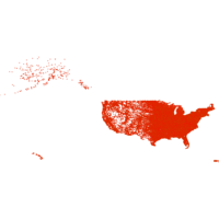
U.S. Census Tracts, 2017. Shapefile. Esri. princeton-m613n273g. 2010. TomTom North America, Inc. U.S. Census Tracts represents the Census tracts of the United States in the 50 states, the District of Columbia, and Puerto Rico.
U.S. Highways, 2008. Shapefile. Esri. princeton-k3569847z. 2002. TomTom North America, Inc. U.S. Highways represents the major and minor highways of the United States. These include interstates, U.S. highways, state highways, major roads, ...
U.S. Major Highways, 2008. Shapefile. Esri. princeton-2514nq64k. 2002. TomTom North America, Inc. U.S. Major Highways represents the major highways of the United States. These include interstates, U.S. highways, state highways, and major roads. ...
1:1,000,000-Scale County Boundaries of the United States, 2014. Shapefile. Geological Survey (U.S.). stanford-wg010mf7692. 2014. Geological Survey (U.S.). This polygon shapefile contains the county boundaries of the United States, Puerto Rico, and the U.S. Virgin Islands, by showing the counties as ar...
1:1,000,000-Scale National Boundaries of the United States, 2014. Shapefile. Geological Survey (U.S.). stanford-hb541mt8292. 2014. Geological Survey (U.S.). This polygon shapefile contains the boundaries of the United States, Puerto Rico, and the U.S. Virgin Islands. The map layer was created by extract...
Built Up Locations United States, Puerto Rico, and the U.S. Virgin Islands 2010. Shapefile. Geological Survey (U.S.). tufts-usbuiltuplocations10. 1972. This point dataset includes Global Map data showing built up areas, primarily cities and towns, in the United States, Puerto Rico, and the U.S. Vir...
Built Up Locations United States, Puerto Rico, and the U.S. Virgin Islands 2010. Shapefile. Geological Survey (U.S.). tufts-usbuiltupareas10. 1972. This point dataset includes Global Map data showing built up areas, primarily cities and towns, in the United States, Puerto Rico, and the U.S. Vir...
Cities and Towns 1:1,000,000 Scale United States, Puerto Rico, and Virgin Islands 2014. Shapefile. Geological Survey (U.S.). tufts-uscitiestowns1mil14. 2014. This point dataset represents cities and towns in the United States, Puerto Rico, and the U.S. Virgin Islands with data from the 2010 census. A ci...
Cities and Towns 1:2,000,000 Scale United States and Virgin Islands 1972-2004. Shapefile. Geological Survey (U.S.). tufts-uscitiestowns2mil7204. 1972. This point dataset represents cities in the United States, Puerto Rico and the U.S. Virgin Islands, collected from the 1970 National Atlas of the U...
Combined Statistical Areas United States and Puerto Rico 2013. Shapefile. Geological Survey (U.S.). tufts-uscsa13. 2013. This polygon dataset represents Combined Statistical Areas in the United States and Puerto Rico. Combined statistical areas consist of two or more...