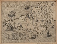
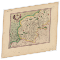
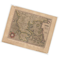
Digital Maps and Geospatial Data | Princeton University

Search Results Header

Search Results

Number of results to display per page

83721. Poly-Olbion

Image Stanford University Public content Poly-Olbion. JPEG 2000. printed by H. L. for Mathew Lownes: I. Browne: I. Helme, and I. Busbie,. stanford-sy295vm4054. 1613. Drayton, Michael, 1563-1631, Hole, William, -1624, Lownes, Matthew, -1625, Helme, John, -1616 or 1617, Busby, John, -1613, Matthewes, Augustine, Marriott, John, active 1616-1657, Grismond, John, and Dewe, Thomas. with intermixture of the most remarquable stories, antiquities, wonders, rarityes, pleasures, and commodities of the fame: digested in a poem by Mi...

83722. Tabula Septentrionalis Russiae, Samoithiae et Tingosiae, quemadmodum ea ab universali Russia Separata \

Image Stanford University Public content Tabula Septentrionalis Russiae, Samoithiae et Tingosiae, quemadmodum ea ab universali Russia Separata \. JPEG 2000. Theodore de Bry. stanford-zg981cj4507. 1613. Massa, Isaac, 1587-1635, Gerritsz., Hessel, approximately 1581-1632, Bry, Johann Israel de, -1611, and Bry, Johann Theodor de, 1561-1623. et ab Isaaco Massa descripta est. Relief shown by shading. Title runs across top. Imprint taken from atlas. Decorative cartouche with descriptive t...

83723. Tabula terræ Novæ Zemblæ, in qua Fretum Sinusq[ue] Waigats item Ora Littorlis Tartariæ atq Russiæ

Image Stanford University Public content Tabula terræ Novæ Zemblæ, in qua Fretum Sinusq[ue] Waigats item Ora Littorlis Tartariæ atq Russiæ. JPEG 2000. Johann Theodore de Bry. stanford-kx049wr4770. 1613. Veer, Gerrit de, Bry, Theodor de, 1528-1598, Bry, Johann Theodor de, 1561-1623, and Barentsz, Willem, approximately 1550-1597. authore Gerhardo de Veer. Relief shown pictorially. Bar scale on map given in "Theutsche meylen". Decorative cartouches, compass roses, rhumb lines...

83724. Vera delineatio totius tractus ex Hollandia Septentrionem versus per fretrum Nassouicum, ad fluvium Oby ducentės, ex Annotatione Iohannis Hugouis Lintschottani, de Annis 1594 et 1595 etc

Image Stanford University Public content Vera delineatio totius tractus ex Hollandia Septentrionem versus per fretrum Nassouicum, ad fluvium Oby ducentės, ex Annotatione Iohannis Hugouis Lintschottani, de Annis 1594 et 1595 etc. JPEG 2000. Theodore de Bry. stanford-rc645gj9010. 1613. Linschoten, Jan Huygen van, 1563-1611, Doetecam, Jan van, Duetecum, Baptista, Gerritsz., Hessel, approximately 1581-1632, Bry, Johann Israel de, -1611, Bry, Johann Theodor de, 1561-1623, and Barentsz, Willem, approximately 1550-1597. Relief shown pictorially. Bar scale on map given in "Milliaria Germanica quorum". Imprint taken from atlas. Decorative cartouche, coats of arms, co...

83725. Asiae nova descriptio

Image Stanford University Public content Asiae nova descriptio. JPEG 2000. Christophe Plantin. stanford-rg871ym7995. 1612. Ortelius, Abraham, 1527-1598 and Plantin, Christophe, approximately 1520-1589. Relief shown pictorially. Latitudinal and longitudinal lines. Decorative border and cartouche with bust; ships. Shows topography, waterways. Appear...

83726. Asiae nova descriptio

Princeton University Public content Asiae nova descriptio. TIFF. [En Anvers : En la libreria Plantiniana, 1612]. princeton-fx719p403. 1612. Ortelius, Abraham, 1527-1598. Relief shown pictorially. Text on verso in Spanish: Asia, p. 3. Probably issued in: Theatro d'el orbe de la tierra de Abraham Ortelio. En Anvers : ...

83727. Cataloniae principatus novissima et accurata descriptio

Image Stanford University Public content Cataloniae principatus novissima et accurata descriptio. JPEG 2000. excudebat Joannes Baptista Vrints. stanford-nv166vj7660. 1612. Vrients, Jan Baptista, 1552-1612 and Ortelius, Abraham, 1527-1598. Joannes Baptista Vrints. Relief shown pictorially. Bar scale on map given in "Scala leucarum... Lleagues... Milles... Millas." Date taken from atla...

83728. Cornwal, Devon Shyre

Princeton University Public content Cornwal, Devon Shyre. TIFF. [London : Michael Drayton, 1612]. princeton-w6634612r. 1612. Hole, William, d. 1624. Relief shown pictorially. From: Poly-Olbion, or a chorographicall description of tracts, rivers, mountaines, forests and other parts of this renown...

83729. Geographia sacra

Image Stanford University Public content Geographia sacra. JPEG 2000. [Officina Plantiniana],. stanford-cd848ng8243. 1612. Grimbergio, Guilielmo, Ortelius, Abraham, 1527-1598, and Plantijnsche Drukkerij. reverendo et illustidno Guilielmo Grimbergio, antverpiensi praesuli dignissimo ; Abrah. Ortelius obsequij deuotionisqe ergo dedicab. consecrabatqe....

83730. Irlandiæ accurata descriptio

Image Stanford University Public content Irlandiæ accurata descriptio. JPEG 2000. , Ioannes Baptista Vrints, geographicarum tabularum calcographus, excud. stanford-bk765fw4510. 1612. Boazio, Baptista, Ortelius, Abraham, 1527-1598, and Vrients, Jan Baptista, 1552-1612. auctore Baptista Boazio. Relief shown pictorially. Oriented with north toward right of sheet. Latitudinal and longitudinal lines along margins. Key...

83731. Palaestina

Image Stanford University Public content Palaestina. JPEG 2000. [publisher not identified],. stanford-dp037ck4409. 1612. Bertius, Petrus, 1565-1629. P. Bertii. Relief shown pictorially. Coordinates approximate and based on Greenwich meridian. Bar scale on map given in "Scala milliarium germanico...

83732. Africa, 1611 or 1612 (Raster Image)

Raster Harvard University Public content Africa, 1611 or 1612 (Raster Image). GeoTIFF. Harvard Map Collection, Harvard College Library. harvard-g8220-1611-h6. 1611. Harvard Map Collection, Harvard College Library, Hondius, Jodocus, 1563-1612., and Mercator, Gerhard, 1512-1594. This layer is a georeferenced raster image of the historic paper map entitled: Nova Africae tabula, auctore Jodoco Hondio. It was published by Excu...

83733. Barkshire described

Princeton University Public content Barkshire described. [London] : are to be solde in Popes head Alley by I. Sud. and Georg Humble, [1610]. princeton-7h149s35q. 1611. Speed, John, 1552?-1629. Pictorial relief. Illustration of Windsor Castle across top of map. Also included is a list of the first members of the Order of the Garter. Verso:...

83734. Berry ducatus, 1611 (Raster Image)

Raster Harvard University Public content Berry ducatus, 1611 (Raster Image). GeoTIFF. Harvard Map Collection, Harvard Library. harvard-g5833-b55-1611-m4. 1611. Harvard Map Collection, Harvard Library, Mercator, Gerhard, 1512-1594, and Hondius, Jodocus, 1563-1612. This layer is a georeferenced raster image of the historic paper map entitled: Berry ducatus. It was published by: J. Hondius in 1611. Scale approx...

83735. Canaan

Image Stanford University Public content Canaan. JPEG 2000. [Robert Barker],. stanford-hj482mr9250. 1611. Speed, John, 1552?-1629, More, John, -1592, and Barker, Robert, -1645. begun by John More ; continued and finished by John Speede. Relief shown pictorially. Latitudinal and longitudinal lines. Coordinates approximate a...

83736. Devonshire, England, 1611 (Raster Image)

Raster Harvard University Public content Devonshire, England, 1611 (Raster Image). GeoTIFF. Harvard Map Collection, Harvard Library. harvard-g5753-d4-1611-s6. 1611. Harvard Map Collection, Harvard Library, Speed, John, 1552?-1629., Sudbury, John., and Humble, George, -1640. This layer is a georeferenced raster image of the historic paper map entitled: Devonshire : with Excester described, and the armes of such Nobles a...

83737. Graecia, 1611 (Raster Image)

Raster Harvard University Public content Graecia, 1611 (Raster Image). GeoTIFF. Harvard Map Collection, Harvard Library. harvard-g6810-1611-m4-recto. 1611. Harvard Map Collection, Harvard Library and Mercator, Gerhard, 1512-1594. This layer is a georeferenced raster image of the historic paper map entitled: Graecia. It was published by: sumptibus & typis Judoci in 1611. Scal...

83738. Islandia

University Of Minnesota Public content Islandia. JPEG. Sumptibus & typis aeneis Iudoci Hondij (Amsterodami). p16022coll230:389. 1611. Mercator, Gerhard, 1512-1594; Hondius, Jodocus, 1563-1612. Cartographic Details: Scale approximately 1:1,300,000, 15 Miliaria Germanica communia = 5,2 cm. Relief shown pictorially. Latin text on verso, titl...

83739. Islandia, 1611 (Raster Image)

Raster Harvard University Public content Islandia, 1611 (Raster Image). GeoTIFF. Harvard Map Collection, Harvard Library. harvard-g6930-1611-m4. 1611. Harvard Map Collection, Harvard Library, Mercator, Gerhard, 1512-1594, Mercator, Gerhard, 1512-1594, and Hondius, Jodocus, 1563-1612. This layer is a georeferenced raster image of the historic paper map entitled: Islandia. It was published by: Sumptibus & typis aeneis Iudoci Hondi...

83740. [Jerusalem]

Image Stanford University Public content [Jerusalem]. JPEG 2000. [Christian Wechelius],. stanford-yk186tt2438. 1611. Vesconte, Pietro, Sanudo, Marino, approximately 1260-1343, and Wechel, Chrestien, 1495-1554. [Petrus Vesconte]. Relief shown pictorially. Coordinates approximate and based on Greenwich meridian. Shows topography, drainage, places of histori...