Digital Maps and Geospatial Data | Princeton University

latin america census costa rica Remove constraint latin america census costa rica

Search Results Header

Search Results

Number of results to display per page

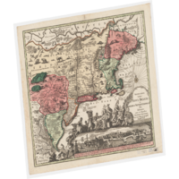
1. Indiae orientalis insvlarvmqve adiacientivm typvs

University Of Minnesota Public content Indiae orientalis insvlarvmqve adiacientivm typvs. JPEG. (Antwerp). p16022coll230:3600. 1592. Ortelius, Abraham, 1527-1598. Relief shown pictorially.; Includes title in cartouche, coat of arms and illustrations of ships, mermaids, and sea monsters.; Includes southwest se...

2. Americae nova tabula

University Of Chicago Public content Americae nova tabula. JPEG. Abraham Ortelius. 5cfaa6aa-db0e-4056-8622-70145a3f4298. 1635. Blaeu, Willem Janszoon, 1571-1638. 1 map: color; Relief shown pictorially; Shows drainage and settlements; Appears in the author's Le théâtre dv monde, on novvel atlas; Includes 10...

3. [Americae sive novi orbis nova descriptio]

Image Stanford University Public content [Americae sive novi orbis nova descriptio]. JPEG 2000. Abraham Ortelius. stanford-ms282mt5756. 1570. Ortelius, Abraham, 1527-1598. [Abraham Ortelius] Relief shown pictorially. [In Ortel (Abraham). Theatrum orbis terrarum. fol. Antiverpiæ, apud Ægid Coppenium Diesth, 1570]. Cum ...

4. Americae sive novi orbis nova descriptio

University Of Chicago Public content Americae sive novi orbis nova descriptio. JPEG. Abraham Ortelius. 7e0062d1-6643-4c90-aaa0-97bac5389481. 1570. Ortelius, Abraham, 1527-1598. 1 map: hand colored; Relief shown pictorially; (In Ortel (Abraham). Theatrum orbis terrarum. fol. Antiverpiæ, apud Ægid Coppenium Diesth, 1570); Cu...

6. Tartariae Imperium

Image Stanford University Public content Tartariae Imperium. JPEG 2000. Apud Haeredes Simonis Galignani de Karera,. stanford-pm323nt1979. 1596. Magini, Giovanni Antonio, 1555-1617 and Porro, Girolamo, 1520-1604. Giovanni Antonio Magini. From the 1596 atlas : Geographiae universae tum veteris tum novae absolutissimum opus duobus voluminibus distinctum, in qu...

7. Orbis vetus, et orbis veteris utraque continens, terrarum q3 tractus Arcticus, et Antarcticus

Image Stanford University Public content Orbis vetus, et orbis veteris utraque continens, terrarum q3 tractus Arcticus, et Antarcticus. JPEG 2000. Apud P. Mortier. stanford-fm706sb1090. 1705. Sanson, Nicolas, 1600-1667, Mortier, Pierre, 1661-1711, and Cóvens et Mortier. Auctore N. Sanson Abbavillaeo, et Christianiss. Galliar Regis Geographo. California shown as an unlabeled island with flat northern coast. Depicts ...

8. Orbis vetus, et orbis veteris utraque continens, terrarum q3 tractus Arcticus, et Antarcticus

Image Stanford University Public content Orbis vetus, et orbis veteris utraque continens, terrarum q3 tractus Arcticus, et Antarcticus. JPEG 2000. Apud P. Mortier. stanford-qx771kk2987. 1705. Sanson, Nicolas, 1600-1667, Mortier, Pierre, 1661-1711, and Cóvens et Mortier. Auctore N. Sanson Abbavillaeo, et Christianiss. Galliar Regis Geographo. California shown as an unlabeled island with flat northern coast. Depicts ...

9. Cities: San Francisco Bay Area, California, 2010

Polygon Stanford University Public content Cities: San Francisco Bay Area, California, 2010. Shapefile. Bay Area Open Space Council. stanford-vj593xs7263. 2010. Bay Area Open Space Council, Conservation Lands Network, San Francisco Bay Area Upland Habitat Goals Project, and GreenInfo Network (Firm). This polygon shapefile depicts cities in the nine county San Francisco Bay Area Region, California. This data was compiled by the GreenInfo Network...

10. Counties: San Francisco Bay Area and Santa Cruz County, California, 2010

Polygon Stanford University Public content Counties: San Francisco Bay Area and Santa Cruz County, California, 2010. Shapefile. Bay Area Open Space Council. stanford-yr040fy2643. 2010. Bay Area Open Space Council, Conservation Lands Network, San Francisco Bay Area Upland Habitat Goals Project, and GreenInfo Network (Firm). This polygon file depicts boundaries of the nine counties in the San Francisco Bay Area Region, California. The Bay Area Open Space Council officia...

11. Counties: San Francisco Bay Area, California, 2010

Polygon Stanford University Public content Counties: San Francisco Bay Area, California, 2010. Shapefile. Bay Area Open Space Council. stanford-ck517xn7937. 2010. Bay Area Open Space Council, Conservation Lands Network, San Francisco Bay Area Upland Habitat Goals Project, and GreenInfo Network (Firm). This polygon shapefile depicts the nine counties of the San Francisco Bay Area Region in California. This data was derived from the United States C...

12. Geographic Names: San Francisco Bay Area, California, 2006

Point Stanford University Public content Geographic Names: San Francisco Bay Area, California, 2006. Shapefile. Bay Area Open Space Council. stanford-gq515vq0921. 2006. Bay Area Open Space Council, Conservation Lands Network, San Francisco Bay Area Upland Habitat Goals Project, and GreenInfo Network (Firm). This point shapefile depicts physical and cultural geographic features of all types, not including roads and highways, within the nine county San F...

13. Highways: San Francisco Bay Area, California, 2011

Line Stanford University Public content Highways: San Francisco Bay Area, California, 2011. Shapefile. Bay Area Open Space Council. stanford-vg822dt4563. 2011. Bay Area Open Space Council, Conservation Lands Network, San Francisco Bay Area Upland Habitat Goals Project, and GreenInfo Network (Firm). This polyline shapefile depicts most highways in the nine county San Francisco Bay Area Region, California and is not meant to be precisely accurat...

14. Major and Minor Roads: San Francisco Bay Area, California, 2011

Line Stanford University Public content Major and Minor Roads: San Francisco Bay Area, California, 2011. Shapefile. Bay Area Open Space Council. stanford-rf409zy3497. 2011. Bay Area Open Space Council, Conservation Lands Network, San Francisco Bay Area Upland Habitat Goals Project, and GreenInfo Network (Firm). This polyline shapefile depicts most major and minor roads in the nine county San Francisco Bay Area Region, California. These data were created fr...

15. Population Density in Watersheds: San Francisco Bay Area, California, 2009

Polygon Stanford University Public content Population Density in Watersheds: San Francisco Bay Area, California, 2009. Shapefile. Bay Area Open Space Council. stanford-wc460zb2749. 2009. Bay Area Open Space Council, Conservation Lands Network, San Francisco Bay Area Upland Habitat Goals Project, and GreenInfo Network (Firm). This polygon shapefile depicts a watershed integrity cluster analysis at the CalWater 2.2.1 Planning Watershed (PWS) level performed by mapping fac...

16. Population Density Per Acre: San Francisco Bay Area, California, 2000

Raster Stanford University Public content Population Density Per Acre: San Francisco Bay Area, California, 2000. ArcGRID. Bay Area Open Space Council. stanford-bf412pw9968. 2000. Bay Area Open Space Council, Conservation Lands Network, San Francisco Bay Area Upland Habitat Goals Project, and GreenInfo Network (Firm). This raster dataset depicts the population denisty of the nine county San Francisco Bay Area Region, California produced with a Dasymetric Mapping ...

17. Unincorporated Cities: San Francisco Bay Area, California, 2010

Polygon Stanford University Public content Unincorporated Cities: San Francisco Bay Area, California, 2010. Shapefile. Bay Area Open Space Council. stanford-pm866wk9581. 2010. Bay Area Open Space Council, Conservation Lands Network, San Francisco Bay Area Upland Habitat Goals Project, and GreenInfo Network (Firm). This polygon shapefile depicts unincorporated cities in the nine county San Francisco Bay Area Region, California. This data was compiled by the Gr...

18. 1990 Census Roads - San Francisco Bay Area, California

Line Stanford University Public content 1990 Census Roads - San Francisco Bay Area, California. Shapefile. California. Metropolitan Transportation Commission. stanford-hp348jr8547. 1990. California. Metropolitan Transportation Commission. This line shapefile contains primary and secondary roads for the San Francosco Bay Area in California. Primary roads are generally divided, limited...

19. 2000 Census Traffic Analysis Zones - San Francisco Bay Area, California

Polygon Stanford University Public content 2000 Census Traffic Analysis Zones - San Francisco Bay Area, California. Shapefile. California. Metropolitan Transportation Commission. stanford-tm960wp6354. 2000. California. Metropolitan Transportation Commission and U.S. Department of Commerce, Bureau of the Census, Geography Division. This polygon shapefile contains the traffic analysis zones (TAZs) for the San Francisco Bay Area in California. These data have been clipped to the...

20. California Metropolitan Transportation Commission Traffic Analysis Zones, 2002

Polygon Stanford University Public content California Metropolitan Transportation Commission Traffic Analysis Zones, 2002. Shapefile. California. Metropolitan Transportation Commission. stanford-jw123vr9109. 2002. California. Metropolitan Transportation Commission. This polygon shapefile contains traffic analysis zones with population statistics for the San Francisco Bay Area in California. These data have ben...

21. California Metropolitan Transportation Commission Travel Analysis Zones, 1990

Polygon Stanford University Public content California Metropolitan Transportation Commission Travel Analysis Zones, 1990. Shapefile. California. Metropolitan Transportation Commission. stanford-fv911pc4805. 1990. California. Metropolitan Transportation Commission. This polygon shapefile contains regional traffic analysis zones (RTAZ) for the San Francisco Bay Area in California. These data have ben clipped to...

22. Census Block Groups, 2000 - San Francisco Bay Area, California

Polygon Stanford University Public content Census Block Groups, 2000 - San Francisco Bay Area, California. Shapefile. California. Metropolitan Transportation Commission. stanford-nk081sx0125. 2000. California. Metropolitan Transportation Commission and U.S. Department of Commerce, Bureau of the Census, Geography Division. This polygon shapefile displays U.S. Census Block Groups for the San Francisco Bay Area in California as of January 1, 2000. Block Groups (BGs) are...

23. Census Blocks, 2000 - San Francisco Bay Area, California

Polygon Stanford University Public content Census Blocks, 2000 - San Francisco Bay Area, California. Shapefile. California. Metropolitan Transportation Commission. stanford-rv407ym2175. 2000. California. Metropolitan Transportation Commission and U.S. Department of Commerce, Bureau of the Census, Geography Division. This polygon shapefile represents U.S. Census Blocks for the San Francisco Bay Area of California as of the year 2000. Census blocks are statistica...

24. Census Blocks, 2000 - San Francisco Bay Area, California

Polygon Stanford University Public content Census Blocks, 2000 - San Francisco Bay Area, California. Shapefile. California. Metropolitan Transportation Commission. stanford-ts501wk9853. 2000. California. Metropolitan Transportation Commission and U.S. Department of Commerce, Bureau of the Census, Geography Division. The polygons in this data layer represent U.S. Census Blocks for the San Francisco Bay Area in California. These data have been clipped to the shor...

25. Census Counties, 2000 - San Francisco Bay Area, California

Polygon Stanford University Public content Census Counties, 2000 - San Francisco Bay Area, California. Shapefile. California. Metropolitan Transportation Commission. stanford-hv237bh9962. 2000. California. Metropolitan Transportation Commission and U.S. Department of Commerce, Bureau of the Census, Geography Division. This polygon shapefile displays the 9 counties for the San Francisco Bay Area of California, as of January 1, 2000. The primary legal divisions of ...

26. Census Counties, 2000 - San Francisco Bay Area, California (Clipped)

Polygon Stanford University Public content Census Counties, 2000 - San Francisco Bay Area, California (Clipped). Shapefile. California. Metropolitan Transportation Commission. stanford-xv509rh6426. 2000. California. Metropolitan Transportation Commission and U.S. Department of Commerce, Bureau of the Census, Geography Division. This polygon shapefile displays the boundaries for the 9 counties of the San Francisco Bay Area in California as of January 1, 2000. These data hav...

27. Census Hydrographic Features, 2000 - San Francisco Bay Area, California

Polygon Stanford University Public content Census Hydrographic Features, 2000 - San Francisco Bay Area, California. Shapefile. California. Metropolitan Transportation Commission. stanford-ws441bn8045. 2000. California. Metropolitan Transportation Commission. This polygon shapefile displays the hydrographic features throughout the San Francisco Bay Area of California. This category includes shorelines of...

28. Census Landmark Polygon Features, 2000 - San Francisco Bay Area, California

Polygon Stanford University Public content Census Landmark Polygon Features, 2000 - San Francisco Bay Area, California. Shapefile. California. Metropolitan Transportation Commission. stanford-mw173fz6932. 2000. California. Metropolitan Transportation Commission and U.S. Department of Commerce, Bureau of the Census, Geography Division. This polygon shapefile displays landmark features throughout the San Francisco Bay Area in California. "Landmark" is the general name given to a ca...

29. Census Places, 1990 - San Francisco Bay Area, California

Polygon Stanford University Public content Census Places, 1990 - San Francisco Bay Area, California. Shapefile. California. Metropolitan Transportation Commission. stanford-rf385pb1942. 1990. California. Metropolitan Transportation Commission. This polygon shapefile contains the Census places for the state based as of January 1, 1990. Places, for the reporting of decennial census data, in...

30. Census Places, 1990 - San Francisco Bay Area, California (Clipped)

Polygon Stanford University Public content Census Places, 1990 - San Francisco Bay Area, California (Clipped). Shapefile. California. Metropolitan Transportation Commission. stanford-th890tz9933. 1990. California. Metropolitan Transportation Commission and U.S. Department of Commerce, Bureau of the Census, Geography Division. This polygon shapefile contains the Census places for the San Francisco Bay Area based as of January 1, 2000. These data have been clipped to the s...

31. Census Tracts, 1990 - San Francisco Bay Area, California

Polygon Stanford University Public content Census Tracts, 1990 - San Francisco Bay Area, California. Shapefile. California. Metropolitan Transportation Commission. stanford-pb075qv9758. 1990. California. Metropolitan Transportation Commission. This polygon shapefile displays Census tracts for the San Francisco Bay Area in California, based on entity boundaries established on January 1, 19...

32. Census Tracts, 1990 - San Francisco Bay Area, California (Clipped)

Polygon Stanford University Public content Census Tracts, 1990 - San Francisco Bay Area, California (Clipped). Shapefile. California. Metropolitan Transportation Commission. stanford-nv463hf9457. 1990. California. Metropolitan Transportation Commission. This polygon shapefile displays Census tracts for the San Francisco Bay Area in California based on entity boundaries established on January 1, 199...

33. Census Tracts, 2000 - San Francisco Bay Area, California

Polygon Stanford University Public content Census Tracts, 2000 - San Francisco Bay Area, California. Shapefile. California. Metropolitan Transportation Commission. stanford-hj076fv2254. 2000. California. Metropolitan Transportation Commission. This polygon shapefile displays Census tracts for the San Francisco Bay Area in California, based on entity boundaries established on January 1, 20...

34. Census Traffic Analysis Zones, 1990 - San Francisco Bay Area, California

Polygon Stanford University Public content Census Traffic Analysis Zones, 1990 - San Francisco Bay Area, California. Shapefile. California. Metropolitan Transportation Commission. stanford-xd776gb4294. 1990. California. Metropolitan Transportation Commission. This polygon shapefile contains the Census Traffic Analysis Zones (CTAZ) for California for the year 1990. The CTAZ zones range in size from multip...

35. Census Traffic Analysis Zones, 2000 - San Francisco Bay Area, California

Polygon Stanford University Public content Census Traffic Analysis Zones, 2000 - San Francisco Bay Area, California. Shapefile. California. Metropolitan Transportation Commission. stanford-hq850hh1120. 2000. California. Metropolitan Transportation Commission. This polygon shapefile contains the U.S. Census 2000 traffic analysis zones (TAZs) with population statistics for the San Francisco Bay Area in Cal...

36. Census Water Bodies, 2000 - San Francisco Bay Area, California

Polygon Stanford University Public content Census Water Bodies, 2000 - San Francisco Bay Area, California. Shapefile. California. Metropolitan Transportation Commission. stanford-mb777jk0330. 2000. California. Metropolitan Transportation Commission. This polygon shapefile displays water bodies in the San Francisco Bay area of California. This category includes lakes, ponds, bays, rivers, reserv...

37. Census Zip Code Tabulation Areas, 2000 - San Francisco Bay Area, California

Polygon Stanford University Public content Census Zip Code Tabulation Areas, 2000 - San Francisco Bay Area, California. Shapefile. California. Metropolitan Transportation Commission. stanford-df986nv4623. 2000. California. Metropolitan Transportation Commission. This polygon shapefile represents ZIP Code Tabulation Areas (ZCTAs) for the entire state. ZCTAs are a new statistical entity developed by the U.S. ...

38. Superdistricts with Populations, San Francisco Bay Area, California, 1990

Polygon Stanford University Public content Superdistricts with Populations, San Francisco Bay Area, California, 1990. Shapefile. California. Metropolitan Transportation Commission. stanford-dp099sn0794. 1990. California. Metropolitan Transportation Commission. This polygon shapefile contains superdistrict boundaries and population statistics created by the Metropolitan Transportation Comission (MTC) using...

39. Superdistricts with Populations, San Francisco Bay Area, California, 2000

Polygon Stanford University Public content Superdistricts with Populations, San Francisco Bay Area, California, 2000. Shapefile. California. Metropolitan Transportation Commission. stanford-sn432sp4756. 2000. California. Metropolitan Transportation Commission. This polygon shapefile contains superdistrict boundaries and population statistics created by the Metropolitan Transportation Comission (MTC) using...

40. California Urbanized Areas 1990

Polygon University of California, Berkeley Public content California Urbanized Areas 1990. Shapefile. California. Metropolitan Transportation Commission. ark28722-s7359h. 2003. MTC. Urban areas in California as defined by the United States Census: http://www.census.gov/geo/www/cob/ua_metadata.html.

41. California Urbanized Areas 2000

Polygon University of California, Berkeley Public content California Urbanized Areas 2000. Shapefile. California. Metropolitan Transportation Commission. ark28722-s76w21. 2003. MTC. Urban areas in California as defined by the United States Census: http://www.census.gov/geo/www/ua/ua_2k.html.

42. San Francisco Bay Area Census Block Groups 2000

Polygon University of California, Berkeley Public content San Francisco Bay Area Census Block Groups 2000. Shapefile. California. Metropolitan Transportation Commission. ark28722-s7bs3m. 2003. MTC. Census block groups in the San Francisco Bay Area, California from 2000.

43. San Francisco Bay Area Census Blocks 2000

Polygon University of California, Berkeley Public content San Francisco Bay Area Census Blocks 2000. Shapefile. California. Metropolitan Transportation Commission. ark28722-s7730n. 2003. MTC. Census blocks in the San Francisco Bay Area, California from 2000.

44. San Francisco Bay Area Census Blocks 2000

Polygon University of California, Berkeley Public content San Francisco Bay Area Census Blocks 2000. Shapefile. California. Metropolitan Transportation Commission. ark28722-s79w2z. 2003. MTC. Census blocks in the San Francisco Bay Area with no water, California from 2000.

45. San Francisco Bay Area Census Tracts 1990

Polygon University of California, Berkeley Public content San Francisco Bay Area Census Tracts 1990. Shapefile. California. Metropolitan Transportation Commission. ark28722-s7k88h. 2003. MTC. Census tracts, with water, in the San Francisco Bay Area, California.

46. San Francisco Bay Area Census Tracts 2000

Polygon University of California, Berkeley Public content San Francisco Bay Area Census Tracts 2000. Shapefile. California. Metropolitan Transportation Commission. ark28722-s7q300. 2003. MTC. Census tracts, with water, for the San Francisco Bay Area, California.

47. San Francisco Bay Area Census Tracts 2000

Polygon University of California, Berkeley Public content San Francisco Bay Area Census Tracts 2000. Shapefile. California. Metropolitan Transportation Commission. ark28722-s78w2n. 2003. MTC. Census tracts, without water, for the San Francisco Bay Area, California.

48. San Francisco Bay Area Superdistricts 2003

Polygon University of California, Berkeley Public content San Francisco Bay Area Superdistricts 2003. Shapefile. California. Metropolitan Transportation Commission. ark28722-s7jc7v. 2003. MTC. Census superdistricts in the San Francisco Bay Area, California.

49. Costa Rica. (1991/relief).

Princeton University Public content Costa Rica. (1991/relief). . TIFF. Central Intelligence Agency. princeton-fj236354d. 1991. Central Intelligence Agency. This is a map of Costa Rica with relief, shown at a 1:1,500,000 scale. The map was created by the Central Intelligence Agency.

50. Costa Rica summary map. (1991/relief).

Princeton University Public content Costa Rica summary map. (1991/relief). . TIFF. Central Intelligence Agency. princeton-47429b53k. 1991. Central Intelligence Agency. This is a map of Costa Rica, shown at a scale of 1:1,500,000. Included is information pertaining to the country profile. The map was created by the...

51. AUDIENCE DE GUADALAJARA, NOUVEAU MEXIQUE, CALIFORNIE, &c.

Image Stanford University Public content AUDIENCE DE GUADALAJARA, NOUVEAU MEXIQUE, CALIFORNIE, &c. JPEG 2000. Chez P. Mariette. stanford-kc128tv5108. 1656. Sanson, Nicolas, 1600-1667. [1656], in French, with imprint 'A Paris chez P. Mariette rue S. Iacques a l'Esperance Avec Pri. pour 20 ans'. Manuscript '63' (top right, outside ...

52. Peruuiae avriferæ regionis typus

Image Stanford University Public content Peruuiae avriferæ regionis typus. JPEG 2000. Christophe Plantin. stanford-zs626pm4125. 1588. Méndez, Diego, Ortelius, Abraham, 1527-1598, Chaves, Geronimo, 1523-1574, and Plantin, Christophe, approximately 1520-1589. Didaco Mendezio auctore. La Florida auctore Hieron. Chiaues. Guastecan reg. Relief shown pictorially. Decorative cartouches, ships. Maps show porti...

53. Tabularum geographicarum contractarum libri quatuor

Image Stanford University Public content Tabularum geographicarum contractarum libri quatuor. JPEG 2000. Cornelium Nicolai. stanford-qv774nk8098. 1600. Bertius, Petrus, 1565-1629, Claesz, Cornelis, approximately 1546-1609, Jansson, Jan, 1588-1664, Hondius, Jodocus, 1563-1612, and Keere, Pieter van den, 1571-approximately 1646. P Bertii. Errata on p. [646]. Engraved t.p. with navigators, cosmographers at table and America & ship in background. Verso depicts Magellan's ...

54. Atlas de la America del Sur

Image Stanford University Public content Atlas de la America del Sur. JPEG 2000. Direccion Hidrografica de Madrid ;. stanford-zs890wk1927. 1800. Espinosa, Jose de, Salazar, Luis Maria de, Massa, Gasparo, González, Tomás, Maré, M. C., Oyarvide, Andrés de, Bauzá, Felipe, Esteve, Rafael, 1772-1847, Morata, Juan, Noguera, C., Jorata, J., Lángara, Juan de, 1736-1806, Selma, Ferdinand, 1752-1810, Moreno Tejada, Juan, Gangoiti, Pedro Manuel, 1779-1830, Cornel, Antonio, Noguera, Clemente, Cardano, Felipe, Malaspina, Alessandro, 1754-1809, and Spain Dirección de Hidrografía. Leather binding with decorative gilt trim. Marbled end papers. First 4 and last 4 pages blank (included in page description). Depths shown by bathy...

55. Population at the SDE (Section d'énumération) level Port au-Prince Haiti 2003

Polygon Tufts University Public content Population at the SDE (Section d'énumération) level Port au-Prince Haiti 2003. Shapefile. Elsevier-Dutton (Publishing firm). tufts-haitipopulationsde2003. 2003. This polygon dataset represents population density within Haiti at the SDE (Section d'énumération) level from 2003.

56. U.S. Census Block Groups, 2017

Princeton University Restricted content U.S. Census Block Groups, 2017. Shapefile. Esri. princeton-6395wc232. 2010. TomTom North America, Inc. U.S. Census Block Groups represents the Census block groups of the United States in the 50 states, the District of Columbia, and Puerto Rico.

57. U.S. Census Tracts, 2017

Princeton University Restricted content U.S. Census Tracts, 2017. Shapefile. Esri. princeton-m613n273g. 2010. TomTom North America, Inc. U.S. Census Tracts represents the Census tracts of the United States in the 50 states, the District of Columbia, and Puerto Rico.

58. U.S. Highways, 2008

Princeton University Restricted content U.S. Highways, 2008. Shapefile. Esri. princeton-k3569847z. 2002. TomTom North America, Inc. U.S. Highways represents the major and minor highways of the United States. These include interstates, U.S. highways, state highways, major roads, ...

59. U.S. Major Highways, 2008

Princeton University Restricted content U.S. Major Highways, 2008. Shapefile. Esri. princeton-2514nq64k. 2002. TomTom North America, Inc. U.S. Major Highways represents the major highways of the United States. These include interstates, U.S. highways, state highways, and major roads. ...

60. 1:1,000,000-Scale County Boundaries of the United States, 2014

Polygon Stanford University Public content 1:1,000,000-Scale County Boundaries of the United States, 2014. Shapefile. Geological Survey (U.S.). stanford-wg010mf7692. 2014. Geological Survey (U.S.). This polygon shapefile contains the county boundaries of the United States, Puerto Rico, and the U.S. Virgin Islands, by showing the counties as ar...

61. 1:1,000,000-Scale National Boundaries of the United States, 2014

Polygon Stanford University Public content 1:1,000,000-Scale National Boundaries of the United States, 2014. Shapefile. Geological Survey (U.S.). stanford-hb541mt8292. 2014. Geological Survey (U.S.). This polygon shapefile contains the boundaries of the United States, Puerto Rico, and the U.S. Virgin Islands. The map layer was created by extract...

62. Built Up Locations United States, Puerto Rico, and the U.S. Virgin Islands 2010

Point Tufts University Public content Built Up Locations United States, Puerto Rico, and the U.S. Virgin Islands 2010. Shapefile. Geological Survey (U.S.). tufts-usbuiltuplocations10. 1972. This point dataset includes Global Map data showing built up areas, primarily cities and towns, in the United States, Puerto Rico, and the U.S. Vir...

64. Cities and Towns 1:1,000,000 Scale United States, Puerto Rico, and Virgin Islands 2014

Point Tufts University Public content Cities and Towns 1:1,000,000 Scale United States, Puerto Rico, and Virgin Islands 2014. Shapefile. Geological Survey (U.S.). tufts-uscitiestowns1mil14. 2014. This point dataset represents cities and towns in the United States, Puerto Rico, and the U.S. Virgin Islands with data from the 2010 census. A ci...

65. Cities and Towns 1:2,000,000 Scale United States and Virgin Islands 1972-2004

Point Tufts University Public content Cities and Towns 1:2,000,000 Scale United States and Virgin Islands 1972-2004. Shapefile. Geological Survey (U.S.). tufts-uscitiestowns2mil7204. 1972. This point dataset represents cities in the United States, Puerto Rico and the U.S. Virgin Islands, collected from the 1970 National Atlas of the U...

66. Combined Statistical Areas United States and Puerto Rico 2013

Polygon Tufts University Public content Combined Statistical Areas United States and Puerto Rico 2013. Shapefile. Geological Survey (U.S.). tufts-uscsa13. 2013. This polygon dataset represents Combined Statistical Areas in the United States and Puerto Rico. Combined statistical areas consist of two or more...

67. Congressional Districts for 107th Congress United States 2001

Polygon Tufts University Public content Congressional Districts for 107th Congress United States 2001. Shapefile. Geological Survey (U.S.). tufts-uscongdist107th01. 2001. This polygon dataset represents the Congressional Districts of the United States for the 107th Congress. The data set was created by extracting li...

68. Core Based Statistical Areas United States and Puerto Rico 2010

Polygon Tufts University Public content Core Based Statistical Areas United States and Puerto Rico 2010. Shapefile. Geological Survey (U.S.). tufts-uscbsa10. 2013. This polygon datasets portrays core based statistical areas in the United States and Puerto Rico in 2010. The map layer was created from the CENSU...

69. Federal and Department of Defense Expenditures by State United States 2000 2005 2009

Polygon Tufts University Public content Federal and Department of Defense Expenditures by State United States 2000 2005 2009. Shapefile. Geological Survey (U.S.). tufts-usfederaldodexpendituresperstate000509. 2000. This polygon dataset shows Federal and Department of Defense (DOD) Expenditures by State for the United States for the years 2000, 2005, and 2009. ...

70. Federal Expenditures by County United States 2000 2005 2009

Polygon Tufts University Public content Federal Expenditures by County United States 2000 2005 2009. Shapefile. Geological Survey (U.S.). tufts-usfedexpenditures000509. 2000. This polygon dataset shows Federal expenditures by US county or county equivalent for the years 2000, 2005, and 2009. Amounts listed are total doll...

71. Voter Data per State United States 2000 - 2008

Polygon Tufts University Public content Voter Data per State United States 2000 - 2008. Shapefile. Geological Survey (U.S.). tufts-usvoterperstate0008. 2000. This polygon dataset shows the US percentage of voting age persons registered to vote and voted, per State for 2000-2008. Data is expressed in perc...

72. Costa Rica District Boundaries, 1997

Princeton University Restricted content Costa Rica District Boundaries, 1997. Shapefile. Gfk MACON Company. princeton-v405sb93q. 2006. GfK MACON. This map includes the district boundaries of Costa Rica created by GfK MACON company, Germany.

73. Costa Rica Major Cities, 1996

Princeton University Restricted content Costa Rica Major Cities, 1996. Shapefile. Gfk MACON Company. princeton-nz8061278. 2006. GfK MACON. This data includes Costa Rica major cities created by GfK MACON company, Germany.

74. Costa Rica Major Lakes, 1996

Princeton University Restricted content Costa Rica Major Lakes, 1996. Shapefile. Gfk MACON Company. princeton-dv13zv717. 2006. GfK MACON. This data include major lakes of Costa Rica created by GfK MACON company, Germany.

75. Costa Rica Major Rivers, 1996

Princeton University Restricted content Costa Rica Major Rivers, 1996. Shapefile. Gfk MACON Company. princeton-j098zc62r. 2006. GfK MACON. This data include major rivers of Costa Rica created by GfK MACON company, Germany.

76. Costa Rica Major Roads, 1996

Princeton University Restricted content Costa Rica Major Roads, 1996. Shapefile. Gfk MACON Company. princeton-gm80hx03n. 2006. GfK MACON. This data includes Costa Rica major roads created by GfK MACON company, Germany.

77. Costa Rica Minor Cities, 1996

Princeton University Restricted content Costa Rica Minor Cities, 1996. Shapefile. Gfk MACON Company. princeton-9c67wp23g. 2006. GfK MACON. This data includes Costa Rica minor cities created by GfK MACON company, Germany.

78. Costa Rica Municipality Boundaries, 1997

Princeton University Restricted content Costa Rica Municipality Boundaries, 1997. Shapefile. Gfk MACON Company. princeton-wm117q46f. 2006. GfK MACON. This map includes the municipality boundaries of Costa Rica created by GfK MACON company, Germany.

79. Costa Rica Province Boundaries, 1997

Princeton University Restricted content Costa Rica Province Boundaries, 1997. Shapefile. Gfk MACON Company. princeton-cf95jc90x. 2006. GfK MACON. This map includes the province boundaries of Costa Rica created by GfK MACON company, Germany.

80. A map of the United States of Mexico

Image Stanford University Public content A map of the United States of Mexico. JPEG 2000. H.S. Tanner, No. 177 Chestnut St. ,. stanford-pn863fv0810. 1800. Tanner, Henry Schenck, 1786-1858. by H. S. Tanner. Relief shown by hachures. Latitudinal and longitudinal lines. Prime meridian: Washington. Coordinates approximate and based on Gre...

81. Costa Rica 1:50,000, Map Series Index

Polygon Harvard University Public content Costa Rica 1:50,000, Map Series Index. GeoJSON. Harvard Map Collection. harvard-g4860-s50-c6-index-gr. 1961. Harvard Map Collection, San José : Instituto Geográfico Nacional, and United States. Army Map Service. This polygon is an index to 1:50,000 scale maps of Costa Rica, titled Costa Rica 1:50,000. This map series was originally produced by the San José ...

82. Eastern North America, 1813 (Image 2 of 4) (Raster Image)

Raster Harvard University Public content Eastern North America, 1813 (Image 2 of 4) (Raster Image). GeoTIFF. Harvard Map Collection, Harvard College Library. harvard-g3700-1813-l4-sh2. 1813. Harvard Map Collection, Harvard Library, Lewis, Samuel, 1753 or 4-1822., Plowman, Thomas Lowry., Fairman, Gideon, 1774-1827., and Hooker, William, 1782-1856. This layer is a georeferenced raster image of the historic paper map entitled: A correct map of the United States with the West Indies : from the b...

83. Eastern North America, 1813 (Image 3 of 4) (Raster Image)

Raster Harvard University Public content Eastern North America, 1813 (Image 3 of 4) (Raster Image). GeoTIFF. Harvard Map Collection, Harvard College Library. harvard-g3700-1813-l4-sh3. 1813. Harvard Map Collection, Harvard Library, Lewis, Samuel, 1753 or 4-1822., Plowman, Thomas Lowry., Fairman, Gideon, 1774-1827., and Hooker, William, 1782-1856. This layer is a georeferenced raster image of the historic paper map entitled: A correct map of the United States with the West Indies : from the b...

84. Eastern North America, 1813 (Image 4 of 4) (Raster Image)

Raster Harvard University Public content Eastern North America, 1813 (Image 4 of 4) (Raster Image). GeoTIFF. Harvard Map Collection, Harvard College Library. harvard-g3700-1813-l4-sh4. 1813. Harvard Map Collection, Harvard Library, Lewis, Samuel, 1753 or 4-1822., Plowman, Thomas Lowry., Fairman, Gideon, 1774-1827., and Hooker, William, 1782-1856. This layer is a georeferenced raster image of the historic paper map entitled: A correct map of the United States with the West Indies : from the b...

85. New England and Middle Atlantic States, ca. 1730 (Raster Image)

Raster Harvard University Public content New England and Middle Atlantic States, ca. 1730 (Raster Image). GeoTIFF. Harvard Map Collection, Harvard College Library. harvard-g3720-1730-s4. 1730. Harvard Map Collection, Harvard College Library and Seutter, Matthaeus, 1678-1756. This layer is a georeferenced raster image of the historic paper map entitled: Recens edita totius Novi Belgii in America Septentrionali siti, deli...

86. North America, 1853 (Image 4 of 4) (Raster Image)

Raster Harvard University Public content North America, 1853 (Image 4 of 4) (Raster Image). GeoTIFF. Harvard Map Collection, Harvard College Library. harvard-g3300-1853-m6-sh4. 1853. Harvard Map Collection, Harvard College Library, Monk, Jacob., and A. Hoen & Co. This layer is a georeferenced raster image of the historic paper map entitled: New map of that portion of North America, exhibiting the United Stat...

87. North America, 1856 (Image 2 of 4) (Raster Image)

Raster Harvard University Public content North America, 1856 (Image 2 of 4) (Raster Image). GeoTIFF. Harvard Map Collection, Harvard College Library. harvard-g3300-1856-w5-sh2. 1856. Harvard Map Collection, Harvard College Library, Williams, W. (Wellington), and Mitchell, S. Augustus (Samuel Augustus), 1792-1868. This layer is a georeferenced raster image of the historic paper map entitled: Mitchell's new national map exhibiting the United States : with the ...

88. South America, 1807 (Image 1 of 7) (Raster Image)

Raster Harvard University Public content South America, 1807 (Image 1 of 7) (Raster Image). GeoTIFF. Harvard Map Collection, Harvard College Library. harvard-g5200-1807-d4-sh2. 1807. Harvard Map Collection, Harvard College Library, Delarochette, L. (Louis), 1731-1802., and Faden, William, 1749-1836. This layer is a georeferenced raster image of the historic paper map entitled: Colombia Prima or South America : in which it has been attempted to ...

89. South America, 1807 (Image 2 of 7) (Raster Image)

Raster Harvard University Public content South America, 1807 (Image 2 of 7) (Raster Image). GeoTIFF. Harvard Map Collection, Harvard College Library. harvard-g5200-1807-d4-sh3. 1807. Harvard Map Collection, Harvard College Library, Delarochette, L. (Louis), 1731-1802., and Faden, William, 1749-1836. This layer is a georeferenced raster image of the historic paper map entitled: Colombia Prima or South America : in which it has been attempted to ...

90. South America, 1807 (Image 3 of 7) (Raster Image)

Raster Harvard University Public content South America, 1807 (Image 3 of 7) (Raster Image). GeoTIFF. Harvard Map Collection, Harvard College Library. harvard-g5200-1807-d4-sh4. 1807. Harvard Map Collection, Harvard College Library, Delarochette, L. (Louis), 1731-1802., and Faden, William, 1749-1836. This layer is a georeferenced raster image of the historic paper map entitled: Colombia Prima or South America : in which it has been attempted to ...

91. South America, 1807 (Image 4 of 7) (Raster Image)

Raster Harvard University Public content South America, 1807 (Image 4 of 7) (Raster Image). GeoTIFF. Harvard Map Collection, Harvard College Library. harvard-g5200-1807-d4-sh5. 1807. Harvard Map Collection, Harvard College Library, Delarochette, L. (Louis), 1731-1802., and Faden, William, 1749-1836. This layer is a georeferenced raster image of the historic paper map entitled: Colombia Prima or South America : in which it has been attempted to ...

92. South America, 1807 (Image 5 of 7) (Raster Image)

Raster Harvard University Public content South America, 1807 (Image 5 of 7) (Raster Image). GeoTIFF. Harvard Map Collection, Harvard College Library. harvard-g5200-1807-d4-sh6. 1807. Harvard Map Collection, Harvard College Library, Delarochette, L. (Louis), 1731-1802., and Faden, William, 1749-1836. This layer is a georeferenced raster image of the historic paper map entitled: Colombia Prima or South America : in which it has been attempted to ...

93. South America, 1807 (Image 6 of 7) (Raster Image)

Raster Harvard University Public content South America, 1807 (Image 6 of 7) (Raster Image). GeoTIFF. Harvard Map Collection, Harvard College Library. harvard-g5200-1807-d4-sh7. 1807. Harvard Map Collection, Harvard College Library, Delarochette, L. (Louis), 1731-1802., and Faden, William, 1749-1836. This layer is a georeferenced raster image of the historic paper map entitled: Colombia Prima or South America : in which it has been attempted to ...

94. South America, 1807 (Image 7 of 7) (Raster Image)

Raster Harvard University Public content South America, 1807 (Image 7 of 7) (Raster Image). GeoTIFF. Harvard Map Collection, Harvard College Library. harvard-g5200-1807-d4-sh8. 1807. Harvard Map Collection, Harvard College Library, Delarochette, L. (Louis), 1731-1802., and Faden, William, 1749-1836. This layer is a georeferenced raster image of the historic paper map entitled: Colombia Prima or South America : in which it has been attempted to ...

95. Western Hemisphere, 1740 (Image 1 of 2) (Raster Image)

Raster Harvard University Public content Western Hemisphere, 1740 (Image 1 of 2) (Raster Image). GeoTIFF. Harvard Map Collection, Harvard College Library. harvard-g3290-1740-l4-sheet-1. 1740. Harvard Map Collection, Harvard College Library, Harvard University. Library. Open Collections Program, Leth, Andries de, 1662-1731., and Leth, Hendrik de, 1703-1766. This layer is a georeferenced raster image of the historic paper map entitled: Carte nouvelle de la mer du Sud : dressee par ordre des principaux d...

96. Western Hemisphere, 1740 (Image 2 of 2) (Raster Image)

Raster Harvard University Public content Western Hemisphere, 1740 (Image 2 of 2) (Raster Image). GeoTIFF. Harvard Map Collection, Harvard College Library. harvard-g3290-1740-l4-sheet-2. 1740. Harvard Map Collection, Harvard College Library, Harvard University. Library. Open Collections Program, Leth, Andries de, 1662-1731., and Leth, Hendrik de, 1703-1766. This layer is a georeferenced raster image of the historic paper map entitled: Carte nouvelle de la mer du Sud : dressee par ordre des principaux d...

97. Central America & Caribbean Region, 1803 (Image 1 of 4) (Raster Image)

Raster Harvard University Public content Central America & Caribbean Region, 1803 (Image 1 of 4) (Raster Image). GeoTIFF. Harvard Map Collection, Harvard Library. harvard-g4900-1803-a7-sh1. 1803. Harvard Map Collection, Harvard College Library, Arrowsmith, Aaron, 1750-1823., and Jones & Smith. This layer is a georeferenced raster image of the historic paper map entitled: Chart of the West Indies and Spanish Dominions in North America, by ...

98. Central America & Caribbean Region, 1803 (Image 2 of 4) (Raster Image)

Raster Harvard University Public content Central America & Caribbean Region, 1803 (Image 2 of 4) (Raster Image). GeoTIFF. Harvard Map Collection, Harvard Library. harvard-g4900-1803-a7-sh2. 1803. Harvard Map Collection, Harvard College Library, Arrowsmith, Aaron, 1750-1823., and Jones & Smith. This layer is a georeferenced raster image of the historic paper map entitled: Chart of the West Indies and Spanish Dominions in North America, by ...

99. Central America & Caribbean Region, 1803 (Image 3 of 4) (Raster Image)

Raster Harvard University Public content Central America & Caribbean Region, 1803 (Image 3 of 4) (Raster Image). GeoTIFF. Harvard Map Collection, Harvard Library. harvard-g4900-1803-a7-sh3. 1803. Harvard Map Collection, Harvard College Library, Arrowsmith, Aaron, 1750-1823., and Jones & Smith. This layer is a georeferenced raster image of the historic paper map entitled: Chart of the West Indies and Spanish Dominions in North America, by ...

100. Central America & Caribbean Region, 1803 (Image 4 of 4) (Raster Image)

Raster Harvard University Public content Central America & Caribbean Region, 1803 (Image 4 of 4) (Raster Image). GeoTIFF. Harvard Map Collection, Harvard Library. harvard-g4900-1803-a7-sh4. 1803. Harvard Map Collection, Harvard College Library, Arrowsmith, Aaron, 1750-1823., and Jones & Smith. This layer is a georeferenced raster image of the historic paper map entitled: Chart of the West Indies and Spanish Dominions in North America, by ...