- Public66,082
- Restricted10,834
- Stanford20,902
- Princeton20,287
- University of Minnesota5,000
- Indiana University4,796
- UW-Madison Robinson Map Library4,511
- Columbia2,992
- University of Iowa2,557
- UW Digital Collections Center2,524
- more Institution »
- Image24,828
- Polygon19,202
- Line5,996
- Raster5,395
- Point4,985
- 263
- Mixed205
- Collection185
- more Format »
- Planning and Cadastral8,612
- Boundaries5,101
- Transportation4,688
- Oceans4,027
- Imagery and Base Maps3,990
- Climatology, Meteorology and Atmosphere3,603
- Sea ice3,351
- Topographic maps3,207
Search Results Header
Search Results
« Previous |
1 - 100 of 76,916
|
Next »
2. ALPAGE
3. Carticque France Administratif, 2010
4. San Joaquin County, California GIS Maps & Data
5. Salinas-Parajo Generalized Land Use/Land Cover Mapping
6. The Daily Telegraph war graves map of the Western Front
7. Central America & Panamá
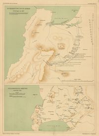
8. De nederzetting aan de Liesbeek in het begin van 1661

9. De trek der Veeboeren gedurende de 18e eeuw

10. Kaapstad en omgeving omstreeks 1800

11. Ontwikkeling van de nederzetting aan de Tafelbaai

12. Zuid-Afrika onder nederlandsch bewind

13. Zuid-Afrika onder nederlandsch bewind

14. Zuid-Afrika onder nederlandsch bewind

15. Zuid-Afrika onder nederlandsch bewind : kolonie- en districtengrenzen in de 18de eeuw

16. Pascaerte van Groen-landt, Yslandt, Straet Davids [sic] en Ian Mayen Eylandt : hoemen de selvige van Hitlandt en de noort custen van Schotlandt en Yrlandt beseylen mach