Digital Maps and Geospatial Data | Princeton University
Insurance maps of Lake Hopatcong, Morris and Sussex counties, New Jersey : including Hopatcong and Mt. Arlington boroughs, Byram, Roxbury and Jefferson townships (Sheet 11)
- Author(s):
- Sanborn Map Company
- Publisher:
- New York : Sanborn Map Company, 1917.
- Access:
- Public
- Description:
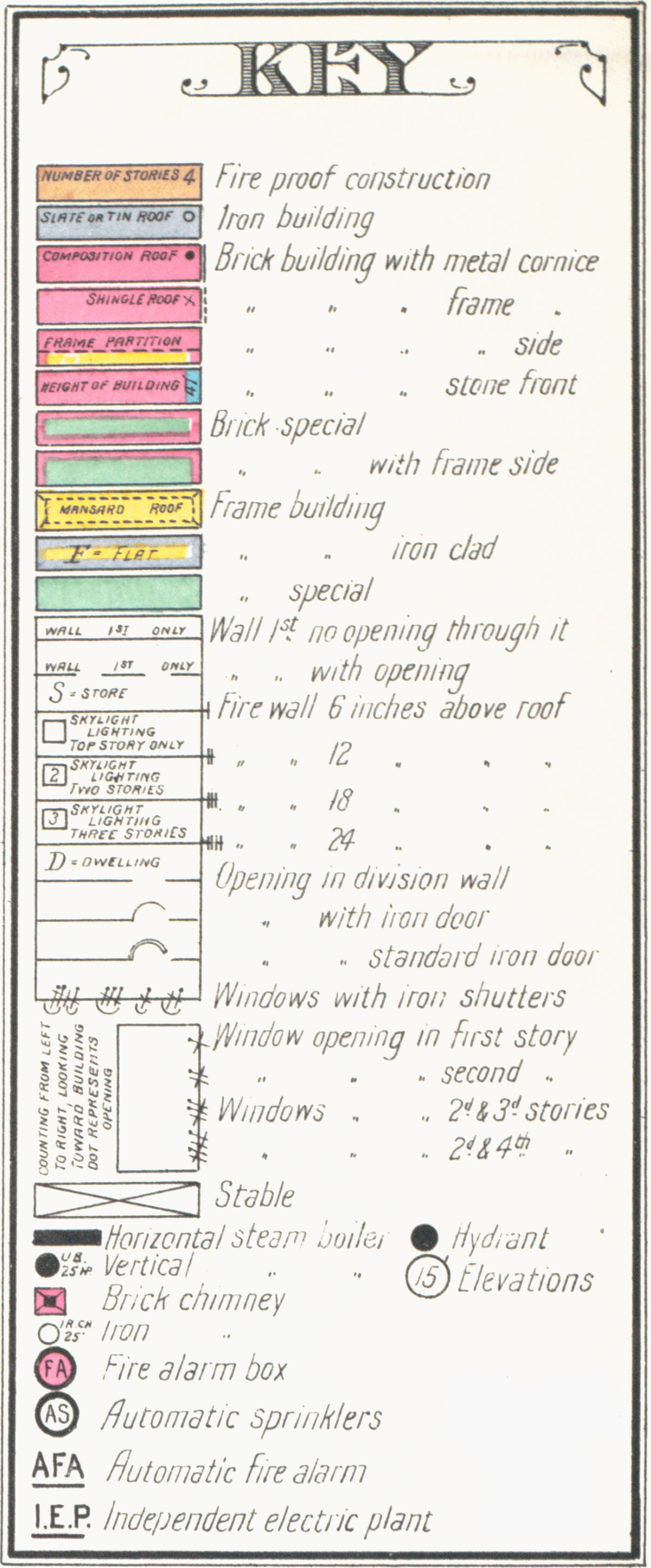
- "Jan'y 1917." Includes location map, key, key map, streets and specials index, cottages, estates, &c. index, and text. "1789." Shows Lake Hopatcong and boroughs and townships on its shore.
- Place(s):
- New Jersey
- Subject(s):
- Real property—New Jersey—Hopatcong, Lake—Maps, Real property—New Jersey—Hopatcong—Maps, Real property—New Jersey—Mount Arlington—Maps, Real property—New Jersey—Byram Township—Maps, Real property—New Jersey—Roxbury Township—Maps, Real property—New Jersey—Jefferson Township—Maps, Hopatcong, Lake (N.J. : Lake)—Maps, Hopatcong (N.J.)—Maps, Mount Arlington (N.J.)—Maps, Byram (N.J. : Township)—Maps, Roxbury (N.J. : Township)—Maps, Jefferson (N.J. : Township)—Maps, Fire insurance maps—New Jersey—Hopatcong, Lake—1917, Fire insurance maps—New Jersey—Hopatcong—1917, Fire insurance maps—New Jersey—Mount Arlington—1917, Fire insurance maps—New Jersey—Byram Township—1917, Fire insurance maps—New Jersey—Roxbury Township—1917, Fire insurance maps—New Jersey—Jefferson Township—1917, Maps—New Jersey—Hopatcong, Lake—1917, Maps—New Jersey—Hopatcong—1917, Maps—New Jersey—Mount Arlington—1917, Maps—New Jersey—Byram Township—1917, Maps—New Jersey—Roxbury Township—1917, and Maps—New Jersey—Jefferson Township—1917
- Call number:
- HMC04 (Lake Hopatcong)
- Held by:
- Princeton: Historic Map Division, Special Collections, Firestone Library
- Rights Statement:
- No Known Copyright
Princeton University Library reasonably believes that the Item is not restricted by copyright or related rights, but a conclusive determination could not be made.
You are free to use this Item in any way that is permitted by the copyright and related rights legislation that applies to your use.Princeton University Library claims no copyright or license governing this digital resource. It is provided for free, on a non-commercial, open-access basis, for fair-use academic and research purposes only. Anyone who claims copyright over any part of these resources and feels that they should not be presented in this manner is invited to contact Princeton University Library, who will in turn consider such concerns and make every effort to respond appropriately. We request that users reproducing this resource cite it according to the guidelines described at https://library.princeton.edu/special-collections/policies/forms-citation.
Tools
-
Legend
Sanborn Legend

- Cite
- SMS This
- Web services