Digital Maps and Geospatial Data | Princeton University

Search Results Header

Search Results

Number of results to display per page

1. ALPAGE

Collection Stanford University Public content ALPAGE. ALPAGE. stanford-zp399nk6394. 2010. Noizet, Hélène, Bourlet, Caroline, Bove, Boris, Sandrine, Robert, and Costa, Laurent. ALPAGE is a geohistorical platform about Paris. Based on a work dynamic initiated in 2006 with support from the French National Research Agency (AN...
2. The Daily Telegraph war graves map of the Western Front

Image Stanford University Public content The Daily Telegraph war graves map of the Western Front. JPEG 2000. "Geographia". stanford-xx990sy0760. 1919. Gross, Alexander, 1879-1958, Daily Telegraph (London, England), and Geographia Ltd. compiled from official sources under the direction of Alexander Gross. Map of the Western Front in France and Belgium showing cemeteries, railways ...

3. De nederzetting aan de Liesbeek in het begin van 1661

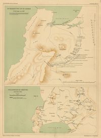
Princeton University Public content De nederzetting aan de Liesbeek in het begin van 1661. TIFF. 's-Gravenhage : M. Nijhoff, [1911-1933]. princeton-rn3013210. 1911. Beekman, A. A. (Anton Albert), 1854-1947. Maps showing Liesbeek in 1661 and Stellenbosch around 1700; relief shown by shading. In top of margin: Geschiedkundige atlas van Nederland. De kolo...

4. De trek der Veeboeren gedurende de 18e eeuw

Princeton University Public content De trek der Veeboeren gedurende de 18e eeuw. TIFF. 's-Gravenhage : M. Nijhoff, [1911-1933]. princeton-j38608782. 1911. Beekman, A. A. (Anton Albert), 1854-1947. Maps showing routes taken by Dutch settlers in South Africa; relief shown by shading. In top of margin: Geschiedkundige atlas van Nederland. De kol...

5. Kaapstad en omgeving omstreeks 1800

Princeton University Public content Kaapstad en omgeving omstreeks 1800. TIFF. 's-Gravenhage : M. Nijhoff, [1911-1933]. princeton-4t64gq00b. 1911. Beekman, A. A. (Anton Albert), 1854-1947. Map showing Cape Town, South Africa, Table Bay and False Bay in 1800; relief shown by shading. In top of margin: Geschiedkundige atlas van Nederlan...

6. Ontwikkeling van de nederzetting aan de Tafelbaai

Princeton University Public content Ontwikkeling van de nederzetting aan de Tafelbaai. TIFF. 's-Gravenhage : M. Nijhoff, [1911-1933]. princeton-x920fz69p. 1911. Beekman, A. A. (Anton Albert), 1854-1947. Maps showing Cape Town, South Africa, and Table Bay, in 1660, 1693, 1767 and 1786; relief shown by shading. In top of margin: Geschiedkundige atlas...

7. Zuid-Afrika onder nederlandsch bewind

Princeton University Public content Zuid-Afrika onder nederlandsch bewind. TIFF. 's-Gravenhage : M. Nijhoff, [1911-1933]. princeton-12579v09c. 1911. Beekman, A. A. (Anton Albert), 1854-1947. Map showing routes of J. W. Janssens in 1803 and J. A. de Mist in 1803-1804; relief shown by shading. In top of margin: Geschiedkundige atlas van N...

8. Zuid-Afrika onder nederlandsch bewind

Princeton University Public content Zuid-Afrika onder nederlandsch bewind. TIFF. 's-Gravenhage : M. Nijhoff, [1911-1933]. princeton-wd375z12b. 1911. Beekman, A. A. (Anton Albert), 1854-1947. Map showing routes of A. F. Beutler in 1752 and H. Hop and J. Coetsee in 1761-1762; relief shown by shading. "De politieke grenzen zijn die van 177...

9. Zuid-Afrika onder nederlandsch bewind

Princeton University Public content Zuid-Afrika onder nederlandsch bewind. TIFF. 's-Gravenhage : M. Nijhoff, [1911-1933]. princeton-db78td86n. 1911. Beekman, A. A. (Anton Albert), 1854-1947. Map showing boundaries of Cape Colony in 1798 and 1805 and routes of Olof Bergh in 1682, Simon van der Stel in 1685-1686 and I. Schrijver in 1689; ...

10. Zuid-Afrika onder nederlandsch bewind : kolonie- en districtengrenzen in de 18de eeuw

Princeton University Public content Zuid-Afrika onder nederlandsch bewind : kolonie- en districtengrenzen in de 18de eeuw. TIFF. 's-Gravenhage : M. Nijhoff, [1911-1933]. princeton-8k71nj92g. 1911. Beekman, A. A. (Anton Albert), 1854-1947. Map showing colonial boundaries in 1750 and 1798; relief shown by shading. In top of margin: Geschiedkundige atlas van Nederland. De koloniën, bla...

11. Polus Antarcticus

University Of Minnesota Public content Polus Antarcticus. JPEG. (Amsterdam). p16022coll230:3857. 1650. Jansson, Jan. 500 Hemispherical map centered on the South Pole to the Tropic of Capricorn; includes southern parts of South America and South Africa and the west...

16. Map of the routes examined and surveyed for the Winchester and Potomac Rail Road, State of Virginia, under the direction of Capt. J.D. Graham, U.S. Top. Eng., 1831 and 1832; surveyed by Lts. A.D. Mackay and E. French, 1st Arty., assistants in 1831, and Lts. E. French and J.F. Izard, assistants in 1832; drawn from the original plot by Lt. Humphreys, 2d Artillery

University Of Minnesota Public content Map of the routes examined and surveyed for the Winchester and Potomac Rail Road, State of Virginia, under the direction of Capt. J.D. Graham, U.S. Top. Eng., 1831 and 1832; surveyed by Lts. A.D. Mackay and E. French, 1st Arty., assistants in 1831, and Lts. E. French and J.F. Izard, assistants in 1832; drawn from the original plot by Lt. Humphreys, 2d Artillery. JPEG. (], ). p16022coll230:1567. 1832. Humphreys, A. A. (Andrew Atkinson), 1810-1883. Topographic map surveyed in strips along the railroad routes. Shows property owners and covers an area between the Shenandoah and Potomac Rivers to...

18. Bois le Prêtre

Image Stanford University Public content Bois le Prêtre. JPEG 2000. 29th Engineers, U. S. Army,. stanford-cx844qm7927. 1914. United States Army. Engraved and printed at the base printing plant, 29th Engineers, U. S. Army. Relief shown by shading, contours, spot heights. Shows roads, railroad...

19. Plan directeur

Image Stanford University Public content Plan directeur. JPEG 2000. 29th Engineers, U.S. Army. stanford-js417df6703. 1919. United States Army. Engineer Regiment, 29th, United States Army. American Expeditionary Forces, and United States Army G-2-C. Printed at Base Printing Plant, 29th Engineers, U.S. Army ; G-2-C, A.E.F. Contour and spot-height relief. Shows topography, various locations , bui...

20. Preliminary plan directeur of Langres and region to the northeast

Image Stanford University Public content Preliminary plan directeur of Langres and region to the northeast. JPEG 2000. 29th Engineers, U.S. Army. stanford-hq982nq2019. 1918. United States Army. Engineer Regiment, 29th. G-2-C (Topography) ; 29th Engineers, U.S. Army ; Printed at Base Printing Plant, 29th Engineers, U.S. Army 1918. Contour and spot-height relief. Sh...

21. [Langres area]

Image Stanford University Public content [Langres area]. JPEG 2000. 29th Engineers, U.S. Army,. stanford-qf828cz0777. 1918. United States Army. Corps of Engineers. Printed at Base Printing Plant 29th Engineers, U.S. Army 1918. Relief shown by contours, spot heights, and hachuring. Shows railways, roads (includ...

22. Germany

Image Stanford University Public content Germany. JPEG 2000. 666th Engr. Top. Co., U.S. Army. stanford-cs209hv4920. 1945. United States Army. Map showing Hitler's Berghof residence and surrounding area, including buildings, various woods, roads, tunnels, drainage, lanterns, telephones, tr...

23. [World map]

Image Stanford University Public content [World map]. JPEG 2000. :s.n., c. stanford-dv052xw4248. 1720. Asia - "pag. 513." at top right. Africa - "pag. 603." at top right. Each map includes small cartouche depicting the continents. Possibly the work o...

24. [World map]

Image Stanford University Public content [World map]. JPEG 2000. :s.n., c. stanford-sp186wx4106. 1720. Asia - "pag. 513." at top right. Africa - "pag. 603." at top right. Each map includes small cartouche depicting the continents. Possibly the work o...

25. [World map]

Image Stanford University Public content [World map]. JPEG 2000. :s.n., c. stanford-qp651yf0751. 1720. Asia - "pag. 513." at top right. Africa - "pag. 603." at top right. Each map includes small cartouche depicting the continents. Possibly the work o...

26. Carte de l'Afrique françoise ou du Senegal : dressée sur un grand nombre de cartes manuscrites et d'itineraires rectifiés par diverses observations

Princeton University Public content Carte de l'Afrique françoise ou du Senegal : dressée sur un grand nombre de cartes manuscrites et d'itineraires rectifiés par diverses observations. TIFF. A Amsterdam : Chez Jean Cóvens et Corneille Mortier, [1730?]. princeton-6108vd089. 1730. L'Isle, Guillaume de, 1675-1726. Covers portion of western Africa from Mauritania to Guinea. Relief shown pictorially. Prime meridian: Ferro. Includes text and ornamental cartouche...

27. Carte des costes de l'Afrique sur la Mer Mediterranée, et le detroit de Gibraltar, les îles de Madere et des Canaries, iusques à Tungarral

Princeton University Public content Carte des costes de l'Afrique sur la Mer Mediterranée, et le detroit de Gibraltar, les îles de Madere et des Canaries, iusques à Tungarral. TIFF. A Amsterdam : Chez Pierre Mortier ... , [1700]. princeton-wd375x733. 1700. Mortier, Pierre. Map of the coast of North Africa; relief shown by bathymetric soundings. From: Suite du Neptune franc̦ois ... Amsterdam : Pierre Mortier, 1700. Ins...

28. Carte particuliere de la Mer Rouge &c. : leveé par ordre expres des Roys de Portugal sous qui on en a fait la decouverte

Princeton University Public content Carte particuliere de la Mer Rouge &c. : leveé par ordre expres des Roys de Portugal sous qui on en a fait la decouverte. TIFF. A Amsterdam : Chez Pierre Mortier libraire sur la Vygen Dam, [1700]. princeton-pn89d906b. 1700. Mortier, Pierre. Insets: Fortification de Monbasa ou Monbaca -- L'Isle de Monbasa ou Monbaca. Relief shown pictorially; bathymetry (on inset) shown by soundings. Or...

29. L'ancienne Thebaide, ou, Les deserts d'Egypte : habitez par les Ss. pères des deserts

Princeton University Public content L'ancienne Thebaide, ou, Les deserts d'Egypte : habitez par les Ss. pères des deserts. TIFF. A Amsterdam : Chez Pierre Mortier, [1705]. princeton-zs25xb29k. 1705. Mortier, Pierre. Map showing northern Egypt, the Arabian Peninsula, and the island of Cyprus, with portraits of St. Paul and St. Anthony on either side of title; re...

30. Græciæ pars septentrionalis

Princeton University Public content Græciæ pars septentrionalis. TIFF. A Paris : Chez Dezauche, Géograph. Successeur et Possesseur du Fond Géographique des Srs. Delisle et Buache, Rue de Noyers, 1780. princeton-zp38wg150. 1780. L'Isle, Guillaume de, 1675-1726. Shows rivers, roads and settlements. Relief shown pictorially. "Avec privilege d'aut." In lower margin: Ph. Buache P.G.d.R.d.l'A.R.d.S. Gendre de l...

31. L'Afrique selon les relations les plus nouvelles

Princeton University Public content L'Afrique selon les relations les plus nouvelles. TIFF. A Paris : Chez I. B. Nolin, sur le Quay de l'Horloge du Palais, proche la rue de Harlay, à l'Enseigne de la Place des Victoires, 1689. princeton-np193c36z. 1689. Coronelli, Vincenzo, 1650-1718. Relief shown pictorially.

32. Carte physique et politique de l'Afrique

Princeton University Public content Carte physique et politique de l'Afrique. TIFF. A Paris : Chez J. Goujon ... ; à Berlin : chez Simon Schropp et Compie. ; à Manheim : chez Artaria ; à Vienne : chez Riedl, au Bureau d'Industrie ; à Zurich : chez Fuessli et Compie. ; à Londres : chez Jas. Gardner ... ; à Milan : chez Betailli et Compie. , 1826. princeton-8w32r743q. 1826. Brué, Adrien Hubert, 1786-1832. "1822, revue et augmentée en 1826." In upper margin: 32. Relief shown by hachures. Regional outlines and some rivers hand colored. Prime meridian:...

33. Carte itinéraire de la France, indiquant les différentes espèces de routes & les distances de villes à autres, en lieues de 2000 toises chacune, compris les sinuosutés des montagnes

Princeton University Public content Carte itinéraire de la France, indiquant les différentes espèces de routes & les distances de villes à autres, en lieues de 2000 toises chacune, compris les sinuosutés des montagnes. TIFF. A Paris : Chez Vilquin, Md. d'Estampes et de Cartes Géographiques, Grand Cour du Palais Royal, no. 20 ; Desposé au Bureau Des Estampes, [ca. 1820]. princeton-vq27zq89m. 1820. Simencourt, Edouard de. Road map of France drawn circa 1820 showing the main roads between cities and towns more than 2 miles apart. Distinctions are made between principa...

34. Partie orientale d'Afrique : ou se trouvent l'Egipte, la Nubie, l'Abissine, et l'Ajan et partie de la Nigritie, du Grand Desert et du Bildulgerid &c. : ou se trouvent encore l'Arabie qui fait partie de l'Asie, et la Mer Rouge

Princeton University Public content Partie orientale d'Afrique : ou se trouvent l'Egipte, la Nubie, l'Abissine, et l'Ajan et partie de la Nigritie, du Grand Desert et du Bildulgerid &c. : ou se trouvent encore l'Arabie qui fait partie de l'Asie, et la Mer Rouge. TIFF. A Paris : Chez l'Auteur, 1705. princeton-1j92g992p. 1705. Fer, Nicolas de, 1646-1720. Relief shown pictorially. "Avec privilege du Roy." In upper right-hand margin: 117. From: L'Atlas curieux ... A Paris : Chez l'auteur, 1705.

35. Routes des postes d'Italie

Princeton University Public content Routes des postes d'Italie. TIFF. A Paris : Chez l'auteur dans l'Isle du Palais sur le Quay de l'Orloge à la Sphere Royale, 1705. princeton-9s1618618. 1705. Fer, Nicolas de, 1646-1720. Map of Italy, including Corsica and Sardinia, showing postal routes; relief shown pictorially. Includes table of distances between locations. From:...

36. Partie de l'Afrique audelà de l'Equateur, comprenant le Congo, la Cafrerie &c.

Princeton University Public content Partie de l'Afrique audelà de l'Equateur, comprenant le Congo, la Cafrerie &c. A Paris : Chez le Sr. Desnos ... , 1786. princeton-xw42n932c. 1786. Brion de la Tour, Louis, -1823. Relief shown pictorially. From: Atlas général, civil, ecclesiastique et militaire ... In upper right corner: Pl. 47.

37. Carte géographicque des postes qui trauersent la France

Princeton University Public content Carte géographicque des postes qui trauersent la France. TIFF. A Paris : Par Melchior Tauernier, graueur et imprimeur ordinaire du roy pour les tailles douces demeurant en l'Isle du Palais sur le quay qui regarde la Megiserie, 1632. princeton-t148fk58n. 1632. Sanson, Nicolas, 1600-1667. "Auec priuillege du roy. Ao. 1632." "Au lecteur. L'estat de toutes les postes qui trauersent la France m'éstant tombé depuis peu entre les mains ...

39. Carte des royaumes d'Espagne et de Portugal où l'on a marqué les routes de poste, et les limites des diverses provinces et gouvernemens : pour servir à l'intelligence des opérations militaires : dressée d'après les dernières observations astronomiques, les nouvelles cartes espagnoles, gravées ou manuscrites, et l'atlas de ces deux royaumes donné en 1770

Princeton University Public content Carte des royaumes d'Espagne et de Portugal où l'on a marqué les routes de poste, et les limites des diverses provinces et gouvernemens : pour servir à l'intelligence des opérations militaires : dressée d'après les dernières observations astronomiques, les nouvelles cartes espagnoles, gravées ou manuscrites, et l'atlas de ces deux royaumes donné en 1770. TIFF. A Paris : chez E. Collin, graveur éditeur, Rue St. Thomas du Louvre, no. 22, 1808. princeton-rf55zb25r. 1808. López de Vargas Machuca, Tomás, 1731-1802. Relief shown pictorially. Inset: Plan de Gibraltar : réduit d'après celui du Gal. Darçon publié à Strasbourg par le graveur Weiss en 1782. In ...

40. L'ocean pres d'Europe, auec les costes de France, d'Espagne, de Portugal, d'Angleterre, de Holande, de Danemarc, &c. : suivant les cartes marines, les plus nouvelles

Princeton University Public content L'ocean pres d'Europe, auec les costes de France, d'Espagne, de Portugal, d'Angleterre, de Holande, de Danemarc, &c. : suivant les cartes marines, les plus nouvelles. TIFF. A Paris : chez l'auteur, 1666. princeton-2227ms11v. 1666. Duval, P. (Pierre), 1619-1682. Depths shown by soundings. From: Cartes de geographie les plus nouvelles et les plus fideles, avecque leurs divisions regulieres / suivant les memo...

41. Carte générale et détaillée de l'Afrique : d'après les observations les plus récentes et les voyageurs les plus estimées : indiquant les routes de Mungo-Park, de Bruce, d'Hornemann, de Brown, de Brisson et de Barrow

Princeton University Public content Carte générale et détaillée de l'Afrique : d'après les observations les plus récentes et les voyageurs les plus estimées : indiquant les routes de Mungo-Park, de Bruce, d'Hornemann, de Brown, de Brisson et de Barrow. TIFF. A Paris : chez les auteurs, P. G. Chanlaire, rue Geoffroy-Langevin No. 7 ; E. Mentelle, rue Mazarine No. 52 , [1807]. princeton-wp988m63g. 1807. Mentelle, E. (Edme), 1730-1815. Relief shown pictorially. From: Atlas universel de géographie physique et politique, ancienne et moderne. Paris : P. G. Chanlaire & E. Mentelle, 1...

42. L'Europe divisée en ses principaux etats, suivant les nouvelles observations astronomiques

Princeton University Public content L'Europe divisée en ses principaux etats, suivant les nouvelles observations astronomiques. TIFF. A Paris : chés Lattré, graveur rue St. Jacques .... , 1760. princeton-4f16c529x. 1760. Janvier, Jean Denis. Map of Europe, with parts of Turkey and North Africa. Relief shown pictorially. "Avec privilege du Roi." Cartouche signed: Chofard fecit.

43. Afrique divisée en ses principaux empires et royaumes

Princeton University Public content Afrique divisée en ses principaux empires et royaumes. TIFF. A Paris : chéz l'autheur ... , 1771. princeton-n583xw812. 1771. Robert de Vaugondy, Didier, 1723-1786. Relief shown pictorially.

44. Carte des terres Australes : comprises entre le Tropique du Capricorne et le Pole Antarctique ... par les ordres de Mrs. de la Compagnie des Indes ...

Princeton University Public content Carte des terres Australes : comprises entre le Tropique du Capricorne et le Pole Antarctique ... par les ordres de Mrs. de la Compagnie des Indes ... TIFF. A Paris : sur le Quay de l'Horloge du Palais sous le Privilege de l'Academie R'le des Sciences 5 Septembre 1739, [1757]. princeton-df65vb044. 1757. Buache, Philippe, 1700-1773. "Dressée sur les Mémoires et sur la Carte Originale de Mr. de Lozier Bouvet, chargé de cette expedition." Amerique Meridion. Prime Meridians: Is...

45. South Africa

Image Stanford University Public content South Africa. JPEG 2000. A. & C. Black. stanford-hz658qx6533. 1800. Bartholomew, John, 1831-1893, Schenck, E.E. Friedrich, (Emil Ernst), 1811-1885, and Adam and Charles Black (Firm). Drawn & Engraved by ... J. Bartholomew Edinr ; Edinburgh, Published by A. & C. Black ; Printed in Colours by Fr. Schenck Edinburgh. Hachure...

46. South Africa

Image Stanford University Public content South Africa. JPEG 2000. A. & C. Black,. stanford-jc295yd4059. 1882. Bartholomew, John, 1831-1893 and Adam and Charles Black (Firm). by J. Bartholomew, F.R.G.S. ; J. Bartholomew Edinr. Hachure relief. Greenwich meridian. "Missionary Stations are marked with the initials M.S." Bri...

48. Western hemisphere

Image Stanford University Public content Western hemisphere. JPEG 2000. A. Arrowsmith Hydrographer to His Majesty No. 10 Soho Square. stanford-wb154dq4708. 1800. Arrowsmith, Aaron, 1750-1823. Page 27 of a published atlas, possibly A comparative atlas of ancient and modern geography ... London : A.Arrowsmith, 1828.

49. Eastern hemisphere

Image Stanford University Public content Eastern hemisphere. JPEG 2000. A. Arrowsmith Hydrographer to His Majesty No. 10 Soho Square. stanford-nj516jq6039. 1800. Arrowsmith, Aaron, 1750-1823. Page 1 of a published atlas, possibly A comparative atlas of ancient and modern geography ... London : A.Arrowsmith, 1828.

50. Atlas Vidal. Lablache

Image Stanford University Public content Atlas Vidal. Lablache. JPEG 2000. A. Colin. stanford-xy658qf4887. 1921. Vidal de La Blache, Paul, 1845-1918. 123. Carte Physique de l'Afrique. 1:40,000,000 Cartouche : Régions naturelles 1:90,000. 124-125. Afrique. Carte politique 1:30,000,000 Cartouches :...

51. Afrique

Image Stanford University Public content Afrique. JPEG 2000. A. Combette. stanford-yr827gg8421. 1850. Laguillermie, Frederic, 1841-1934, Levasseur, V. (Victor), Bonheur, Raimond, Lemercier, Alfred (Printer), and Combette, A. gravé par Laguillermie ; illustré par Raimond Bonheur ; géographie et statistique de V. Levasseur. Relief shown by hachures. Includes engraved illu...

52. Africa, with the discoveries to May 1858 of Livingstone, Barth, Vogel, & of the Chadda Expedition, from documents in possession of The Royal Geographical Society

Image Stanford University Public content Africa, with the discoveries to May 1858 of Livingstone, Barth, Vogel, & of the Chadda Expedition, from documents in possession of The Royal Geographical Society. JPEG 2000. A. Fullarton & Co.,. stanford-dk753gs3765. 1800. Swanston, George H., Fullarton, Archibald, active 1809-1840, and Royal Geographical Society (Great Britain). by G. H. Swanston Edinr. Relief shown by hachures. Latitudinal and longitudinal lines. Prime meridian: Greenwich. Bar scale on map given in "Englis...

53. Plan of Jerusalem from the ordnance survey

Image Stanford University Public content Plan of Jerusalem from the ordnance survey. JPEG 2000. A. Fullarton & Co.,. stanford-vh464nn1992. 1800. Bartholomew, John, 1831-1893 and A. Fullarton & Co. J. Bartholomew. Relief shown by hachures and spot heights. Coordinates approximate and based on Greenwich meridian. Bar scale on map given in "Mile...

55. Aisne et Champagne

University Of Minnesota Public content Aisne et Champagne. JPEG. A. Hatier . p16022coll230:3338. 1917. Shows cities, roads, and railroads in the Aisne and Champagne regions of France.; Relief shown by hachures.; Printed on recycled map.|26 x 36 centi...

56. Johnson's Africa

Image Stanford University Public content Johnson's Africa. JPEG 2000. A. J. Johnson. stanford-kt405cm9788. 1800. Johnson, A. J. (Alvin Jewett), 1827-1884. Map of Africa. There are areas on the map coloured pink, and areas coloured green. The colour coding is not explained. Relief and depths indicated ...

57. Map of the island of Ceylon : (corrected to the beginning of 1868), exhibiting the principal roads, rivers & mountains with the Colombo and Kandy Railway and the proposed extensions

University Of Minnesota Public content Map of the island of Ceylon : (corrected to the beginning of 1868), exhibiting the principal roads, rivers & mountains with the Colombo and Kandy Railway and the proposed extensions. JPEG. A. M. Ferguson. p16022coll246:435. 1868. J. Haddon and Co. and Ferguson, A. M. Cartographic Details: Scale approximately 1:515,000 Relief shown by hachures and spot heights. Ancillary map: Ceylon Railway. Includes text, and de...

58. Fessae, et Marocchi Regna Africae celeberr

Image Stanford University Public content Fessae, et Marocchi Regna Africae celeberr. JPEG 2000. A. Ortelius. stanford-nb741sf6635. 1595. Ortelius, Abraham, 1527-1598 and Pigafetta, Filippo, 1533-1604. describebat Abrah. Ortelius. Covers Morocco and portions of Spain, West Sahara and Algeria. Relief shown pictorially and by hachures. Prime meridia...

60. Dolomiti, carta a rilievo plastico : Dolomites, plastic relief map

University Of Minnesota Public content Dolomiti, carta a rilievo plastico : Dolomites, plastic relief map. JPEG. A. Trúb & C. Aarau. . p16022coll230:3395. 1924. Hôtel Karersee. Relief shown pictorially and with spot heights.; Relief section shows Dolomite Alps in full color, surrounding area shown in black, red, and blue o...

61. Dolomiti, carta a rilievo plastico : Dolomites, plastic relief map

University Of Minnesota Public content Dolomiti, carta a rilievo plastico : Dolomites, plastic relief map. JPEG. A. Trúb & C. Aarau. . p16022coll230:3431. 1924. Hôtel Karersee. Relief shown pictorially and with spot heights.; Relief section shows Dolomite Alps in full color, surrounding area shown in black, red, and blue o...

62. Colonia Eritrea

Image Stanford University Public content Colonia Eritrea. JPEG 2000. A. Vallardi. stanford-dp390wf0754. 1895. Ministero della guerra and Italy Ministero della guerra. Relief shown by hachures and shading. Geographic features in Italian. Category of scale: a Constant ratio linear horizontal scale: 700000 West long...

63. Wagner's map of Marion County, Indiana

Public content Wagner's map of Marion County, Indiana. JPEG. A.C. Wagner Company. VAC3073-M-00987. 1931. Partial cadastral map showing landowners outside the city boundaries of Indianapolis. 'Copyright 1931 by A.C. Wagner.' Shows rural delivery routes ...

64. Johnson's Africa

Image Stanford University Public content Johnson's Africa. JPEG 2000. A.J. Johnson. stanford-vr547vx3621. 1864. Johnson, A. J. Inset maps of Liberia, Nile River, Cape Colony, Cape Verde Islands and St. Helena. From: Johnson's new illustrated family atlas. "Entered according...

65. Topographic maps of Afghanistan and Kabul

Collection Stanford University Public content Topographic maps of Afghanistan and Kabul. AIMS. stanford-xh132fs5952. 2002. Afghanistan Information Management Service. "Projection geographic." Computer disks include shapes files of Afghanistan and Kabul. CD 1. 34 provinces shapefiles; specific city data including ...

66. [Atlas Geográfico de España]

Image Stanford University Public content [Atlas Geográfico de España]. JPEG 2000. Academia de S. Fernando,. stanford-wq035vh2804. 1769. López de Vargas Machuca, Tomás, 1731-1802. Marbled front and back covers. Relief shown pictorially. Latitudinal and longitudinal lines on maps. Coordinates approximate and based on Greenwich...

68. Ghana : electoral districts

Princeton University Restricted content Ghana : electoral districts. TIFF. Accra : Survey of Ghana, 1965. princeton-6q182n88w. 1965. Survey of Ghana. Map shows regional, electoral district, and town boundaries, three classes of roads and railways. Index to for of electoral districts recommended f...

69. Togoland under U.K. Trusteeship

Princeton University Public content Togoland under U.K. Trusteeship. TIFF. Accra [Ghana] : [Gold Coast, Survey Department], 1954. princeton-pc289m717. 1954. Gold Coast. Survey Department. Relief shown by spot heigts. Map shows international boundaries, territories, sectional, district, trusteeship administrative divisions, public bui...

70. Togoland under U.K. Trusteeship

Princeton University Public content Togoland under U.K. Trusteeship. TIFF. Accra [Ghana] : [Gold Coast, Survey Department], 1956. princeton-mw22v810k. 1956. Gold Coast. Survey Department. Relief shown by spot heigts. Map shows international boundaries, territories, sectional, district, trusteeship administrative divisions, public bui...

71. Russia in Europe

University Of Minnesota Public content Russia in Europe. JPEG. Adam & Charles Black, et al . p16022coll230:3498. 1846. Imprint derived from the atlas in which the map was issued.; "Engraved by S. Hall ..."; Numbered XXVIII.; Shows boundaries, rivers, roads and settl...

72. Map of Adelaide and suburbs shewing streets and allotments

Princeton University Public content Map of Adelaide and suburbs shewing streets and allotments. Adelaide : H.E. Powell, Govt. photolithographer, 1927. princeton-5999n8793. 1927. South Australia. Office of the Surveyor General. Set of Adelaide town plans showing cadastral information along with tramways, railways and roads closed. Map Library has sheets 1-9, 12. "Compiled ...

73. The U.B.D. map of Adelaide city and suburbs : including maps of Salisbury and Elizabeth

Princeton University Restricted content The U.B.D. map of Adelaide city and suburbs : including maps of Salisbury and Elizabeth. TIFF. Adelaide : Universal Business Directories (Aust.), 1965. princeton-rf55zf06k. 1965. Universal Business Directories (Aust.) Pty. Ltd. Map shows streets, railways, and postal districts. Includes mile radius distances from G.P.O. "New in this edition: local government areas and boun...

74. India

Image Stanford University Public content India. JPEG 2000. Admiralty Hydrographic Office. stanford-gp777wb7478. 1800. Powell, E. J and Great Britain Admiralty. Surveyed by Lieut. (now Comr.) R.W. Whish, H.M.I.N. assisted by Lieut. R. Williams, A.L. Brown, Mate, A.W. Campbell, J.L. Leckie, W. Marshall, R.C....

75. China - east coast

Image Stanford University Public content China - east coast. JPEG 2000. Admiralty Hydrographic Office,. stanford-zy733gw5622. 1942. Moore, W. Usborne (William Usborne), 1849-, Dawson, Llewellyn Styles, Evans, F. J. (Frederick John), 1815-1885, Potter, J. D. (John Dennett), active 1830-1892, Great Britain Hydrographic Office, United States Hydrographic Office, and China Hai guan zong shui wu si shu. From Surveys by Commr. W.U. Moore, R.N., H.M.S. 'Rambler," 1887, and Commanders W.U. Moore and L.S. Dawson R.N., H.M.S. 'Rambler,' 1888-1890, and C...

76. Red Sea

Image Stanford University Public content Red Sea. JPEG 2000. Admiralty Hydrographic Office,. stanford-fp025sr9817. 1962. Great Britain Hydrographic Office. Compiled from the most recent Surveys in the Hydrographic Office of the Admiralty to 1884 ; ...under the Superintendence of Captain W.J.L. Wharton,...

77. Sumatra _ west coast

Image Stanford University Public content Sumatra _ west coast. JPEG 2000. Admiralty Hydrographic Office,. stanford-zk145wg4431. 1940. Wharton, W. J. L. (William James Lloyd), 1843-1905, Potter, J. D., Great Britain Admiralty, United States Hydrographic Office, and Davies & Company. From Netherlands Government charts to 1924 ; published at the Admiralty, 21st, Mar. 1899, under the Superintendence of Rear Admiral Sir W.J.L. Whar...

78. Atlas of Audubon County, 1930

University Of Iowa Public content Atlas of Audubon County, 1930. JPEG. Advocate-Republican. 145ecf04-d66e-4514-abf7-78660438c97c. 1930. Advocate-Republican and University of Iowa. Libraries. Map Collection. 36 l.: b&w; 31 x 23 cm. "Showing land ownership, U.S. highways, state highways, county roads, township roads, mail routes, railroads, streams, drai...

79. Veldtipes van Suid-Afrika

Image Stanford University Public content Veldtipes van Suid-Afrika. JPEG 2000. Afdeling Plant- en Plantsiektekunde, Departement van Landbou, Unie van Suid-Afrika. stanford-wh635px2129. 1951. Acocks, J. P. H. (John Phillip Harison) and South Africa Department of Agriculture Division of Botany and Plant Pathology. deur J.P.H. Acocks. Prime meridian: Greenwich. In Afrikaans and English. "Basic map revised by the Trigonmetrical Survey Office 1947. Overprints dr...

80. Veldtipes van Suid-Afrika

Image Stanford University Public content Veldtipes van Suid-Afrika. JPEG 2000. Afdeling Plant- en Plantsiektekunde, Departement van Landbou, Unie van Suid-Afrika. stanford-qb422mt8938. 1951. Acocks, J. P. H. (John Phillip Harison) and South Africa Department of Agriculture. Division of Botany and Plant Pathology. deur J.P.H. Acocks. Prime meridian: Greenwich. In Afrikaans and English. "Basic map revised by the Trigonmetrical Survey Office 1947. Overprints dr...

81. Main Roads Afghanistan

Line Tufts University Public content Main Roads Afghanistan. Shapefile. Afghanistan Information Management Service. tufts-afghanistanmainroads. This line dataset represents main roads in Afghanistan.

82. Roads Afghanistan 1998

Line Tufts University Public content Roads Afghanistan 1998. Shapefile. Afghanistan Information Management Service. tufts-afghanistanroads98. 1998. This line dataset represents roads in Afghanistan.

83. Street Centerlines, Alameda County, California, 2016

Line University of California, Berkeley Public content Street Centerlines, Alameda County, California, 2016. Shapefile. Alameda County. berkeley-s7597r. 2016. Alameda County. Street centerlines of Alameda County, California.

84. Map of the rail-roads of the state of New York prepared under the direction of the Rail Road Commissioners, John S. Clark, William J. McAlpine, James B. Swain

Princeton University Public content Map of the rail-roads of the state of New York prepared under the direction of the Rail Road Commissioners, John S. Clark, William J. McAlpine, James B. Swain. TIFF. Albany, NY : [s.n.], 1856. princeton-m326m3407. 1856. [Railroad Commission]. Relief shown by hachures. Different colors indicate railroads in operation, in progress of construction and proposed; canals...

85. Carte des environs d'Alger

Princeton University Public content Carte des environs d'Alger. TIFF. Alger : Adolphe Jourdan, libraire éditeur, [1884]. princeton-pg15bg73d. 1884. Jourdan, Adolphe. Relief shown by spot heights. Date from Tooley's dictionary of mapmakers.

86. Bouira plan de ville, 1:6 000

Princeton University Restricted content Bouira plan de ville, 1:6 000. TIFF. Alger : Institut national de cartographie et de télédétection, 2009. princeton-v405sf21v. 2009. Maʻhad al-Waṭanī lil-Kharāʾiṭ wa-al-Kashf ʻan Buʻd (Algeria). Shows land use and cemeteries. "Dépôt légal 197--2ème trimestre 2009." Title from cover. Includes index.

87. Bou Ismaïl plan de ville, 1:5 000

Princeton University Restricted content Bou Ismaïl plan de ville, 1:5 000. TIFF. Alger : Institut national de cartographie et de télédétection, [2010]. princeton-7d278x867. 2010. Maʻhad al-Waṭanī lil-Kharāʾiṭ wa-al-Kashf ʻan Buʻd (Algeria). Shows land use and cemeteries. "Dépôt légal 166--4ème trimestre 2008." Title from cover.

88. Cheraga plan de ville, 1:5 000

Princeton University Restricted content Cheraga plan de ville, 1:5 000. TIFF. Alger : Institut national de cartographie et de télédétection, [2010]. princeton-6w924g651. 2010. Maʻhad al-Waṭanī lil-Kharāʾiṭ wa-al-Kashf ʻan Buʻd (Algeria). Shows land use and cemeteries. "Dépôt légal 24--1ér trimestre 2009." Title from cover.

89. El Affroun plan de ville, 1:5 000

Princeton University Restricted content El Affroun plan de ville, 1:5 000. TIFF. Alger : Institut national de cartographie et de télédétection, [2010]. princeton-c534fs789. 2010. Maʻhad al-Waṭanī lil-Kharāʾiṭ wa-al-Kashf ʻan Buʻd (Algeria). Shows land use and cemeteries. "Dépôt légal 26--1ér trimestre 2009." Title from cover.

90. Staouéli plan de ville, 1:5 000

Princeton University Restricted content Staouéli plan de ville, 1:5 000. TIFF. Alger : Institut national de cartographie et de télédétection, [2010]. princeton-qf85ng12s. 2010. Maʻhad al-Waṭanī lil-Kharāʾiṭ wa-al-Kashf ʻan Buʻd (Algeria). Shows land use and cemeteries. "Dépôt légal 216--4ème trimestre 2008." Title from cover.

92. 2010 China province population census data with GIS maps

Collection Stanford University Public content 2010 China province population census data with GIS maps. All China Marketing Research Co. stanford-nz187ct8959. 2012. Beijing Hua tong ren shi chang xin xi you xian ze ren gong si and University of Michigan China Data Center. "2010 China Province Population Census Data with GIS Maps" , which includes about 1,300 variables from 2010 population Census data for all province...

93. 2010 China province population census data with GIS maps

Collection Stanford University Public content 2010 China province population census data with GIS maps. All China Marketing Research Co. stanford-qv036gj9039. 2012. Beijing Hua tong ren shi chang xin xi you xian ze ren gong si and University of Michigan China Data Center. "2010 China Province Population Census Data with GIS Maps" , which includes about 1,300 variables from 2010 population Census data for all province...

94. Zhongguo 2000 nian xiang zhen ren kou pu cha zi liao yu di tu

Collection Stanford University Public content Zhongguo 2000 nian xiang zhen ren kou pu cha zi liao yu di tu. All China Marketing Research Co. stanford-nh800mm2361. 2005. Beijing Hua tong ren shi chang xin xi you xian ze ren gong si, 北京华通人市场信息有限责任公司, Beijing Hua tong ren shi chang xin xi you xian ze ren gong si, and University of Michigan China Data Center. Includes 2000 township GIS maps with about 2,000 variables from 2000 population Census data for all townships. The GIS map layers include: (1) 2000...

95. Almaty iInformative guide : where to stay, where to go, where relaxe...

Princeton University Restricted content Almaty iInformative guide : where to stay, where to go, where relaxe... Almaty : "E-ALEM", 2011. princeton-3b591g49z. 2011. TOO "E-Alem". Map shows city districts by color coding; railway and bus terminals; subway stations and lines; roads; airports; places of worship. Ancillary map o...

96. County Boundary, Amador County, California, 2006

Polygon University of California, Berkeley Public content County Boundary, Amador County, California, 2006. Shapefile. Amador County (Calif.). berkeley-s7rh4z. 2006. Amador County (Calif.). Boundary of Amador County, California.

97. Minnesota, official AAA road map

University Of Minnesota Public content Minnesota, official AAA road map. JPEG. American Automobile Association (Washington, D.C). p16022coll206:326. 1925. American Automobile Association.

98. Africa

University Of Minnesota Public content Africa. JPEG. American Geographical Society (New York). p16022coll230:3816. 1918. American Geographical Society of New York. Shows rivers, railroads, cities and towns.|83 x 105 centimeters or smaller|Scale 1:5,000,000.

99. Vegetation map of Africa

University Of Minnesota Public content Vegetation map of Africa. JPEG. American Geographical Society of New York (New York), 1923. p16022coll230:3777. 1923. Inset: Soil map of Africa (Scale 1:25,000,000).|84 x 78 centimeters|Scale 1:10,000,000.

100. Global GIS : Bailey equal-area grid

Line Harvard University Public content Global GIS : Bailey equal-area grid. Shapefile. American Geological Association. harvard-glb-bailey. 2003. Environmental Systems Research Institute (Redlands, Calif.). This dataset is a polyline coverage representing the Bailey Equal-Area Grid. The Bailey Equal-Area Grid is an area-reference grid that uses meridia...