Digital Maps and Geospatial Data | Princeton University

Search Results Header

Search Results

Number of results to display per page

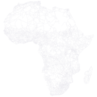
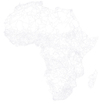
1. South Africa Roads, 2007

Line Columbia University Public content South Africa Roads, 2007. Shapefile. sde-columbia-iscgm_southafrica_2007_roadl. 2007. International Steering Committee for Global Mapping (ISCGM) and Department of Land Affairs. South Africa Roads is a line theme representing roadways in South Africa. This layer is a component of the Global Map, a 1:1,000,000 scale frame...

2. South Africa Roads, 2007

Line Columbia University Public content South Africa Roads, 2007. Shapefile. sde-columbia-global_mapping_zaf_roadl. 2007. International Steering Committee for Global Mapping (ISCGM) and Department of Land Affairs. South Africa Roads is a line theme representing roadways in South Africa. This layer is a component of the Global Map, a 1:1,000,000 scale frame...

3. Africa road network, 2000s

Princeton University Public content Africa road network, 2000s. Shapefile. princeton-b27745211. 2000. Map and Geospatial Information Center, Lewis Library, Princeton University. Shapefile representing significant roads in Africa during the 2000s. Data were extracted from Michelin Africa maps published that decade and drawn ...

4. Africa road network, 1980s

Princeton University Public content Africa road network, 1980s. Shapefile. princeton-6969z9290. 1980. Map and Geospatial Information Center, Lewis Library, Princeton University. Shapefile representing significant roads in Africa during the 1980s. Data were extracted from Michelin Africa maps published that decade and drawn ...

5. Africa road network, 1970s

Princeton University Public content Africa road network, 1970s. Shapefile. princeton-qb98mq99s. 1970. Map and Geospatial Information Center, Lewis Library, Princeton University. Shapefile representing significant roads in Africa during the 1970s. Data were extracted from Michelin Africa maps published that decade and drawn ...

6. Africa road network, 1990s

Princeton University Public content Africa road network, 1990s. Shapefile. princeton-ft849114b. 1990. Map and Geospatial Information Center, Lewis Library, Princeton University. Shapefile representing significant roads in Africa during the 1990s. Data were extracted from Michelin Africa maps published that decade and drawn ...

7. Africa road network, 1960s

Princeton University Public content Africa road network, 1960s. Shapefile. princeton-v405sk892. 1960. Map and Geospatial Information Center, Lewis Library, Princeton University. Shapefile representing significant roads in Africa during the 1960s. Data were extracted from Michelin Africa maps published that decade and drawn ...

8. Africa road network, 1980s

Princeton University Public content Africa road network, 1980s. Shapefile. princeton-kk91fw09g. 1980. Map and Geospatial Information Center, Lewis Library, Princeton University. Shapefile representing significant roads in Africa during the 1980s. Data were extracted from Michelin Africa maps published that decade and drawn ...

9. Burundi Roads

Line Harvard University Public content Burundi Roads. Shapefile. Harvard Map Collection, Harvard College Library. harvard-africover-bu-roads. 2002. Food and Agriculture Organization of the United Nations, Di Gregorio, Antonio, Institut geographique du Burundi, and Hakizimana, Cyprien. Burundi roads from The Multipurpose Africover Database for the Environmental Resources produced by the Food and Agriculture Organization of the Uni...

10. Eritrea Roads

Line Harvard University Public content Eritrea Roads. Shapefile. Harvard Map Collection, Harvard College Library. harvard-africover-er-roads. 2002. Food and Agriculture Organization of the United Nations, Di Gregorio, Antonio, National Food Information System (Eritrea), and Tekleyohannes, Yemane. Eritrea roads from The Multipurpose Africover Database for the Environmental Resources produced by the Food and Agriculture Organization of the Uni...

11. Kenya Roads

Line Harvard University Public content Kenya Roads. Shapefile. Harvard Map Collection, Harvard College Library. harvard-africover-ke-roads. 2002. Food and Agriculture Organization of the United Nations, Di Gregorio, Antonio, Kenya. Ministry of Environment and Natural Resources., and Muchoki, Charles. Kenya roads from The Multipurpose Africover Database for the Environmental Resources produced by the Food and Agriculture Organization of the Unite...

12. Tanzania Roads

Line Harvard University Public content Tanzania Roads. Shapefile. Harvard Map Collection, Harvard College Library. harvard-africover-tz-roads. 2002. Food and Agriculture Organization of the United Nations, Di Gregorio, Antonio, Tanzania. Idara ya Upimaji na Ramani., and Mollel, Lazarus L. Tanzania roads from The Multipurpose Africover Database for the Environmental Resources produced by the Food and Agriculture Organization of the Un...

13. Egypt Roads

Line Harvard University Public content Egypt Roads. Shapefile. Harvard Map Collection, Harvard College Library. harvard-africover-eg-roads. 2002. Food and Agriculture Organization of the United Nations, Di Gregorio, Antonio, Egypt. Ministry of Agriculture. Soil and Water Research Institute, and El Mowelhi, Nabil. Egypt roads from The Multipurpose Africover Database for the Environmental Resources produced by the Food and Agriculture Organization of the Unite...

14. Rwanda Roads

Line Harvard University Public content Rwanda Roads. Shapefile. Harvard Map Collection, Harvard College Library. harvard-africover-rw-roads. 2002. Food and Agriculture Organization of the United Nations, Di Gregorio, Antonio, Rwanda. Ministere des terres, de la reinstallation et de la protection de l'environnement, and Burabyo, Eugene Rurangwa. Rwanda roads from The Multipurpose Africover Database for the Environmental Resources produced by the Food and Agriculture Organization of the Unit...

15. Sudan Roads

Line Harvard University Public content Sudan Roads. Shapefile. Harvard Map Collection, Harvard College Library. harvard-africover-sd-roads. 2003. Food and Agriculture Organization of the United Nations, Di Gregorio, Antonio, Sudan. National Survey Corporation., and Mohie El Deen, Fatah El Aleem. Sudan roads from The Multipurpose Africover Database for the Environmental Resources produced by the Food and Agriculture Organization of the Unite...

16. Somalia Roads

Line Harvard University Public content Somalia Roads. Shapefile. Harvard Map Collection, Harvard College Library. harvard-africover-sm-roads. Food and Agriculture Organization of the United Nations and Di Gregorio, Antonio. Somalia roads from The Multipurpose Africover Database for the Environmental Resources produced by the Food and Agriculture Organization of the Uni...

17. Democratic Republic of the Congo Roads

Line Harvard University Public content Democratic Republic of the Congo Roads. Shapefile. Harvard Map Collection, Harvard College Library. harvard-africover-drc-roads. 2003. Food and Agriculture Organization of the United Nations, Di Gregorio, Antonio, Congo (Democratic Republic). Ministere de l'environnement. Service Permanent d'Inventaire et d'Amenagement Forestier, and Yobwa, Joseph Ipalaka. The Democratic Republic of the Congo roads from The Multipurpose Africover Database for the Environmental Resources produced by the Food and Agricu...

18. Roads, Colombia, 2011

Line Tufts University Public content Roads, Colombia, 2011. Shapefile. Instituto Geografico "Agustin Codazzi". tufts-colombia-roads-11. 2011. This line dataset represents roads in Colombia at a 1:500,000 scale as of 2011.

19. Africa, north & west : scenic routes, temperatures, rainfall per region = Afrique, nord et ouest : parcours pittoresques, températures, pluviométrie / dressée par la Manufacture française des pneumatiques Michelin.

Princeton University Restricted content Africa, north & west : scenic routes, temperatures, rainfall per region = Afrique, nord et ouest : parcours pittoresques, températures, pluviométrie / dressée par la Manufacture française des pneumatiques Michelin. TIFF. Paris : Michelin cartes et guides, 2019. princeton-dc1r66jd15n. 2019. Pneu Michelin (Firm). Relief shown by shading and spot heights. Title from panel. Includes : index and location maps; and major cities temperature and rainfall data tabl...

20. Map of Africa

Image Stanford University Public content Map of Africa. JPEG 2000. Cady & Burgess,. stanford-fz558cn6880. 1800. Cady & Burgess. Relief shown by hachures and spot shading (for deserts). Latitudinal and longitudinal lines. Prime meridians: Greenwich (top), Washington (bottom)....