Digital Maps and Geospatial Data | Princeton University

Search Results Header

Search Results

Number of results to display per page

86751. World oil & gas map / Petroleum Economist Cartographic ; produced by the Petroleum Economist, a division of Euromoney Global Limited in partnership with ABN-AMRO ; designed by K. Fuller and P. Bush.

Princeton University Restricted content World oil & gas map / Petroleum Economist Cartographic ; produced by the Petroleum Economist, a division of Euromoney Global Limited in partnership with ABN-AMRO ; designed by K. Fuller and P. Bush. London : Petroleum Economist Ltd., 2014. princeton-dcj6731g81g. 2014. Petroleum Economist Cartographic (Firm). Relief shown by gradient tints and shading. Depths shown by bathymetric tints and shading. Shows gas fields, oil fields, gas pipelines, oil pipelin...

86752. 2020 Middle East Telecommunications Map : /

Princeton University Restricted content 2020 Middle East Telecommunications Map : /. TIFF. Washington, D.C. : TeleGeography, 2020. princeton-dc5x21tt46v. 2024. TeleGeography, Inc. Relief shown by shading. Includes 7 ancillary maps: growth, planned cable systems, high-capacity routes, broadband subs., high-capacity routes, IP ...

86753. Davis County, Utah land parcels, 2014

Princeton University Restricted content Davis County, Utah land parcels, 2014. Shapefile. princeton-2r36v188d. 2014. Boundary Solutions, Inc. Land parcels in portions of Davis County, Utah, 2014.

86754. Pierce County, Washington roads, 2008

Princeton University Restricted content Pierce County, Washington roads, 2008. Shapefile. princeton-t722hd171. 2008. Boundary Solutions, Inc. Roads and highways in Pierce County, Washington, 2008.

86755. Infogroup Business Locations for Massachusetts, 2017

Princeton University Restricted content Infogroup Business Locations for Massachusetts, 2017. Shapefile. princeton-1n79h789s. 2017. ESRI. Points representing businesses in Massachusetts for 2017, taken from ESRI's national Infogroup Business Locations data. This dataset contains the l...

86756. Chambers County, Texas roads, 2011

Princeton University Restricted content Chambers County, Texas roads, 2011. Shapefile. princeton-g158bm65t. 2011. Boundary Solutions, Inc. Roads and highways in Chambers County, Texas, 2011.

86757. Irdell County, North Carolina land parcels, 2011

Princeton University Restricted content Irdell County, North Carolina land parcels, 2011. Shapefile. princeton-c821gp15s. 2011. Boundary Solutions, Inc. Land parcels in Irdell County, North Carolina, 2011.

86758. White County, Arkansas roads, 2014

Princeton University Restricted content White County, Arkansas roads, 2014. Shapefile. princeton-js956k18v. 2014. U.S. Department of Commerce, U.S. Census Bureau, Geography Division, Geographic Products Branch. Roads and highways in White County, Arkansas, 2014. The TIGER/Line shapefiles and related database files (.dbf) are an extract of selected geograph...

86759. Dallas County, Iowa roads, 2011

Princeton University Restricted content Dallas County, Iowa roads, 2011. Shapefile. princeton-pk02cf09m. 2011. Boundary Solutions, Inc. Roads and highways in Dallas County, Iowa, 2011.

86760. Township map of Guizhou with 2000 Census short form data

Princeton University Restricted content Township map of Guizhou with 2000 Census short form data. Shapefile. princeton-gt54kp677. 2000. All China Marketing Research Co., Ltd. Township locations in Guizhou Province, China, with 2000 Census data from short form tables A1-A8 (100% counts). Includes general information, age ...

86761. Pondicherry Village Map

Princeton University Restricted content Pondicherry Village Map. Shapefile. princeton-hx11xg73v. 2001. ML InfoMap Pvt. Ltd. Socio-Demographic and Economic Census data for Pondicherry.

86762. Township map of Anhui with 2000 Census long form data (L7-L8)

Princeton University Restricted content Township map of Anhui with 2000 Census long form data (L7-L8). Shapefile. princeton-g732db71r. 2000. All China Marketing Research Co., Ltd. Township locations in Anhui Province, China, with 2000 Census data from long form tables L7-L8 (9.5% counts). Includes introductory, employed popul...

86763. San Bernardino County, California land parcels, 2009

Princeton University Restricted content San Bernardino County, California land parcels, 2009. Shapefile. princeton-wh246t80q. 2009. Boundary Solutions, Inc. Land parcels in San Bernardino County, California, 2009.

86764. Burundi housing data from 2008 census (province-level)

Princeton University Restricted content Burundi housing data from 2008 census (province-level). Shapefile. princeton-dcmk61rt64n. 2008. East View Geospatial. Official housing data from the 2008 Burundi census. Data are presented at the province level.

86765. Burundi housing data from 2008 census (colline-level)

Princeton University Restricted content Burundi housing data from 2008 census (colline-level). Shapefile. princeton-dc0r967f43q. 2008. East View Geospatial. Official housing data from the 2008 Burundi census. Data are presented at the colline level.

86766. Burundi housing data from 2008 census (commune-level)

Princeton University Restricted content Burundi housing data from 2008 census (commune-level). Shapefile. princeton-dcw0892n64m. 2008. East View Geospatial. Official housing data from the 2008 Burundi census. Data are presented at the commune level.

86767. Burundi demographic data from 2008 census (colline-level)

Princeton University Restricted content Burundi demographic data from 2008 census (colline-level). Shapefile. princeton-dcnk322r03q. 2008. East View Geospatial. Official demographic data from the 2008 Burundi census. Data are presented at the colline level.

86768. Burundi migration data from 2008 census (province-level)

Princeton University Restricted content Burundi migration data from 2008 census (province-level). Shapefile. princeton-dc79408786b. 2008. East View Geospatial. Official migration data from the 2008 Burundi census. Data are presented at the province level.

86769. Burundi migration data from 2008 census (commune-level)

Princeton University Restricted content Burundi migration data from 2008 census (commune-level). Shapefile. princeton-dcc247f3804. 2008. East View Geospatial. Official migration data from the 2008 Burundi census. Data are presented at the commune level.

86770. Burundi transportation data from 2008 census (commune-level)

Princeton University Restricted content Burundi transportation data from 2008 census (commune-level). Shapefile. princeton-dckk91fx27t. 2008. East View Geospatial. Official transportation data from the 2008 Burundi census. Data are presented at the commune level.

86771. Burundi transportation data from 2008 census (colline-level)

Princeton University Restricted content Burundi transportation data from 2008 census (colline-level). Shapefile. princeton-dcqb98ms172. 2008. East View Geospatial. Official transportation data from the 2008 Burundi census. Data are presented at the colline level.

86772. Energy Web Atlas biodiesel plants (USA), 2015

Princeton University Restricted content Energy Web Atlas biodiesel plants (USA), 2015. Shapefile. princeton-dc3t946235w. 2015. Energy Web Atlas. Points representing biodiesel plants in the United States as of May 2015. Data are taken from the US Energy Information Administration's monthly bi...

86773. Little Falls Township, Passaic County, New Jersey

Princeton University Public content Little Falls Township, Passaic County, New Jersey. New York : Sanborn Map Company, 1925. princeton-c821gn69j. 1925. Sanborn Map Company. "Including Great Notch & Singac." "March 1925." Includes location map, key, key map, streets and specials index, and text. "2077.".

86774. Western Australia state map / Hema Maps ; cartography, Ray Martin.

Princeton University Restricted content Western Australia state map / Hema Maps ; cartography, Ray Martin. Eight Mile Plains, Qld. : Hema Maps, ©2019. princeton-dchq37w163p. 2019. Hema Maps (Firm). Relief shown by spot heights and shading. Map of Greater Hobart showing: roads; railroads; walking, hiking, and biking routes; topology; political ...

86775. Somerville, Somerset County, New Jersey

Princeton University Public content Somerville, Somerset County, New Jersey. New York : Sanborn Map Company, 1924. princeton-8p58pg85n. 1924. Sanborn Map Company. "April, 1924." Includes location map, key, key map, streets and specials index, and text. "1568.".

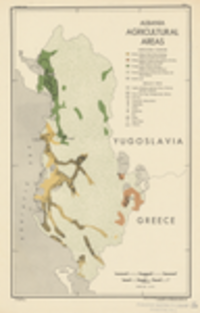
86776. Albania : agricultural areas / compiled and drawn in the Branch of Research and Analysis, OSS.

Princeton University Public content Albania : agricultural areas / compiled and drawn in the Branch of Research and Analysis, OSS. TIFF. [Washington, D.C.] : Office of Strategic Services. Research and Analysis Branch, 1943. princeton-dczg64tz91k. 1943. United States. Office of Strategic Services. Research and Analysis Branch. Map is number 2604. 5 October 1943. "Reliability code 2B-2B-2." Map shows agricultural complexes and specialty crops.

86777. Atchison County, Missouri land parcels, 2019

Princeton University Restricted content Atchison County, Missouri land parcels, 2019. Shapefile. princeton-dc2227n2685. 2019. Boundary Solutions, Inc. Land parcels in Atchison County, Missouri, 2019.

86778. Carta regionale della Toscana : Scale 1:350 000.

Princeton University Restricted content Carta regionale della Toscana : Scale 1:350 000. TIFF. Firenze : Instituo Geografico Militare , 2020. princeton-dczk51vv795. 2020. Istituto geografico militare (Italy). Relief shown by contours, shading, and spot heights. Includes sources of mapping. Geodetic reference system: ETRF 2000 (2008.0). "Sistema di riferi...

86779. Barry County, Missouri land parcels, 2019

Princeton University Restricted content Barry County, Missouri land parcels, 2019. Shapefile. princeton-dcsn00b9799. 2019. Boundary Solutions, Inc. Land parcels in Barry County, Missouri, 2019.

86780. Athine centre

Princeton University Restricted content Athine centre. Athens : [s.n.], 1978[?]. princeton-dc8s45qn773. 1978. Pacific Limited. No relief shown. Some buildings represented pictorially List and location of tourist sights, including Public Squares, Railway Stations, State Serv...

86781. Asia: Near East. GSGS 2555

Princeton University Public content Asia: Near East. GSGS 2555. princeton-dcr494vx13n. 1912. United Kingdom. War Office. Princeton does not own these maps. Holding institutions for individual sheets are indicated in the respective sheets' metadata.

86782. Princeton Campus Map 1902-1903

Princeton University Public content Princeton Campus Map 1902-1903. TIFF. Princeton University. princeton-sf268685v. 1903. Princeton University. This is a map of the grounds of Princeton University. It has been scanned from the Princeton University Catalogue 1902-1903.

86783. Princeton Campus Map 1886-1887

Princeton University Public content Princeton Campus Map 1886-1887 . TIFF. Princeton University. princeton-9306t096m. 1887. Princeton University. This is a map of the grounds of Princeton University. It has been scanned from the Princeton University Catalogue 1886-1887.

86784. Belvidere, Warren County, New Jersey

Princeton University Public content Belvidere, Warren County, New Jersey. New York : Sanborn Map Company, 1909. princeton-zw12z8227. 1909. Sanborn Map Company. "Sept. 1909." "1774." Includes key, key map, streets and specials index, and text.

86785. Belvidere, Warren Co., New Jersey

Princeton University Public content Belvidere, Warren Co., New Jersey. New York : Sanborn Map Company, 1903. princeton-m039k7857. 1903. Sanborn Map Company. "June 1903." "6318." Includes key, key map, streets and specials index, and text.

86786. Northern Africa

Princeton University Public content Northern Africa. TIFF. [London] : London Printing and Publishing Company, [1851?]. princeton-z890rw087. 1851. Rapkin, J. Relief shown by hachures. Includes views of Mogador, Marocco, Constantine, Algiers, and Tunis. Probably included in: The illustrated atlas, and mod...

86787. Princeton, Mercer County, New Jersey

Princeton University Public content Princeton, Mercer County, New Jersey. New York : Sanborn Map Company, 1927. princeton-0c483n289. 1927. Sanborn Map Company. Title taken from sheet 1. "Oct. 1927." Includes location map, key, streets and specials index, and text. Oriented with the north to the upper right...

86788. Galapagos Islands, Quito & Guayaquil : scale 1:350,000/1:12,400/1:10,000 : Quito region, Guayaquil region / International Travel Maps.

Princeton University Restricted content Galapagos Islands, Quito & Guayaquil : scale 1:350,000/1:12,400/1:10,000 : Quito region, Guayaquil region / International Travel Maps. Richmond, BC : ITMB Publishing Ltd., 2022. princeton-dcbz60d802b. 2022. International Travel Maps (Firm). Relief on Galapagos Islands map shown by contours, gradient tints, hachures, and spot heights. Depths shown by bathymetric tints. Panel title. "© I...

86789. Energy map of Mexico / produced by the Petroleum Economist Ltd., London, a division of Euromoney Global Ltd., in association with Fermaca ; designed by K. Fuller and P. Bush ; satellite derived imagery courtesy of CGG NPA Satellite Mapping.

Princeton University Restricted content Energy map of Mexico / produced by the Petroleum Economist Ltd., London, a division of Euromoney Global Ltd., in association with Fermaca ; designed by K. Fuller and P. Bush ; satellite derived imagery courtesy of CGG NPA Satellite Mapping. London : Petroleum Economist, 2015. princeton-dc2514nz55h. 2015. Petroleum Economist Cartographic (Firm). Relief shown shading. Depth shown by shading. Shows crude oil fields, structures and pipelines (existing, under construction, and planned), gas fie...

86790. Oil & gas map of Mexico / Petroleum Economist Cartographic ; produced by the Petroleum Economist, a division of Euromoney Global Limited in association with PEMEX ; designed by K. Fuller and P. Bush.

Princeton University Restricted content Oil & gas map of Mexico / Petroleum Economist Cartographic ; produced by the Petroleum Economist, a division of Euromoney Global Limited in association with PEMEX ; designed by K. Fuller and P. Bush. London : Petroleum Economist Ltd., 2015. princeton-dc6w924q869. 2015. Petroleum Economist Cartographic (Firm). Relief shown shading. Depth shown by shading. Shows gas fields, oil fields, gas pipelines, oil pipelines, liquefied natural gas import terminals, r...

86791. نقشه راهنماى شهر تبرىز / تهىه و چاپ از: گىتاشناسى.

Princeton University Restricted content نقشه راهنماى شهر تبرىز / تهىه و چاپ از: گىتاشناسى. TIFF. Tihrān : Gītā ́Shināsī, [1986?]. princeton-dcpv63gc28r. 1986. Shirkat-i Gītā Shināsī and شرکت گىتاشناسى. Selected buildings shown pictorially. Includes legend and key to historical monuments, government offices, and places of interest to tourists. Cove...

86792. Sumter County, Alabama land parcels, 2017

Princeton University Restricted content Sumter County, Alabama land parcels, 2017. Shapefile. princeton-9s161g595. 2017. Boundary Solutions, Inc. Land parcels in Sumter County, Alabama, 2017.

86793. Kodiak Island Borough, Alaska land parcels, 2019

Princeton University Restricted content Kodiak Island Borough, Alaska land parcels, 2019. Shapefile. princeton-1831cv37g. 2020. Boundary Solutions, Inc. Land parcels in Kodiak Island Borough, Alaska, 2019.

86794. Oneida County, Idaho land parcels, 2019

Princeton University Restricted content Oneida County, Idaho land parcels, 2019. Shapefile. princeton-dc9306t8564. 2019. Boundary Solutions, Inc. Land parcels in Oneida County, Idaho, 2019.

86795. Gem County, Idaho land parcels, 2019

Princeton University Restricted content Gem County, Idaho land parcels, 2019. Shapefile. princeton-dczs25xk73t. 2019. Boundary Solutions, Inc. Land parcels in Gem County, Idaho, 2019.

86796. Holmes County, Florida land parcels, 2009

Princeton University Restricted content Holmes County, Florida land parcels, 2009. Shapefile. princeton-4q77fv71r. 2009. Boundary Solutions, Inc. Land parcels in Holmes County, Florida, 2009.

86797. Jerome County, Idaho land parcels, 2019

Princeton University Restricted content Jerome County, Idaho land parcels, 2019. Shapefile. princeton-dcb2774596k. 2019. Boundary Solutions, Inc. Land parcels in Jerome County, Idaho, 2019.

86798. Payette County, Idaho land parcels, 2019

Princeton University Restricted content Payette County, Idaho land parcels, 2019. Shapefile. princeton-dccv43p708p. 2019. Boundary Solutions, Inc. Land parcels in Payette County, Idaho, 2019.

86799. Cassia County, Idaho land parcels, 2019

Princeton University Restricted content Cassia County, Idaho land parcels, 2019. Shapefile. princeton-dcxs55mp35h. 2019. Boundary Solutions, Inc. Land parcels in portions of Cassia County, Idaho, 2019.

86800. Lemhi County, Idaho land parcels, 2019

Princeton University Restricted content Lemhi County, Idaho land parcels, 2019. Shapefile. princeton-dc2j62sg12w. 2019. Boundary Solutions, Inc. Land parcels in Lemhi County, Idaho, 2019.