Digital Maps and Geospatial Data | Princeton University

Start over

Current results range from 1099 to 2024

Search Results Header

Search Results

Number of results to display per page

11. Roads, South Africa, 2016

Line Stanford University Public content Roads, South Africa, 2016. Shapefile. International Steering Committee for Global Mapping. stanford-fz199pb2459. 2016. International Steering Committee for Global Mapping and South Africa. National Geo-spatial Information. This line shapefile represents roads in South Africa. The bulk of the data, for this layer, was captured from the South African Provincial Map Seri...

12. Colony of the Cape of Good Hope

Princeton University Public content Colony of the Cape of Good Hope. TIFF. London : published for the Journal of the Royal Geographical Society, by J. Murray, Albemarle Street, 1836. princeton-br86b6076. 1836. Relief shown by hachures. Roads and kloofs (mountain passes) are shown. From: Journal of the Royal Geographical Society of London. Vol. 6 (1836), p...

13. South Africa, Cape Town (Roads, 2008)

Line Massachusetts Institute of Technology Public content South Africa, Cape Town (Roads, 2008). Shapefile. Cape Town (South Africa) Strategic Development Information and GIS Department (CCT) . mit-mfabxtyu7zjva. Strategic Development Information and GIS Department, Strategy and Planning Directorate, City of Cape Town. This dataset shows roadways within Cape Town.

14. West Africa, 1983

Princeton University Public content West Africa, 1983. TIFF. Central Intelligence Agency. princeton-j098zc80p. 1983. Central Intelligence Agency. This is a map of West Africa, shown at a 1:3,000,000 scale. The map was created by the Central Intelligence Agency.

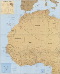
15. Northwest Africa, 1991

Princeton University Public content Northwest Africa, 1991. TIFF. Central Intelligence Agency. princeton-ms35tb05h. 1991. Central Intelligence Agency. This is a map of Northwest Africa, shown at a 1:5,000,000 scale. The map was created by the Central Intelligence Agency.

16. Map of the northern desert of Africa

Image Stanford University Public content Map of the northern desert of Africa. JPEG 2000. John Murray, Albemarle Street,. stanford-jb438dq7552. 1800. Society for the Diffusion of Useful Knowledge (Great Britain) and Edward Stanford Ltd. Stanford's Geographl. Estabt. Relief shown by hachures. Latitudinal and longitudinal lines. Prime meridian: Greenwich. Shows topography, drainage, ...

17. South Africa, Cape Town (Major Roads, 2000)

Line Massachusetts Institute of Technology Public content South Africa, Cape Town (Major Roads, 2000). Shapefile. Cape Town (South Africa) Strategic Development Information and GIS Department (CCT) . mit-npyubdys3jklu. Strategic Development Information and GIS Department, Strategy and Planning Directorate, City of Cape Town. This dataset shows major roadways within Cape Town.

18. The Cape Peninsula diagram of roads

Image Stanford University Public content The Cape Peninsula diagram of roads. JPEG 2000. Cape Times Ltd. stanford-fh159fk9016. 1900. Cape of Good Hope (South Africa). Department of Roads. Dutch translations.

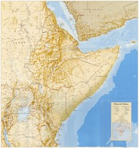
19. Horn of Africa, 1994

Princeton University Public content Horn of Africa, 1994. TIFF. Central Intelligence Agency. princeton-mp48sf427. 1994. Central Intelligence Agency. This is a map of the Horn of Africa, shown at a 1:4,000,000 scale. The map was created by the Central Intelligence Agency.

20. Madagascar (Roads, 2006)

Line Massachusetts Institute of Technology Public content Madagascar (Roads, 2006). Shapefile. Southern Africa Humanitarian Information Management System (SAHIMS). mit-y67e2lue5zids. unknown. All roads in Madagascar.