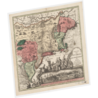
Digital Maps and Geospatial Data | Princeton University

latin america census uruguay Remove constraint latin america census uruguay

Search Results Header

Search Results

Number of results to display per page

251. Cuba Insula

Image Stanford University Public content Cuba Insula. JPEG 2000. Jodocus Hondius. stanford-jc686tb6436. 1613. Mercator, Gerard, approximately, 1565-1656 and Hondius, Jodocus, 1563-1612. Relief shown pictorially. Prime meridian: [Ferro]. Latitudinal and longitudinal lines along margins. Decorative cartouches, ships, sea monsters. Sh...

252. Congressional Districts for 107th Congress United States 2001

Polygon Tufts University Public content Congressional Districts for 107th Congress United States 2001. Shapefile. Geological Survey (U.S.). tufts-uscongdist107th01. 2001. This polygon dataset represents the Congressional Districts of the United States for the 107th Congress. The data set was created by extracting li...

253. World distribution of spirochetal diseases: 1.Yaws, pinta, bejel

Princeton University Restricted content World distribution of spirochetal diseases: 1.Yaws, pinta, bejel. TIFF. New York, NY : American Geographical Society, 1955. princeton-5999n5195. 1955. American Geographical Society of New York. Briesemeister elliptical equal-area projection. On upper right margin: Atlas of distribution of diseases...

254. Correctional Institution Locations New Hampshire 2006-2009

Point Tufts University Public content Correctional Institution Locations New Hampshire 2006-2009. Shapefile. NH GRANIT (Firm). tufts-nhcorrectionalinstitutions0609. 2008. This point dataset shows correctional institutions in New Hampshire. Jails and Prisons (Correctional Institutions). The Jails and Prisons sub-laye...

255. MEXIQVE ou N.LE ESPAGNE

Image Stanford University Public content MEXIQVE ou N.LE ESPAGNE. JPEG 2000. stanford-dq232gc5337. 1661. Duval, P. (Pierre), 1619-1682. Title in French. California unlabelled. M. de Californie to its east Issued in his: Geographie Universelle. -- Paris, ca.1661. Title in Latin: MEXI...

256. Voter Data per State United States 2000 - 2008

Polygon Tufts University Public content Voter Data per State United States 2000 - 2008. Shapefile. Geological Survey (U.S.). tufts-usvoterperstate0008. 2000. This polygon dataset shows the US percentage of voting age persons registered to vote and voted, per State for 2000-2008. Data is expressed in perc...

257. [Celestial charts and world maps]

Image Stanford University Public content [Celestial charts and world maps]. JPEG 2000. s.n. stanford-qg633rp8719. 1700. Includes 7 figures, with a large celestial chart in the center labeled Fig B. California as an island shown in Figures I and D, which are hemispher...

258. Cities and Towns 1:1,000,000 Scale United States, Puerto Rico, and Virgin Islands 2014

Point Tufts University Public content Cities and Towns 1:1,000,000 Scale United States, Puerto Rico, and Virgin Islands 2014. Shapefile. Geological Survey (U.S.). tufts-uscitiestowns1mil14. 2014. This point dataset represents cities and towns in the United States, Puerto Rico, and the U.S. Virgin Islands with data from the 2010 census. A ci...

259. [World map]

Image Stanford University Public content [World map]. JPEG 2000. Johann Christoph Weigel. stanford-qh664hf2573. 1719. Doppelmayr, Johann Gabriel, 1677-1750. California shown as an unlabeled island with a very indented western coast. Hemispheres are tilted at a 45 degree angle toward the center. Includes...

260. Orbis vetus, et orbis veteris utraque continens, terrarum q3 tractus Arcticus, et Antarcticus

Image Stanford University Public content Orbis vetus, et orbis veteris utraque continens, terrarum q3 tractus Arcticus, et Antarcticus. JPEG 2000. Apud P. Mortier. stanford-fm706sb1090. 1705. Sanson, Nicolas, 1600-1667, Mortier, Pierre, 1661-1711, and Cóvens et Mortier. Auctore N. Sanson Abbavillaeo, et Christianiss. Galliar Regis Geographo. California shown as an unlabeled island with flat northern coast. Depicts ...

261. Orbis vetus, et orbis veteris utraque continens, terrarum q3 tractus Arcticus, et Antarcticus

Image Stanford University Public content Orbis vetus, et orbis veteris utraque continens, terrarum q3 tractus Arcticus, et Antarcticus. JPEG 2000. Apud P. Mortier. stanford-qx771kk2987. 1705. Sanson, Nicolas, 1600-1667, Mortier, Pierre, 1661-1711, and Cóvens et Mortier. Auctore N. Sanson Abbavillaeo, et Christianiss. Galliar Regis Geographo. California shown as an unlabeled island with flat northern coast. Depicts ...

262. Orbis terrarum typus

Image Stanford University Public content Orbis terrarum typus. JPEG 2000. s.n. stanford-dy019kj1197. 1700. Clüver, Philipp, 1580-1622. California shown as a labeled island with a slightly indented northern coast and a few place names. Shows a wide strait to the NW of California. An...

263. Orbis terrarum typus

Image Stanford University Public content Orbis terrarum typus. JPEG 2000. s.n. stanford-cm303hd3051. 1700. Clüver, Philipp, 1580-1622. California shown as a labeled island with a slightly indented northern coast and a few place names. Shows a wide strait to the NW of California. An...

264. Mapemonde planisphere ou carte generale du monde

Image Stanford University Public content Mapemonde planisphere ou carte generale du monde. JPEG 2000. s.n. stanford-wb781xz8377. 1710. Baeck, Elias 1679-1747. California as an island with a narrowing northern end. Portion of northwestern continent above California is left blank. Antartic land mass almost ...

265. New England and Middle Atlantic States, ca. 1730 (Raster Image)

Raster Harvard University Public content New England and Middle Atlantic States, ca. 1730 (Raster Image). GeoTIFF. Harvard Map Collection, Harvard College Library. harvard-g3720-1730-s4. 1730. Harvard Map Collection, Harvard College Library and Seutter, Matthaeus, 1678-1756. This layer is a georeferenced raster image of the historic paper map entitled: Recens edita totius Novi Belgii in America Septentrionali siti, deli...

266. Tartariae Imperium

Image Stanford University Public content Tartariae Imperium. JPEG 2000. Apud Haeredes Simonis Galignani de Karera,. stanford-pm323nt1979. 1596. Magini, Giovanni Antonio, 1555-1617 and Porro, Girolamo, 1520-1604. Giovanni Antonio Magini. From the 1596 atlas : Geographiae universae tum veteris tum novae absolutissimum opus duobus voluminibus distinctum, in qu...

267. Gulf of Mexico and Caribbean Sea Region, ca. 1708 (Raster Image)

Raster Harvard University Public content Gulf of Mexico and Caribbean Sea Region, ca. 1708 (Raster Image). GeoTIFF. Harvard Map Collection, Harvard Library. harvard-g4390-1708-o8. 1708. Harvard Map Collection, Harvard Library, Ottens, R. (Reiner), 1698-1750., Ottens, J. (Josua), 1704-1765., and R. & J. Ottens. This layer is a georeferenced raster image of the historic paper map entitled: Nova Isthmi Americani, qui et Panamiensis item Dariensis, tabula, in...

268. Combined Statistical Areas United States and Puerto Rico 2013

Polygon Tufts University Public content Combined Statistical Areas United States and Puerto Rico 2013. Shapefile. Geological Survey (U.S.). tufts-uscsa13. 2013. This polygon dataset represents Combined Statistical Areas in the United States and Puerto Rico. Combined statistical areas consist of two or more...

269. Cities and Towns 1:2,000,000 Scale United States and Virgin Islands 1972-2004

Point Tufts University Public content Cities and Towns 1:2,000,000 Scale United States and Virgin Islands 1972-2004. Shapefile. Geological Survey (U.S.). tufts-uscitiestowns2mil7204. 1972. This point dataset represents cities in the United States, Puerto Rico and the U.S. Virgin Islands, collected from the 1970 National Atlas of the U...

270. AUDIENCE DE GUADALAJARA, NOUVEAU MEXIQUE, CALIFORNIE, &c.

Image Stanford University Public content AUDIENCE DE GUADALAJARA, NOUVEAU MEXIQUE, CALIFORNIE, &c. JPEG 2000. Chez P. Mariette. stanford-kc128tv5108. 1656. Sanson, Nicolas, 1600-1667. [1656], in French, with imprint 'A Paris chez P. Mariette rue S. Iacques a l'Esperance Avec Pri. pour 20 ans'. Manuscript '63' (top right, outside ...

271. Core Based Statistical Areas United States and Puerto Rico 2010

Polygon Tufts University Public content Core Based Statistical Areas United States and Puerto Rico 2010. Shapefile. Geological Survey (U.S.). tufts-uscbsa10. 2013. This polygon datasets portrays core based statistical areas in the United States and Puerto Rico in 2010. The map layer was created from the CENSU...

272. Built Up Locations United States, Puerto Rico, and the U.S. Virgin Islands 2010

Point Tufts University Public content Built Up Locations United States, Puerto Rico, and the U.S. Virgin Islands 2010. Shapefile. Geological Survey (U.S.). tufts-usbuiltuplocations10. 1972. This point dataset includes Global Map data showing built up areas, primarily cities and towns, in the United States, Puerto Rico, and the U.S. Vir...

274. Ecuador Toponyms

Point The University of Texas at Austin Public content Ecuador Toponyms. Shapefile. utaustin_121140. This shapefile is comprised of toponymic data generated from topographic maps (1:50,000) of Ecuador’s Oriente - a region which is defined by the tr...