Digital Maps and Geospatial Data | Princeton University

Search Results Header

Search Results

Number of results to display per page

86851. Greece and the Aegean : mean temperatures for January / compiled and drawn in the Branch of Research and Analysis, OSS.

Princeton University Public content Greece and the Aegean : mean temperatures for January / compiled and drawn in the Branch of Research and Analysis, OSS. TIFF. [Washington, D.C.] : Office of Strategic Services. Research and Analysis Branch, 1943, provisional. princeton-dcz316qd641. 1943. United States. Office of Strategic Services. Research and Analysis Branch. "Map number 2218. 8 April 1943." "Compiled and drawn in the branch of research and analysis, OSS. Reproduced in the Reproduction Section, OSS." Tem...

86852. Scotland energy map 2019 : electricity generation & transmission (including renewable energy sites > 1.0MW) / compiled, designed and produced by La Tene Maps.

Princeton University Restricted content Scotland energy map 2019 : electricity generation & transmission (including renewable energy sites > 1.0MW) / compiled, designed and produced by La Tene Maps. TIFF. Dublin : La Tene Maps, 2019. princeton-dc5m60r494h. 2019. La Tene Maps Ltd. 1 main map with territorial waters and 3 inset maps of Aberdeenshire Area, Glasgow-Edinburgh and Shetland. Shows renewable and nonrenewable energy ...

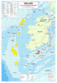
86853. Ireland oil & gas exploration / compiled, designed and produced by La Tene Maps.

Princeton University Restricted content Ireland oil & gas exploration / compiled, designed and produced by La Tene Maps. TIFF. Shankill, Dublin : La Tene Maps, 2022. princeton-dctb09jj700. 2022. La Tene Maps Ltd. Depths shown by bathymetric contours and soundings. Offshore waters are overlaid with an index grid. Sea basins are labelled on map. Includes legen...

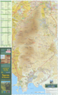
86856. Ymēttos / Road Ekdoseis A.E. = Mt. Hymettus : outdoor activities map / Road Editions S.A.

Princeton University Restricted content Ymēttos / Road Ekdoseis A.E. = Mt. Hymettus : outdoor activities map / Road Editions S.A. Athēna : Road Ekdoseis A.E., 2007. princeton-dchd76sc07b. 2007. Road Ekdoseis A.E. Relief shown by contours and spot heights. Text, color illustrations, tables of caves showing latitude, longitude, and altitude, and 2 maps of part...

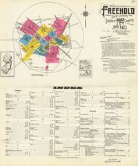
86857. Freehold, Monmouth County, New Jersey

Princeton University Public content Freehold, Monmouth County, New Jersey. New York : Sanborn Map Company, 1923. princeton-j6731668n. 1923. Sanborn Map Company. "July, 1923." Includes location map, key, streets and specials index, and text. "1114." Title from index sheet.

86858. Plano general de los Ferrocarriles Nacionales de Mexico

Princeton University Public content Plano general de los Ferrocarriles Nacionales de Mexico. TIFF. [S.l.] : Ferrocarriles Nacionales de Mexico, 1910. princeton-dz010s583. 1910. Ferrocarriles Nacionales de México. In upper margin: Map of National Railways of Mexico. Insets: Plano de los ferrocarriles nacionales entre Mexico y Vera Cruz -- [Baja California and...

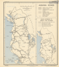
86859. Albania: roads / compiled and drawn in the Branch of Research and Analysis, OSS.

Princeton University Public content Albania: roads / compiled and drawn in the Branch of Research and Analysis, OSS. [Washington, D.C.] : Office of Strategic Services, Branch of Research and Analysis, 1943. princeton-dcpz50h811j. 1943. United States. Office of Strategic Services. Research and Analysis Branch. Map is number 2599. 6 October 1943. "Reliability code 1A-2B-2." Ancillary map: "Roads according to terrain types traversed," showing five classes o...

86860. Butler County, Missouri land parcels, 2019

Princeton University Restricted content Butler County, Missouri land parcels, 2019. Shapefile. princeton-dc1257b529c. 2019. Boundary Solutions, Inc. Land parcels in Butler County, Missouri, 2019.

86861. Bates County, Missouri land parcels, 2019

Princeton University Restricted content Bates County, Missouri land parcels, 2019. Shapefile. princeton-dcwd376832b. 2019. Boundary Solutions, Inc. Land parcels in Bates County, Missouri, 2019.

86862. Caldwell County, Missouri land parcels, 2019

Princeton University Restricted content Caldwell County, Missouri land parcels, 2019. Shapefile. princeton-dcnv935f88j. 2019. Boundary Solutions, Inc. Land parcels in Caldwell County, Missouri, 2019.

86863. Audrain County, Missouri land parcels, 2019

Princeton University Restricted content Audrain County, Missouri land parcels, 2019. Shapefile. princeton-dcj3860k976. 2019. Boundary Solutions, Inc. Land parcels in Audrain County, Missouri, 2019.

86864. Callaway County, Missouri land parcels, 2019

Princeton University Restricted content Callaway County, Missouri land parcels, 2019. Shapefile. princeton-dcdb78tr07p. 2019. Boundary Solutions, Inc. Land parcels in Callaway County, Missouri, 2019.

86865. Partie du Désert de Sahara

Princeton University Public content Partie du Désert de Sahara. TIFF. [Bruxelles : Ph. Vandermaelen, 1827]. princeton-6d56zz904. 1827. Vandermaelen, Philippe, 1795-1869. Relief shown pictorially. Covers parts of Morocco, Western Sahara and the Canary Islands. From: Atlas universel de géographie physique, politique,...

86866. Camden County, Missouri land parcels, 2019

Princeton University Restricted content Camden County, Missouri land parcels, 2019. Shapefile. princeton-dc8k71nw121. 2019. Boundary Solutions, Inc. Land parcels in Camden County, Missouri, 2019.

86867. Andrew County, Missouri land parcels, 2019

Princeton University Restricted content Andrew County, Missouri land parcels, 2019. Shapefile. princeton-dc4t64h120b. 2019. Boundary Solutions, Inc. Land parcels in Andrew County, Missouri, 2019.

86868. Adair County, Missouri land parcels, 2019

Princeton University Restricted content Adair County, Missouri land parcels, 2019. Shapefile. princeton-dcx920g889p. 2019. Boundary Solutions, Inc. Land parcels in Adair County, Missouri, 2019.

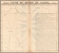
86869. Partie du Désert de Sahara

Princeton University Public content Partie du Désert de Sahara. TIFF. [Bruxelles : Ph. Vandermaelen, 1827]. princeton-x346d654c. 1827. Vandermaelen, Philippe, 1795-1869. Covers parts of Morocco, Algeria, Mali and Mauritania. Includes text: Note sur les Arabes, Bedouins ou Monslemines. From: Atlas universel de géogr...

86870. Anderson County, Kansas land parcels, 2018

Princeton University Restricted content Anderson County, Kansas land parcels, 2018. Shapefile. princeton-dcsq87c612t. 2018. Boundary Solutions, Inc. Land parcels in Anderson County, Kansas, 2018.

86871. Башкирская АССР / карта составлена Киевской картографической фабрикой ГУГК в 1951 г. и исправлена в. 1958 г ; редакторы Королева М.А. и Слепцова Л.М.

Princeton University Restricted content Башкирская АССР / карта составлена Киевской картографической фабрикой ГУГК в 1951 г. и исправлена в. 1958 г ; редакторы Королева М.А. и Слепцова Л.М. TIFF. Moskva : Glavnoe upravlenie geodezii i kartografii, MVD SSSR, 1958. princeton-dctm70n722d. 1951. Soviet Union. Glavnoe upravlenie geodezii i kartografii and Soviet Union. Главное управление геодезии и картографии. Relief shown by spot heights and shading. Administrative divisions (raĭon) listed and located. Publisher's no.: Z-291. З-291 "Administrativnie gran...

86872. West Bank and vicinity : September 1984 [cartographic material].

Princeton University Public content West Bank and vicinity : September 1984 [cartographic material]. [Washington. D.C.] : [Central Intelligence Agency], 1984. princeton-dcp2677761w. 1984. United State. Central Intelligence Agency. Transverse Mercator projection. Verso: index of places and key to abbreviation. Shows Israel-Jordan dema...

86874. Völker - und Sprachenkarte des Vorderen Orient [cartographic material].

Princeton University Restricted content Völker - und Sprachenkarte des Vorderen Orient [cartographic material]. TIFF. Berlin : [s.n.], 1943. princeton-dc44558s34p. 1943. Germany, Reichsamt für Landesaufnahme. Germany, Auswärtiges Amt. Geographischer Dienst. North Decimal Degree 45.500. South Decimal Degree -11.500....

86875. Middle East briefing map. Series 1308 [cartographic material].

Princeton University Public content Middle East briefing map. Series 1308 [cartographic material]. TIFF. Washington D.C. : [s.n.], 1967. princeton-dcd217r257g. 1967. United States. Army Map Service. Corps of Engineers. North Decimal Degree 37.9167. South Decimal Degree 26.0000. East Decimal Degree 42.1667. West ...

86876. West Bank and vicinity, September 1983 [cartographic material].

Princeton University Public content West Bank and vicinity, September 1983 [cartographic material]. [Washington, D.C.] : [Central Intelligence Agency], 1983. princeton-dcwm118203q. 1983. [United States. Central Intelligence Agency]. Transverse Mercator projection. Verso: index of places and key to abbreviation. Shows Israel-Jordan a...

86877. World gas map : 2018 edition / produced by Petroleum Economist, a division of Gulf Publishing, in partnership with Chevron ; designed by K. Fuller and P. Bush.

Princeton University Restricted content World gas map : 2018 edition / produced by Petroleum Economist, a division of Gulf Publishing, in partnership with Chevron ; designed by K. Fuller and P. Bush. London : Petroleum Economist, Ltd., 2017. princeton-dc1544c213n. 2017. Petroleum Economist Ltd. Relief shown by shading and gradient tints. Depth shown by shading and bathymetric tints. "Published December 2017." Shows gas fields, gas pipeline...

86878. מפת אזורי הקרבות.

Princeton University Restricted content מפת אזורי הקרבות. TIFF. Tel Aviv : [Yosef Shapira?], 1967. princeton-dcq811kx693. 1967. Relief shown by shading and spot heights. Map shows international boundaries, roads, highways, railways, oil fields, oil pipelines, and oil refiner...

86879. The Middle East [cartographic material].

Princeton University Restricted content The Middle East [cartographic material]. TIFF. [New York, NY] : [s.n.], 1956. princeton-dchd76sc14b. 1956. Time Weekly Magazine. North Decimal Degree 43.000000. South Decimal Degree 27.0000. East Decimal Degree 78.0000. West Decimal Degree 19.0000. Relie...

86880. Middle East / produced by the Cartographic Division, National Geographic Society ; John B. Garver, Jr., chief cartographer ; Harold E. Aber, Jr., John F. Shupe, associate chief [cartographers].

Princeton University Restricted content Middle East / produced by the Cartographic Division, National Geographic Society ; John B. Garver, Jr., chief cartographer ; Harold E. Aber, Jr., John F. Shupe, associate chief [cartographers]. TIFF. Washington, D.C. : The Division, 1988, ©1984. princeton-dcv118rs60f. 1988. National Geographic Society (U.S.). Cartographic Division and National Geographic Society. Relief shown by shading and spot heights. On Eastern Mediterranean map: "Green shading indicates area occupied by Israel" [West Bank]. Includes lis...

86881. Bible lands and the cradle of western civilization [cartographic material] / compiled and drawn in the Cartographic Section of the National Geographic Society.

Princeton University Restricted content Bible lands and the cradle of western civilization [cartographic material] / compiled and drawn in the Cartographic Section of the National Geographic Society. TIFF. Washington : The Society, 1946. princeton-dc9w032g10w. 1946. National Geographic Society (U.S.). Cartographic Division. Relief shown by shading and spot heights. Includes numerous historical notes covering events from earliest times to the present. Issued with the Na...

86882. Lambertville, N.J.

Princeton University Public content Lambertville, N.J. New York : Sanborn Map & Publishing Co., Limited, 1885. princeton-zc77ss99h. 1885. Sanborn Map Company. "Feb. 1885." Includes key and text.

86883. Shannon County, Missouri land parcels, 2019

Princeton University Restricted content Shannon County, Missouri land parcels, 2019. Shapefile. princeton-dctq57p4085. 2019. Boundary Solutions, Inc. Land parcels in Shannon County, Missouri, 2019.

86884. Macon County, Missouri land parcels, 2019

Princeton University Restricted content Macon County, Missouri land parcels, 2019. Shapefile. princeton-dcfj236f176. 2019. Boundary Solutions, Inc. Land parcels in Macon County, Missouri, 2019.

86885. Polk County, Missouri land parcels, 2019

Princeton University Restricted content Polk County, Missouri land parcels, 2019. Shapefile. princeton-dcpz50h817f. 2019. Boundary Solutions, Inc. Land parcels in Polk County, Missouri, 2019.

86886. New Madrid County, Missouri land parcels, 2019

Princeton University Restricted content New Madrid County, Missouri land parcels, 2019. Shapefile. princeton-dck930c9098. 2019. Boundary Solutions, Inc. Land parcels in New Madrid County, Missouri, 2019.

86887. Stone County, Missouri land parcels, 2019

Princeton University Restricted content Stone County, Missouri land parcels, 2019. Shapefile. princeton-dc9s161k22p. 2019. Boundary Solutions, Inc. Land parcels in Stone County, Missouri, 2019.

86888. Henry County, Missouri land parcels, 2019

Princeton University Restricted content Henry County, Missouri land parcels, 2019. Shapefile. princeton-dc2801pv38p. 2019. Boundary Solutions, Inc. Land parcels in Henry County, Missouri, 2019.

86889. Monroe County, Missouri land parcels, 2019

Princeton University Restricted content Monroe County, Missouri land parcels, 2019. Shapefile. princeton-dc6108vq30h. 2019. Boundary Solutions, Inc. Land parcels in Monroe County, Missouri, 2019.

86890. Montgomery County, Missouri land parcels, 2019

Princeton University Restricted content Montgomery County, Missouri land parcels, 2019. Shapefile. princeton-dcxg94j260n. 2019. Boundary Solutions, Inc. Land parcels in Montgomery County, Missouri, 2019.

86891. Putnam County, Missouri land parcels, 2019

Princeton University Restricted content Putnam County, Missouri land parcels, 2019. Shapefile. princeton-dczg64tz98z. 2019. Boundary Solutions, Inc. Land parcels in Putnam County, Missouri, 2019.

86892. Map of Lhasa

Princeton University Restricted content Map of Lhasa. princeton-dc6t053v056. 1959. Taring, Zasak J. Compiled by Chie Nakane, Institute of Oriental Culture, University of Tokyo. Includes three maps and companion text with index.

86893. Peshāwar guide map

Princeton University Public content Peshāwar guide map. TIFF. [Place of publication not identified] : Survey of India, 1946. princeton-gt54kr850. 1946. Survey of India. "Compiled from air photographs taken by the Royal Air Force 1930 (corrected to March, 1933.)" Map shows Ziārat cantonment boundaries with pillars ...

86894. Narody Peredneĭ Azii / Institut etnografii im. N.N. Miklukho-Maklai︠a︡, Akademii nauk SSSR ; redaktor, I.A. Balakcheva ; tekhnicheskiĭ redaktor, N.I. Bukhanova.

Princeton University Restricted content Narody Peredneĭ Azii / Institut etnografii im. N.N. Miklukho-Maklai︠a︡, Akademii nauk SSSR ; redaktor, I.A. Balakcheva ; tekhnicheskiĭ redaktor, N.I. Bukhanova. TIFF. Moskva : Glavnoe upravlenii geodezii i kartografii, Ministerstva geologii i okhranʹ nedr SSSR, 1960. princeton-dchq37w1664. 1960. Institut ėtnografii imeni N.N. Miklukho-Maklai︠a︡ and Институт этнографии имени Н.Н. Миклухо-Маклая. "Karta sostavlena v 1959-1960 gg. sektorom etnicheskoĭ statistiki i kartografii, Instituta etnografii im. N.N. Miklukho-Maklai︠a︡ AI SSSR pod obsh...

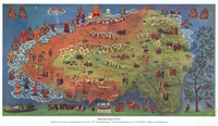
86895. Illustrated map of Tibet / painted by Tenzin Tsonyi of Losel and designed by Kim Yeshi.

Princeton University Restricted content Illustrated map of Tibet / painted by Tenzin Tsonyi of Losel and designed by Kim Yeshi. TIFF. [Dharmsāla, India] : Norbulingka Institute, 1997. princeton-dc1g05fq614. 1997. Nor-gling Bod-kyi-rig-gzhung-gces-skyong-khang (Dharmsāla, India) and Norbulingka Institute. Relief shown pictorially. Map shows monasteries, mountain ranges, fauna, Tibetan national flag.

86896. Tibet cultural map / The Tibetan Museum.

Princeton University Restricted content Tibet cultural map / The Tibetan Museum. TIFF. [Dharmsāla, India] : The Tibetan Museum, 2016. princeton-dc5712mk56n. 2016. The Tibetan Museum. Relief shown pictorially, and with spot heights. Shows monasteries, principal mountains elevation is noted, and principal towns.

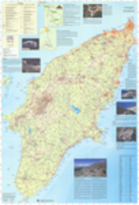
86897. Ρόδος & Σύμη / Ανάβαση.

Princeton University Restricted content Ρόδος & Σύμη / Ανάβαση. Athēna : Anavasē, 2019. princeton-dcvd66wb89q. 2017. Matsouka, P. (Pēnelopē) and Ματσούκα, Πηνελόπη. Recto includes legend of roads and transport, geological features, contour lines, sites of historical interest, museums. Index of Settlements. Rect...

86898. Little Falls, Passaic County, New Jersey

Princeton University Public content Little Falls, Passaic County, New Jersey. New York : Sanborn Map Company, 1915. princeton-2227ms55k. 1915. Sanborn Map Company. "January 1915." Includes location map, key, key map, streets and specials index, and text. "346.".

86899. Iran: reiß- und wasserfest / Iran : rip and waterproof = Iran : indéchirable et imperméable = Irán : irrompible y impermeable = Iran : nervuŝaâsâ i vodonepronicaemaâ. Reise Know-How.

Princeton University Restricted content Iran: reiß- und wasserfest / Iran : rip and waterproof = Iran : indéchirable et imperméable = Irán : irrompible y impermeable = Iran : nervuŝaâsâ i vodonepronicaemaâ. Reise Know-How. Bielefeld : Reise Know-How Verlag. 2020. princeton-dccv43p882s. 2020. Reise Know-How Verlag. Relief shown by contours, gradients, and spot heights. Recto has inset southward continuation Legend in German, English, French, Spanish, and Russi...

86900. Mongolia 1:1 600 000 = Mongolei = Mongolie = Mongolii︠a︡ / Reise Know-How.

Princeton University Restricted content Mongolia 1:1 600 000 = Mongolei = Mongolie = Mongolii︠a︡ / Reise Know-How. Bielefeld : Reise Know-How, 2020. princeton-dc4b29bk018. 2020. Reise Know-How Verlag. Relief shown by contours, spot heights and gradient tints. Panel title. Legend in German and English. "World mapping project." Includes index to pl...